


测绘学报 ›› 2026, Vol. 55 ›› Issue (7): 1199-1211.doi: 10.11947/j.AGCS.2026.20260122
• 大地测量学与导航 • 上一篇
刘新1( ), 押少帅1(), 范鑫1, 贾永君2, 常晓涛3, 朱广彬3, 郭金运1
收稿日期:2026-04-02
修回日期:2026-07-08
发布日期:2026-08-18
通讯作者:
押少帅
E-mail:xinliu1969@126.com;13526663057@163.com
作者简介:刘新(1969—),女,博士,教授,研究方向为空间数据挖掘和机器学习。 E-mail:xinliu1969@126.com
基金资助:
Xin Liu1(), Shaoshuai Ya1(), Xin Fan1, Yongjun Jia2, Xiaotao Chang3, Guangbin Zhu3, Jinyun Guo1
Received:2026-04-02
Revised:2026-07-08
Published:2026-08-18
Contact:
Shaoshuai Ya
E-mail:xinliu1969@126.com;13526663057@163.com
About author:Liu Xin (1969—), female, PhD, professor, majors in spatial data mining and machine learning. E-mail: xinliu1969@126.com
Supported by:摘要:
本文提出一种SWOT/KaRIn测高数据联合沿轨-跨轨交叉点平差方法,以提高SWOT海面高数据质量。该方法采用混合多项式模型对沿轨方向与时间相关的误差进行改正,并利用线性模型对跨轨方向与地理相关的误差进行补偿。以日本周边海域(130°E—145°E,27°N—43°N)为试验区域,采用科学阶段SWOT/KaRIn L2级的海面高产品(L2_LR_SSH)第003周期的数据进行平差方法测试。利用沿轨傅里叶模型、沿轨混合多项式模型、沿轨混合多项式模型+跨轨傅里叶模型和沿轨混合多项式模型+跨轨线性模型4种方法对SWOT/KaRIn海面高数据进行了自交叉点平差解算。结果表明:当仅对沿轨方向进行交叉点平差时,沿轨混合多项式模型交叉点不符值精度要高于沿轨傅里叶模型;加入跨轨方向的平差后,沿轨混合多项式模型+跨轨线性模型的交叉点不符值标准差(STD)最小,在沿轨和跨轨方向分别为4.27和3.62 cm。为了评估该方法的普适性,采用Sentinel-6A和Jason-3海面高数据与SWOT海面高数据进行了互交叉点平差。结果表明,沿轨混合多项式模型+跨轨线性模型平差后互交叉点不符值的精度最优,而且该方法不等权的精度优于等权的精度。因此,联合沿轨-跨轨方向交叉点平差可以显著提高SWOT海面高的数据质量,为海洋重力场研究提供高质量的数据源。
中图分类号:
刘新, 押少帅, 范鑫, 贾永君, 常晓涛, 朱广彬, 郭金运. SWOT/KaRIn测高数据的联合沿轨-跨轨交叉点平差[J]. 测绘学报, 2026, 55(7): 1199-1211.
Xin Liu, Shaoshuai Ya, Xin Fan, Yongjun Jia, Xiaotao Chang, Guangbin Zhu, Jinyun Guo. Joint along-track and cross-track crossover adjustment of SWOT/KaRIn altimetry data[J]. Acta Geodaetica et Cartographica Sinica, 2026, 55(7): 1199-1211.

表1
SWOT、Sentinel-6A和Jason-3试验数据信息"
| 测高卫星 | 轨道高度/km | 轨道倾角/(°) | 发布机构 | 测高任务 | 重复周期/d | 观测时间 | 周期 |
|---|---|---|---|---|---|---|---|
| Sentinel-6A | 1 336 | 66 | ESA | ERM | 10 | 2023-08-26—2023-09-24 | 103~105 |
| Jason-3 | 1 336 | 66 | ESA | ERM | 10 | 2023-08-28—2023-09-26 | 350~351 |
| SWOT | 890 | 77.6 | NASA | ERM | 21 | 2023-08-31—2023-09-21 | 003 |
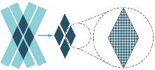
图1
SWOT卫星交叉点位置"
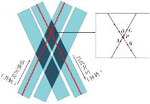
图2
SWOT卫星沿轨交叉点位置精确判断"
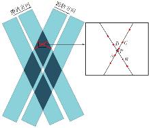
图3
SWOT卫星跨轨交叉点位置精确判断"
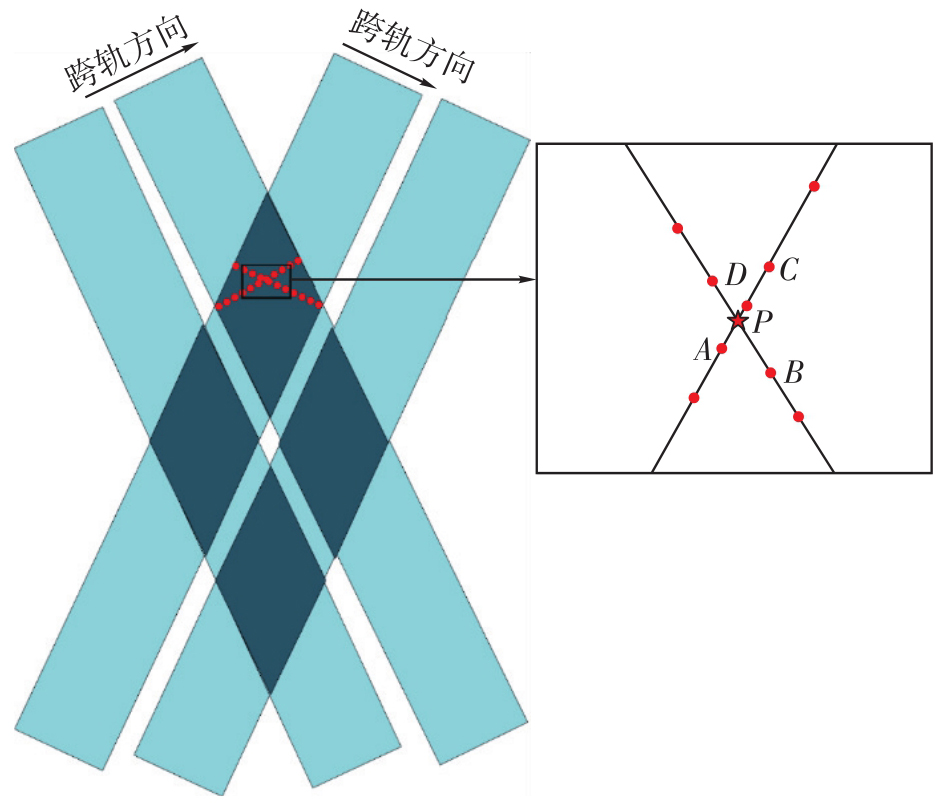
表2
轨迹交叉点数与k值的对应关系"
| 交叉点个数 | 模型形式 | k取值 | 模型参数个数 |
|---|---|---|---|
| 1 | 平均分配交叉点不符值 | 0 | 0 |
| 2~3 | 只选用误差模型线性部分 | 0 | 2 |
| 4~5 | 线性方程与一级傅里叶级数结合 | 1 | 4 |
| 6~8 | 线性方程与二级傅里叶级数结合 | 2 | 6 |
| >8 | 线性方程与三级傅里叶级数结合 | 3 | 8 |
图4
SWOT卫星测高数据交叉点平差流程"
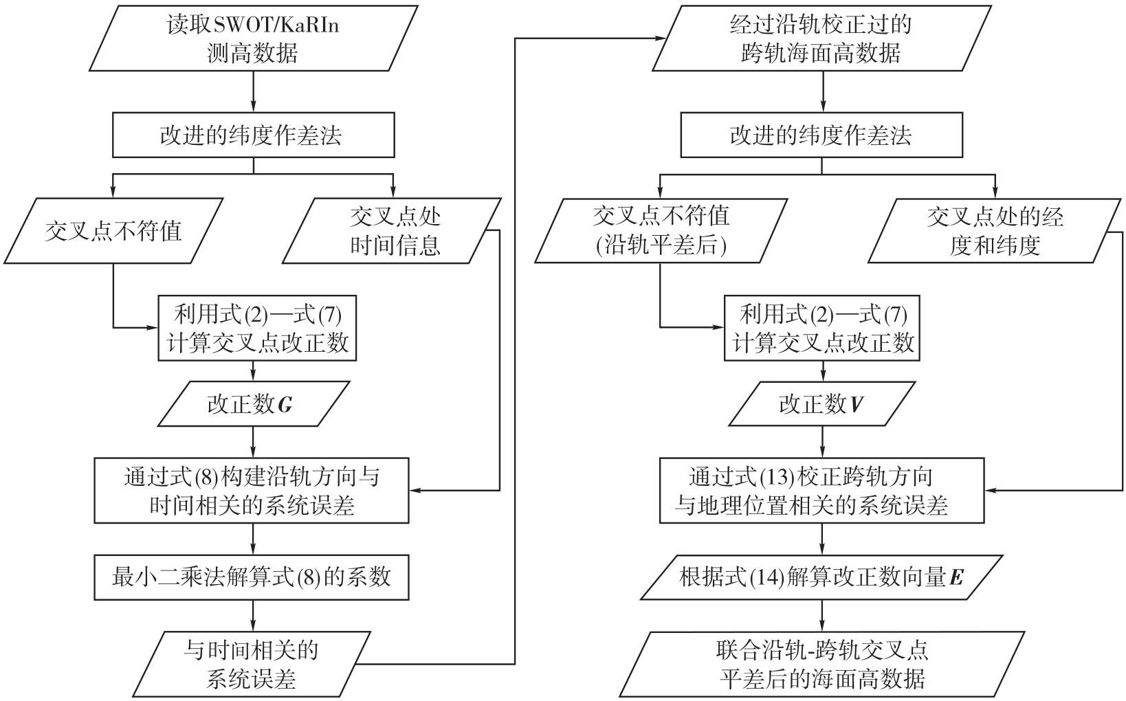
表3
SWOT SSHs自交叉点平差前后沿轨交叉点不符值统计结果"
| 统计量 | 平差前 | 沿轨傅里叶模型 | 沿轨混合多项式模型 | 沿轨混合多项式模型+跨轨傅里叶模型 | 沿轨混合多项式模型+跨轨线性模型 |
|---|---|---|---|---|---|
| Max | 86.93 | 82.26 | 72.29 | 81.64 | 62.33 |
| Min | -55.54 | -53.31 | -53.35 | -55.75 | -51.38 |
| Mean | -1.15 | -0.04 | 0.05 | 0.07 | 0.02 |
| STD | 8.47 | 6.32 | 6.08 | 6.57 | 4.27 |
| RMS | 8.55 | 6.32 | 6.08 | 6.57 | 4.27 |
表4
SWOT SSHs自交叉点平差前后沿轨交叉点不符值不同区间统计结果"
| 范围绝对值/cm | 平差前 | 沿轨傅里叶模型 | 沿轨混合多项式模型 | 沿轨混合多项式模型+跨轨傅里叶模型 | 沿轨混合多项式模型+跨轨线性模型 | |||||
|---|---|---|---|---|---|---|---|---|---|---|
| 数量 | 百分比/(%) | 数量 | 百分比/(%) | 数量 | 百分比/(%) | 数量 | 百分比/(%) | 数量 | 百分比/(%) | |
| <5 | 7 7312 | 55.73 | 99 756 | 71.91 | 10 0872 | 72.72 | 98 482 | 70.99 | 116 853 | 84.23 |
| [5,10) | 37 153 | 36.78 | 24 548 | 17.69 | 24 432 | 17.61 | 25 207 | 18.17 | 17 110 | 12.33 |
| [10,20) | 18 732 | 13.50 | 11 364 | 8.19 | 10 792 | 7.78 | 12 499 | 9.01 | 4 330 | 3.12 |
| [20,30) | 4448 | 3.21 | 2699 | 1.94 | 2384 | 1.72 | 2132 | 1.53 | 331 | 0.24 |
| ≥30 | 1072 | 0.77 | 350 | 0.25 | 237 | 0.17 | 397 | 0.28 | 93 | 0.06 |
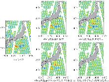
图5
SWOT SSHs沿轨自交叉点不符值高度图"

表5
SWOT SSHs自交叉点平差前后跨轨交叉点不符值统计结果"
| 统计量 | 平差前 | 沿轨傅里叶模型 | 沿轨混合多项式模型 | 沿轨混合多项式模型+跨轨傅里叶模型 | 沿轨混合多项式模型+跨轨线性模型 |
|---|---|---|---|---|---|
| Max | 46.78 | 39.05 | 36.34 | 38.24 | 26.83 |
| Min | -36.91 | -33.72 | -33.64 | -40.64 | -29.57 |
| Mean | -0.98 | -0.23 | 0.07 | 0.17 | 0.11 |
| STD | 8.20 | 6.34 | 6.13 | 6.35 | 3.62 |
| RMS | 8.26 | 6.35 | 6.13 | 6.35 | 3.62 |
表6
SWOT SSHs自交叉点平差前后跨轨交叉点不符值不同区间统计结果"
| 范围绝对值/cm | 平差前 | 沿轨傅里叶模型 | 沿轨混合多项式模型 | 沿轨混合多项式模型+跨轨傅里叶模型 | 沿轨混合多项式模型+跨轨线性模型 | |||||
|---|---|---|---|---|---|---|---|---|---|---|
| 数量 | 百分比/(%) | 数量 | 百分比/(%) | 数量 | 百分比/(%) | 数量 | 百分比/(%) | 数量 | 百分比/(%) | |
| <5 | 63 324 | 56.58 | 81 583 | 72.89 | 82 298 | 73.53 | 81 298 | 72.64 | 97 244 | 86.89 |
| [5,10) | 29 946 | 26.75 | 19 067 | 17.03 | 19 216 | 17.17 | 19 117 | 17.08 | 12 052 | 10.77 |
| [10,20) | 14 569 | 13.01 | 9055 | 8.09 | 8434 | 7.54 | 9325 | 8.33 | 2588 | 2.31 |
| [20,30) | 3423 | 3.05 | 2036 | 1.82 | 1853 | 1.65 | 1782 | 1.59 | 30 | 0.03 |
| ≥30 | 652 | 0.58 | 173 | 0.15 | 113 | 0.10 | 392 | 0.35 | 0 | 0 |
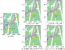
图6
SWOT SSHs跨轨自交叉点不符值高度图"
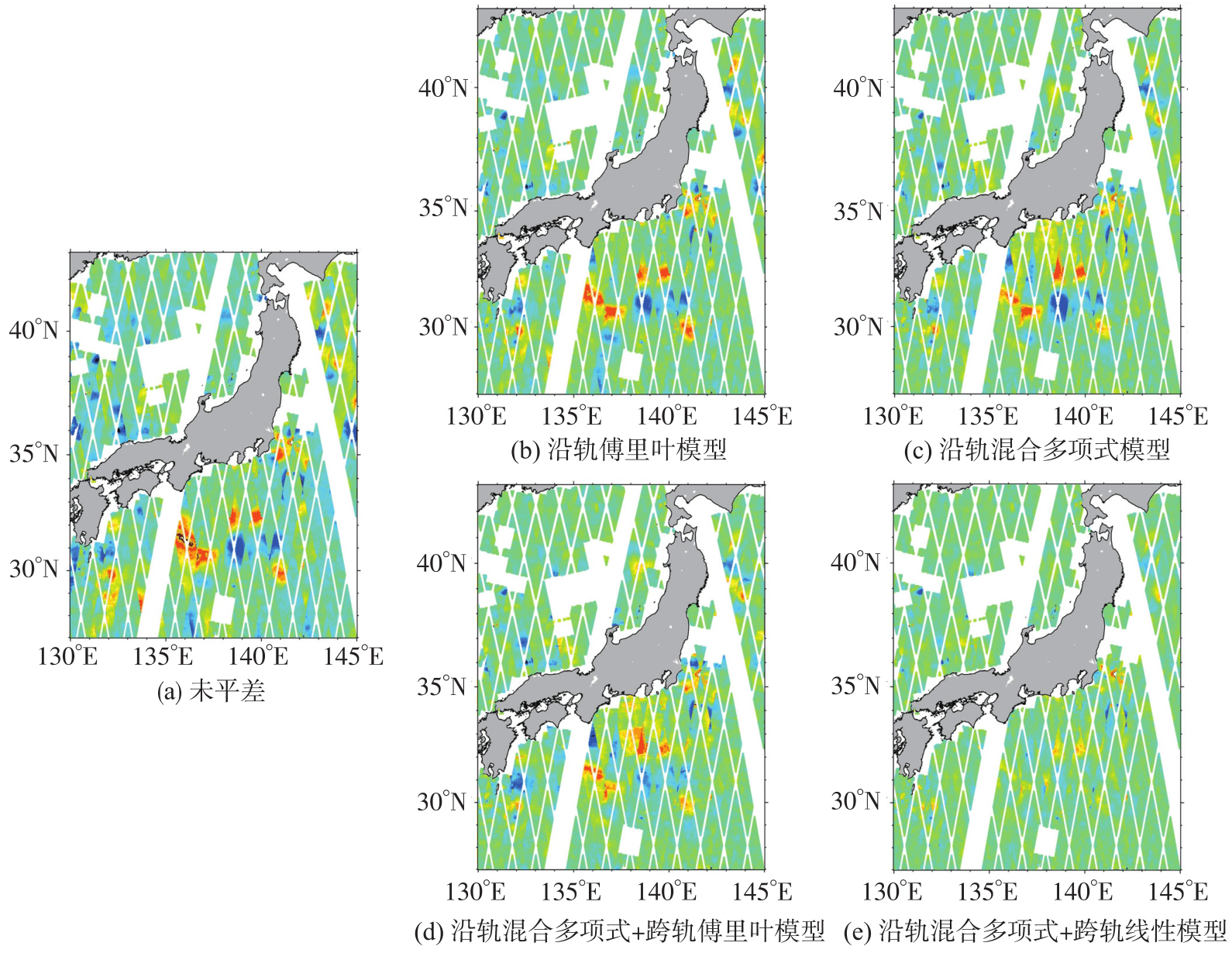
表7
SWOT和Sentinel-6A平差前后的互交叉点统计结果"
| 交叉点平差方法 | 交叉点数量 | Max | Min | Mean | RMS | STD |
|---|---|---|---|---|---|---|
| 平差前 | 16 202 | 48.36 | -49.85 | -3.78 | 9.69 | 8.92 |
| 沿轨傅里叶模型 | 16 202 | 47.69 | -48.07 | -1.92 | 7.71 | 7.47 |
| 沿轨混合多项式模型 | 16 202 | 43.76 | -48.30 | -1.04 | 7.48 | 7.25 |
| 等权沿轨混合多项式模型+跨轨线性模型 | 16 202 | 42.87 | -49.07 | -0.31 | 6.95 | 6.89 |
| 不等权沿轨混合多项式模型+跨轨线性模型 | 16 202 | 40.72 | -47.93 | -0.09 | 6.45 | 6.45 |
表8
SWOT和Jason-3平差前后的互交叉点统计结果"
| 交叉点平差方法 | 交叉点数量 | Max | Min | Mean | RMS | STD |
|---|---|---|---|---|---|---|
| 平差前 | 16 072 | 49.18 | -47.76 | -4.42 | 10.42 | 9.44 |
| 沿轨傅里叶模型 | 16 072 | 44.88 | -40.37 | -2.23 | 8.42 | 8.12 |
| 沿轨混合多项式模型 | 16 072 | 48.31 | -44.11 | -2.17 | 8.20 | 7.91 |
| 等权沿轨混合多项式模型+跨轨线性模型 | 16 072 | 48.69 | -41.94 | -0.53 | 7.67 | 7.61 |
| 不等权沿轨混合多项式模型+跨轨线性模型 | 16 072 | 47.82 | -40.31 | -0.02 | 7.18 | 7.18 |
表9
SWOT和Sentinel-6A平差前后互交叉点不符值不同区间统计结果"
| 范围绝对值/cm | 平差前 | 沿轨傅里叶模型 | 沿轨混合多项式模型 | 等权沿轨混合多项式模型+跨轨线性模型 | 不等权沿轨混合多项式模型+跨轨线性模型 | |||||
|---|---|---|---|---|---|---|---|---|---|---|
| 数量 | 百分比/(%) | 数量 | 百分比/(%) | 数量 | 百分比/(%) | 数量 | 百分比/(%) | 数量 | 百分比/(%) | |
| <5 | 7343 | 45.32 | 9402 | 58.00 | 9480 | 58.50 | 10 135 | 62.54 | 10 549 | 65.10 |
| [5,10) | 4899 | 30.23 | 4387 | 27.06 | 4449 | 27.45 | 4166 | 25.70 | 4039 | 24.92 |
| [10,20) | 3241 | 20.00 | 2031 | 12.53 | 1927 | 11.89 | 1627 | 10.04 | 1434 | 8.84 |
| [20,30) | 542 | 3.34 | 291 | 1.79 | 260 | 1.60 | 206 | 1.27 | 142 | 0.87 |
| ≥30 | 177 | 1.09 | 98 | 0.60 | 88 | 0.54 | 71 | 0.43 | 40 | 0.24 |
表10
SWOT和Jason-3平差前后互交叉点不符值不同区间统计结果"
| 范围绝对值/cm | 平差前 | 沿轨傅里叶模型 | 沿轨混合多项式模型 | 等权沿轨混合多项式模型+跨轨线性模型 | 不等权沿轨混合多项式模型+跨轨沿轨线性模型 | |||||
|---|---|---|---|---|---|---|---|---|---|---|
| 数量 | 百分比/(%) | 数量 | 百分比/(%) | 数量 | 百分比/(%) | 数量 | 百分比/(%) | 数量 | 百分比/(%) | |
| <5 | 6947 | 43.22 | 8851 | 55.07 | 8959 | 55.74 | 9668 | 60.15 | 10 078 | 62.70 |
| [5,10) | 4742 | 29.50 | 4473 | 27.83 | 4467 | 27.79 | 4145 | 25.79 | 3924 | 24.41 |
| [10,20) | 3350 | 20.84 | 2106 | 13.10 | 2107 | 13.10 | 1802 | 11.21 | 1732 | 10.77 |
| [20,30) | 773 | 4.80 | 534 | 3.32 | 429 | 2.66 | 379 | 2.35 | 290 | 1.80 |
| ≥30 | 260 | 1.61 | 108 | 0.67 | 110 | 0.68 | 78 | 0.48 | 48 | 0.29 |
表11
SWOT/KaRIn L3级海面高数据自交叉点不符值统计结果"
| 方向 | Max | Min | Mean | RMS | STD |
|---|---|---|---|---|---|
| 沿轨 | 49.22 | -39.22 | -0.36 | 7.75 | 7.75 |
| 跨轨 | 45.04 | -33.26 | -0.39 | 7.69 | 7.69 |
| [1] | 孙和平. 对我国重力学未来发展的几点思考[J]. 中国科学院院刊, 2024, 39(5): 881-890. |
| Sun Heping. Some reflections on developing trend of gravimetry in China[J]. Bulletin of Chinese Academy of Sciences, 2024, 39(5): 881-890. | |
| [2] |
孙中苗, 管斌, 翟振和, 等. 海洋卫星测高及其反演全球海洋重力场和海底地形模型研究进展[J]. 测绘学报, 2022, 51(6): 923-934. DOI: .
doi: 10.11947/j.AGCS.2022.20220069 |
|
Sun Zhongmiao, Guan Bin, Zhai Zhenhe, et al. Research progress of ocean satellite altimetry and its recovery of global marine gravity field and seafloor topography model[J]. Acta Geodaetica et Cartographica Sinica, 2022, 51(6): 923-934. DOI: .
doi: 10.11947/j.AGCS.2022.20220069 |
|
| [3] | Zhu Chengcheng, Guo Jinyun, Ya Shaoshuai, et al. Moving geoid gradient method for high-precision and high-resolution gravity recovery from SWOT wide-swath data[J]. IEEE Transactions on Geoscience and Remote Sensing, 2025, 63: 4205613 |
| [4] | Li Zhen, Guo Jinyun, Zhu Chengcheng, et al. The SDUST2022GRA global marine gravity anomalies recovered from radar and laser altimeter data: contribution of ICESat-2 laser altimetry[J]. Earth System Science Data, 2024, 16(9): 4119-4135. |
| [5] | 胡敏章, 李建成, 邢乐林. 由垂直重力梯度异常反演全球海底地形模型[J]. 测绘学报, 2014, 43(6): 558-565, 574. |
| Hu Minzhang, Li Jiancheng, Xing Lelin. Global bathymetry model predicted from vertical gravity gradient anomalies[J]. Acta Geodaetica et Cartographica Sinica, 2014, 43(6): 558-565, 574. | |
| [6] | Wan Xiaoyun, Ran Jiangjun. An alternative method to improve gravity field models by incorporating GOCE gradient data[J]. Earth Sciences Research Journal, 2018, 22(3): 187-193. |
| [7] | Yu Daocheng, Hwang C, Andersen O B, et al. Gravity recovery from SWOT altimetry using geoid height and geoid gradient[J]. Remote Sensing of Environment, 2021, 265: 112650. |
| [8] | Yuan Jiajia, Guo Jinyun, Zhu Chengcheng, et al. High-resolution sea level change around China seas revealed through multi-satellite altimeter data[J]. International Journal of Applied Earth Observation and Geoinformation, 2021, 102: 102433. |
| [9] | Yan Weishuang, Liu Xin, Li Zhen, et al. Performance of marine gravity anomalies extracted from SWOT KaRIn data of science phase in the Gulf of Mexico[J]. Scientific Reports, 2025, 15(1): 38385. |
| [10] | Zhang Shengjun, Chen Xu, Zhou Runsheng, et al. NSOAS24: a new global marine gravity model derived from multi-satellite sea surface slopes[J]. Geoscientific Model Development, 2025, 18(4): 1221-1239. |
| [11] |
押少帅, 刘新, 周瑞宸, 等. 基于科学阶段SWOT/KaRIn测高数据反演高精度的垂直重力异常梯度模型[J]. 测绘学报, 2025, 54(9): 1583-1595. DOI: .
doi: 10.11947/j.AGCS.2025.20240520 |
|
Ya Shaoshuai, Liu Xin, Zhou Ruichen, et al. High accuracy vertical gradient of gravity anomaly model determined from SWOT/KaRIn altimetry data during scientific phase[J]. Acta Geodaetica et Cartographica Sinica, 2025, 54(9): 1583-1595. DOI: .
doi: 10.11947/j.AGCS.2025.20240520 |
|
| [12] |
李真, 郭金运, 孙中苗, 等. 基于ICESat-2多波束激光测高数据的全球海洋重力异常反演分析[J]. 测绘学报, 2024, 53(2): 252-262. DOI: .
doi: 10.11947/j.AGCS.2024.20230207 |
|
Li Zhen, Guo Jinyun, Sun Zhongmiao, et al. Global marine gravity anomalies recovered from multi-beam laser altimeter data of ICESat-2[J]. Acta Geodaetica et Cartographica Sinica, 2024, 53(2): 252-262. DOI: .
doi: 10.11947/j.AGCS.2024.20230207 |
|
| [13] | Miao Xiangying, Wang Jing, Mao Peng, et al. Cross-track error correction and evaluation of the Tiangong-2 interferometric imaging radar altimeter[J]. IEEE Geoscience and Remote Sensing Letters, 2022, 19: 1505505. |
| [14] | Dibarbour G, Anandon C, Briol F, et al. Blending 2D topography images from SWOT into the altimeter constellation with the Level-3 multi-mission DUACS system[PP/OL]. EGUsphere (2024-05-27) [2026-02-03]. https://doi.org/10.5194/egusphere-2024-1501. |
| [15] | Wan Jianhua, Sun Qinting, Liu Shanwei, et al. Sea-level change over the China sea and its vicinity derived from 25-year T/P series altimeter data[J]. Journal of the Indian Society of Remote Sensing, 2018, 46(12): 1939-1947. |
| [16] | 胡建国, 章传银, 常晓涛. 近海多卫星测高数据联合处理的方法及应用[J]. 测绘通报, 2004(1): 1-4. |
| Hu Jianguo, Zhang Chuanyin, Chang Xiaotao. Methods of multi-satellite altimetry data processing and its application[J]. Bulletin of Surveying and Mapping, 2004(1): 1-4. | |
| [17] | 金涛勇, 李建成, 邢乐林, 等. 多源卫星测高数据基准的统一研究[J]. 大地测量与地球动力学, 2008, 28(3): 92-95, 99. |
| Jin Taoyong, Li Jiancheng, Xing Lelin, et al. Research on datum unification of multi-satellite altimetric data[J]. Journal of Geodesy and Geodynamics, 2008, 28(3): 92-95, 99. | |
| [18] | Wagner C A. Radial variations of a satellite orbit due to gravitational errors: implications for satellite altimetry[J]. Journal of Geophysical Research: Solid Earth, 1985, 90(B4): 3027-3036. |
| [19] | Rummel R. Principle of satellite altimetry and elimination of radial orbit errors[M]//RUMMEL R, SANSO'F. Satellite altimetry in geodesy and oceanography. Berlin: Springer, 1993: 190-241. |
| [20] | 黄谟涛, 王瑞, 翟国君, 等. 多代卫星测高数据联合平差及重力场反演[J]. 武汉大学学报(信息科学版), 2007, 32(11): 988-993. |
| Huang Motao, Wang Rui, Zhai Guojun, et al. Integrated data processing for multi-satellite missions and recovery of marine gravity field[J]. Geomatics and Information Science of Wuhan University, 2007, 32(11): 988-993. | |
| [21] | 黄谟涛, 翟国君, 欧阳永忠, 等. 海洋磁力测量误差补偿技术研究[J]. 武汉大学学报(信息科学版), 2006, 31(7): 603-606. |
| Huang Motao, Zhai Guojun, Ouyang Yongzhong, et al. On error compensation in marine magnetic survey[J]. Geomatics and Information Science of Wuhan University, 2006, 31(7): 603-606. | |
| [22] | 刘传勇, 暴景阳, 黄谟涛, 等. 验后平差方法在Geosat/GM卫星测高数据处理中的应用[J]. 海洋测绘, 2008, 28(1): 5-8. |
| Liu Chuanyong, Bao Jingyang, Huang Motao, et al. The application of posteriori compensation theory of error in altimeter data set from Geosat/GM crossover adjustment[J]. Hydrographic Surveying and Charting, 2008, 28(1): 5-8. | |
| [23] | Deng X, Featherstone W E. A coastal retracking system for satellite radar altimeter waveforms: application to ERS-2 around Australia[J]. Journal of Geophysical Research: Oceans, 2006, 111(C6): C06012. |
| [24] | 张胜军, 李建成, 王立伟, 等. GM测高数据反演中国近海及邻域精细重力场[J]. 海洋学报(中文版), 2014, 36(11): 85-89. |
| Zhang Shengjun, Li Jiancheng, Wang Liwei, et al. Refined marine gravity field of the China's seas and its adjacent area derived from GM altimeter data[J]. Haiyang Xuebao, 2014, 36(11): 85-89. | |
| [25] | Zwally H, Schutz B, Abdalati W, et al. ICESat's laser measurements of polar ice, atmosphere, ocean, and land[J]. Journal of Geodynamics, 2002, 34(3/4): 405-445. |
| [26] | Rudenko S, Dettmering D, Zeitlhöfler J, et al. Radial orbit errors of contemporary altimetry satellite orbits[J]. Surveys in Geophysics, 2023, 44(3): 705-737. |
| [27] | Tai Changkou, Fu L L. On crossover adjustment in satellite altimetry and its oceanographic implications[J]. Journal of Geophysical Research: Oceans, 1986, 91(C2): 2549-2554. |
| [28] | Fan Xin, Guo Jinyun, Zhang Huiying, et al. A two-step method of crossover adjustment for satellite altimeter data[J]. Advances in Space Research, 2025, 75(1): 219-232. |
| [29] | Van Gysen H, Coleman R. On the satellite altimeter crossover problem[J]. Journal of Geodesy, 1997, 71(2): 83-96. |
| [30] | Fu L L, Pavelsky T, Cretaux J F, et al. The surface water and ocean topography mission: a breakthrough in radar remote sensing of the ocean and land surface water[J]. Geophysical Research Letters, 2024, 51(4): e2023GL107652. |
| [31] |
于道成. 多源卫星测高数据反演南海最佳重力场[J]. 测绘学报, 2025, 54(10): 1908. DOI: .
doi: 10.11947/j.AGCS.2025.20240037 |
|
Yu Daocheng. Optimal gravity field recovery in the South China Sea from multiple altimeter missions[J]. Acta Geodaetica et Cartographica Sinica, 2025, 54(10): 1908. DOI: .
doi: 10.11947/j.AGCS.2025.20240037 |
|
| [32] | Li Zhen, Guo Jinyun, Hwang Cheinway, et al. Tailored method for optimizing deflection of the vertical model using multidirectional geoid gradients from SWOT/KaRIn observations[J]. Geophysical Journal International, 2026, 244(2): ggaf484. |
| [33] | Zhu Chengcheng, Li Zhen, GUO Jinyun, et al. The calculation and analysis of along-track and cross-track crossover SSHs discrepancies from wide-swath altimetry data[PP/OL]. Research Square (2024-08-15) [2026-02-03]. https://doi.org/10.21203/rs.3.rs-4766084/v1. |
| [34] | Guo Hengyang, Wan Xiaoyun, Zhang Keyan, et al. An improved latitude difference method for SWOT accuracy evaluation using crossover discrepancies[J]. IEEE Transactions on Geoscience and Remote Sensing, 2025, 63: 4203912. |
| [35] | Ishii M, Kimoto M, Sakamoto K, et al. Steric sea level changes estimated from historical ocean subsurface temperature and salinity analyses[J]. Journal of Oceanography, 2006, 62(2): 155-170. |
| [36] | Surface Water Ocean Topography Mission. SWOT product description L2_LR_SSH_20220902 Rev A[R/OL]. 2023. https://archive.podaac.earthdata.nasa.gov/podaac-ops-cumulus-docs/web-misc/swot_mission_docs/pdd/D-56407_SWOT_Product_Description_L2_LR_SSH_20220902_RevA.pdf. |
| [37] | Peng Fukai, Deng Xiaoli. Validation of Sentinel-3A SAR mode sea level anomalies around the Australian coastal region[J]. Remote Sensing of Environment, 2020, 237: 111548. |
| [38] |
祝程程, 李真, 郭金运, 等. 基于限定区域的纬度做差法解算宽刈幅测高数据交叉点位置[J]. 测绘学报, 2026, 55(4): 673-683. DOI: .
doi: 10.11947/j.AGCS.2026.20250341 |
|
Zhu Chengcheng, Li Zhen, Guo Jinyun, et al. Improved latitude difference method for calculating cross over point position from wide-swath measurement data[J]. Acta Geodaetica et Cartographica Sinica, 2026, 55(4): 673-683. DOI: .
doi: 10.11947/j.AGCS.2026.20250341 |
|
| [39] | 魏巧云. 交叉点位置确定方法研究及相关数据处理[D]. 开封: 河南大学, 2017: 15-17. |
| Wei Qiaoyun. Research on crossover points location determination method and related data processing[D]. Kaifeng: Henan University, 2017: 15-17. | |
| [40] | Yuan Jiajia, Guo Jinyun, Niu Yupeng, et al. Mean sea surface model over the Sea of Japan determined from multi-satellite altimeter data and tide gauge records[J]. Remote Sensing, 2020, 12(24): 4168. |
| [41] | Gaultier L, Ubelmann C, Fu L L. The challenge of using future SWOT data for oceanic field reconstruction[J]. Journal of Atmospheric and Oceanic Technology, 2016, 33(1): 119-126. |
| [42] | Dibarboure G, Labroue S, Ablain M, et al. Empirical cross-calibration of coherent SWOT errors using external references and the altimetry constellation[J]. IEEE Transactions on Geoscience and Remote Sensing, 2011, 50(6): 2325-2344. |
| [43] | 王振杰, 欧吉坤. 用L-曲线法确定岭估计中的岭参数[J]. 武汉大学学报(信息科学版), 2004, 29(3): 235-238. |
| Wang Zhenjie, Ou Jikun. Determining the ridge parameter in a ridge estimation using L-curve method[J]. Geomatics and Information Science of Wuhan University, 2004, 29(3): 235-238. | |
| [44] | Jiang Maofei, Xu Ke, Wang Jiaming. Evaluation of Sentinel-6 altimetry data over ocean[J]. Remote Sensing, 2022, 15(1): 12. |
| [1] | 高屹, 刘新, 于道成, 押少帅, 边少锋, 孙和平, 郭金运. 综合垂直重力异常梯度和海底地形模型的海山自动探测方法[J]. 测绘学报, 2026, 55(4): 647-657. |
| [2] | 程栋梁, 陈灵秋, 黄志勇, 乔书波, 王丹丹, 闫亚明. 基于COATS的多模多频iGNSS-R测高性能评估[J]. 测绘学报, 2026, 55(1): 73-89. |
| [3] | 押少帅, 刘新, 周瑞宸, 李真, 边少锋, 郭金运. 基于科学阶段SWOT/KaRIn测高数据反演高精度的垂直重力异常梯度模型[J]. 测绘学报, 2025, 54(9): 1583-1595. |
| [4] | 施宏凯, 何秀凤, 吴怿昊, 郑翔天, 宋敏峰. 近海强干扰区域高频全聚焦SAR波形污染识别与海面高精确提取算法[J]. 测绘学报, 2025, 54(2): 272-285. |
| [5] | 李真, 郭金运, 孙中苗, 贾永君, 黄令勇, 孙和平. 基于ICESat-2多波束激光测高数据的全球海洋重力异常反演分析[J]. 测绘学报, 2024, 53(2): 252-262. |
| [6] | 黄令勇, 李世忠, 夏俊明, 王海岩, 孙越强, 杨日新, 杜起飞, 黄志勇. 岸基条件下的星载GNSS-R干涉测高精度验证评估[J]. 测绘学报, 2024, 53(2): 239-251. |
| [7] | 陈灵秋, 柴洪洲, 暴景阳, 王敏, 郑乃铨. 基于多模多频SNR数据逆建模反演海面高度变化[J]. 测绘学报, 2024, 53(11): 2099-2110. |
| [8] | 管斌, 孙中苗, 刘晓刚, 翟振和. 双星串飞编队卫星测高模式下高度计相对定标[J]. 测绘学报, 2017, 46(1): 44-52. |
| [9] | 金涛勇,李建成,姜卫平,王正涛. 基于多源卫星测高数据的新一代全球平均海面高模型[J]. 测绘学报, 2011, 40(6): 723-729. |
| 阅读次数 | ||||||
|
全文 |
|
|||||
|
摘要 |
|
|||||
