


测绘学报 ›› 2026, Vol. 55 ›› Issue (9): 1599-1611.doi: 10.11947/j.AGCS.2026.20260075
熊新1,2( ), 靳国旺1,2(), 李佳豪1, 叶豪1, 杨乐3
收稿日期:2026-02-28
修回日期:2026-08-28
出版日期:2026-10-28
发布日期:2026-10-28
通讯作者:
靳国旺
E-mail:xiongxinhbhh@163.com;guowang_jin@163.com
作者简介:熊新(1991—),男,博士,讲师,研究方向为微波遥感。 E-mail:xiongxinhbhh@163.com
基金资助:
Xin Xiong1,2(), Guowang Jin1,2(), Jiahao Li1, Hao Ye1, Le Yang3
Received:2026-02-28
Revised:2026-08-28
Online:2026-10-28
Published:2026-10-28
Contact:
Guowang Jin
E-mail:xiongxinhbhh@163.com;guowang_jin@163.com
About author:Xiong Xin (1991—), male, PhD, lecturer, majors in microwave remote sensing. E-mail: xiongxinhbhh@163.com
Supported by:摘要:
面向天绘二号(TH-2)卫星系统的双基干涉成像几何,构建了一种三方程有理函数模型(RFM),推导了其正向和反向解析表达式,并建立了基于最小二乘的RFM参数估计方法。该模型在传统两方程RFM基础上,嵌入干涉相位观测方程,实现了像方观测值(方位向坐标、距离向坐标、干涉相位)与大地坐标(纬度、经度、高程)之间的双向几何映射。采用6套天绘二号双基成像InSAR数据进行RFM拟合精度分析试验,结果表明本文模型能够精确拟合严格成像模型。地理编码试验进一步验证了本文模型的实用性。
中图分类号:
熊新, 靳国旺, 李佳豪, 叶豪, 杨乐. 天绘二号双基成像几何的有理函数模型研究[J]. 测绘学报, 2026, 55(9): 1599-1611.
Xin Xiong, Guowang Jin, Jiahao Li, Hao Ye, Le Yang. Research on rational function model for Tianhui-2 bistatic imaging geometry[J]. Acta Geodaetica et Cartographica Sinica, 2026, 55(9): 1599-1611.
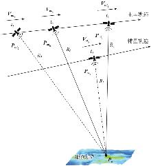
图1
TH-2双基成像几何构型"
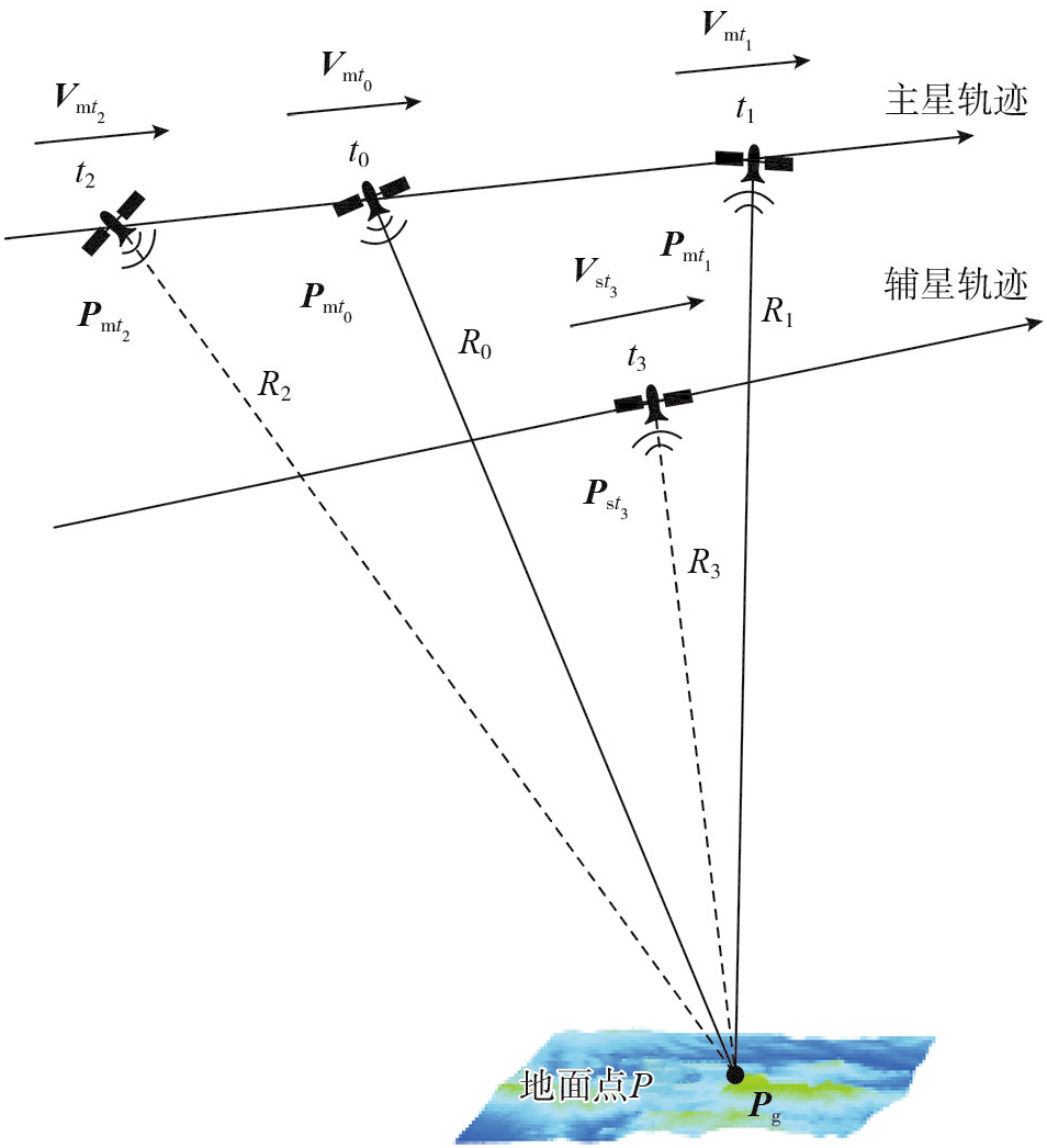
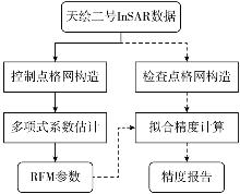
图2
RFM参数解算流程"
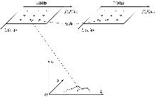
图3
与地形无关的控制点网格设置示意"
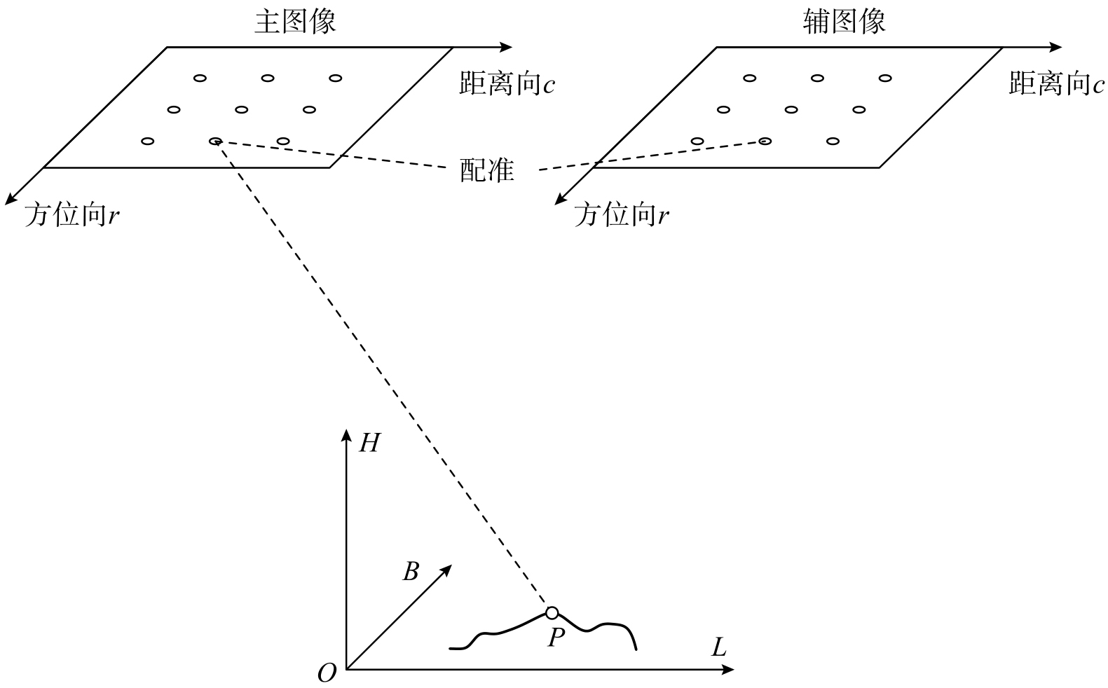
图4
TH-2干涉对数据"

表1
TH-2干涉对数据主要参数"
| 数据 | 区域 | 场景类型 | 获取时间 | 主图像采样间隔/(m×m) | 主图像大小/(像素×像素) |
|---|---|---|---|---|---|
| 1 | 廊坊地区 | 平地 | 2020-05-05 | 2.05×0.94 | 19 902×21 910 |
| 2 | 廊坊地区 | 平地 | 2024-08-01 | 2.00×0.94 | 18 098×21 642 |
| 3 | 郑州地区 | 半山地 | 2019-10-14 | 1.88×0.94 | 19 414×23 014 |
| 4 | 郑州地区 | 半山地 | 2024-03-01 | 1.74×0.94 | 20 767×20 890 |
| 5 | 丽江地区 | 山地 | 2024-09-12 | 1.52×0.94 | 21 044×18 760 |
| 6 | 丽江地区 | 山地 | 2024-09-12 | 1.52×0.94 | 28 340×18 760 |
表2
不同控制点格网大小下的RFM正向解析表达式平均拟合精度"
| 格网大小 | 方位向RMSE/像素 | 方位向MAE/像素 | 距离向RMSE/像素 | 距离向MAE/像素 | 相位RMSE/rad | 相位MAE/rad | 计算耗时/s |
|---|---|---|---|---|---|---|---|
| 10×10 | 2.426×10⁻⁹ | 1.234×10⁻⁸ | 1.446×10⁻⁷ | 7.279×10⁻⁷ | 5.809×10⁻⁷ | 2.507×10⁻⁶ | 0.009 |
| 15×15 | 2.451×10⁻⁹ | 1.115×10⁻⁸ | 1.418×10⁻⁷ | 5.797×10⁻⁷ | 5.299×10⁻⁷ | 1.958×10⁻⁶ | 0.015 |
| 20×20 | 2.451×10⁻⁹ | 1.124×10⁻⁸ | 1.454×10⁻⁷ | 6.095×10⁻⁷ | 5.902×10⁻⁷ | 2.520×10⁻⁶ | 0.024 |
| 25×25 | 2.626×10⁻⁹ | 1.256×10⁻⁸ | 1.505×10⁻⁷ | 8.357×10⁻⁷ | 6.183×10⁻⁷ | 2.297×10⁻⁶ | 0.035 |
| 30×30 | 2.790×10⁻⁹ | 1.512×10⁻⁸ | 1.590×10⁻⁷ | 7.410×10⁻⁷ | 6.613×10⁻⁷ | 2.979×10⁻⁶ | 0.050 |
| 35×35 | 2.874×10⁻⁹ | 1.594×10⁻⁸ | 1.577×10⁻⁷ | 7.109×10⁻⁷ | 6.811×10⁻⁷ | 3.274×10⁻⁶ | 0.064 |
| 40×40 | 2.959×10⁻⁹ | 1.977×10⁻⁸ | 1.615×10⁻⁷ | 7.704×10⁻⁷ | 6.914×10⁻⁷ | 3.267×10⁻⁶ | 0.082 |
| 45×45 | 2.984×10⁻⁹ | 1.671×10⁻⁸ | 1.685×10⁻⁷ | 8.726×10⁻⁷ | 7.117×10⁻⁷ | 3.400×10⁻⁶ | 0.104 |
| 50×50 | 3.030×10⁻⁹ | 1.701×10⁻⁸ | 1.662×10⁻⁷ | 8.845×10⁻⁷ | 7.236×10⁻⁷ | 3.837×10⁻⁶ | 0.128 |
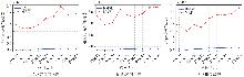
图5
不同控制点格网大小下的RFM正向解析表达式平均拟合精度"
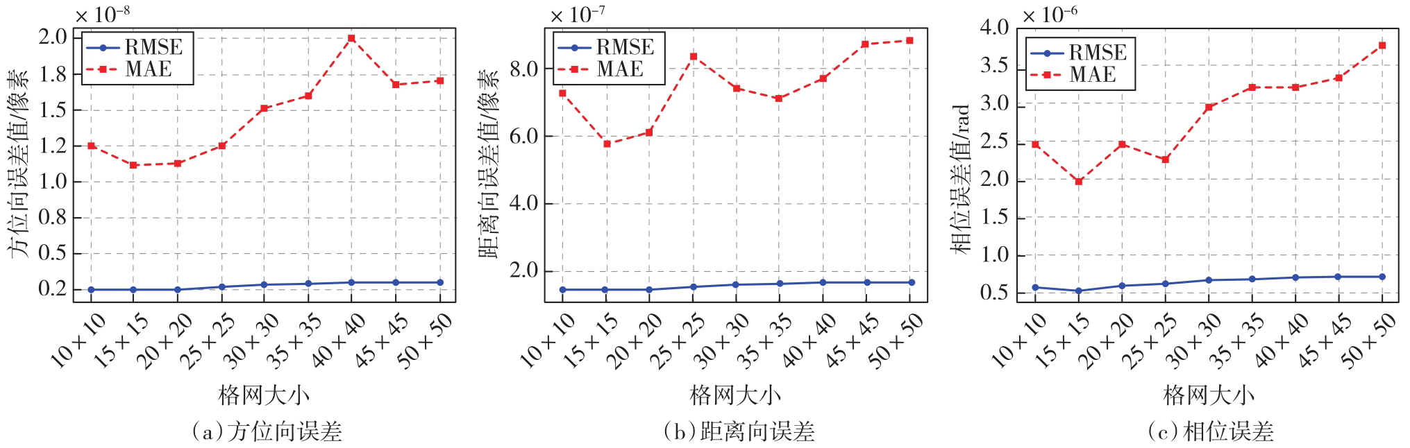
表3
不同控制点格网大小下的RFM反向解析表达式平均拟合精度"
| 格网大小 | 经度RMSE/(°) | 经度MAE/(°) | 纬度RMSE/(°) | 纬度MAE/(°) | 高程RMSE/m | 高程MAE/m | 计算耗时/s |
|---|---|---|---|---|---|---|---|
| 10×10 | 2.421×10⁻¹¹ | 1.230×10⁻¹⁰ | 1.094×10⁻¹¹ | 3.592×10⁻¹¹ | 1.941×10⁻⁵ | 7.552×10⁻⁵ | 0.013 |
| 15×15 | 2.273×10⁻¹¹ | 7.213×10⁻¹¹ | 1.203×10⁻¹¹ | 4.651×10⁻¹¹ | 1.926×10⁻⁵ | 8.671×10⁻⁵ | 0.016 |
| 20×20 | 2.604×10⁻¹¹ | 1.079×10⁻¹⁰ | 1.298×10⁻¹¹ | 4.744×10⁻¹¹ | 1.962×10⁻⁵ | 6.730×10⁻⁵ | 0.025 |
| 25×25 | 2.725×10⁻¹¹ | 1.068×10⁻¹⁰ | 1.384×10⁻¹¹ | 5.412×10⁻¹¹ | 2.164×10⁻⁵ | 9.577×10⁻⁵ | 0.038 |
| 30×30 | 2.919×10⁻¹¹ | 1.305×10⁻¹⁰ | 1.458×10⁻¹¹ | 7.249×10⁻¹¹ | 2.303×10⁻⁵ | 1.045×10⁻⁴ | 0.052 |
| 35×35 | 2.971×10⁻¹¹ | 1.413×10⁻¹⁰ | 1.481×10⁻¹¹ | 7.088×10⁻¹¹ | 2.351×10⁻⁵ | 1.140×10⁻⁴ | 0.069 |
| 40×40 | 3.002×10⁻¹¹ | 1.385×10⁻¹⁰ | 1.471×10⁻¹¹ | 8.014×10⁻¹¹ | 2.381×10⁻⁵ | 1.119×10⁻⁴ | 0.088 |
| 45×45 | 3.109×10⁻¹¹ | 1.510×10⁻¹⁰ | 1.523×10⁻¹¹ | 8.314×10⁻¹¹ | 2.437×10⁻⁵ | 1.221×10⁻⁴ | 0.111 |
| 50×50 | 3.135×10⁻¹¹ | 1.678×10⁻¹⁰ | 1.550×10⁻¹¹ | 9.701×10⁻¹¹ | 2.483×10⁻⁵ | 1.418×10⁻⁴ | 0.141 |
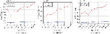
图6
不同控制点格网大小下的RFM反向解析表达式平均拟合精度"
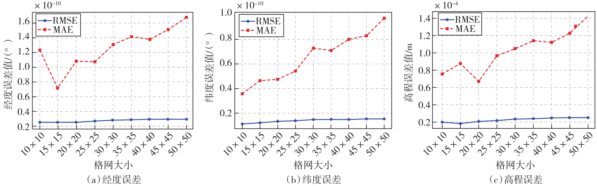
表4
不同解缠相位的平均拟合精度"
| 方案 | 方位向RMSE/像素 | 距离向RMSE/像素 | 相位RMSE/rad | 计算耗时/s |
|---|---|---|---|---|
| 叠加平地相位 | 2.451×10⁻⁹ | 1.418×10⁻⁷ | 5.299×10⁻⁷ | 0.015 |
| 不叠加平地相位 | 2.451×10⁻⁹ | 1.418×10⁻⁷ | 32.17 | 0.015 |
表5
不同地形数据的拟合精度"
| 数据 | 场景类型 | 方位向RMSE/像素 | 距离向RMSE/像素 | 相位RMSE/rad | 计算耗时/s |
|---|---|---|---|---|---|
| 1 | 平地 | 3.727×10⁻⁹ | 5.410×10⁻⁸ | 2.581×10⁻⁷ | 0.015 |
| 2 | 平地 | 3.132×10⁻⁹ | 4.072×10⁻⁸ | 1.955×10⁻⁷ | 0.015 |
| 3 | 半山地 | 4.938×10⁻¹⁰ | 6.883×10⁻⁸ | 5.799×10⁻⁷ | 0.016 |
| 4 | 半山地 | 3.521×10⁻⁹ | 4.054×10⁻⁸ | 3.247×10⁻⁷ | 0.014 |
| 5 | 山地 | 3.306×10⁻⁹ | 1.875×10⁻⁷ | 7.991×10⁻⁷ | 0.015 |
| 6 | 山地 | 5.288×10⁻¹⁰ | 4.593×10⁻⁷ | 1.022×10⁻⁶ | 0.014 |
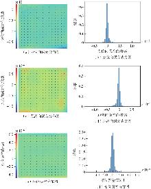
图7
数据1误差分布图和直方图"
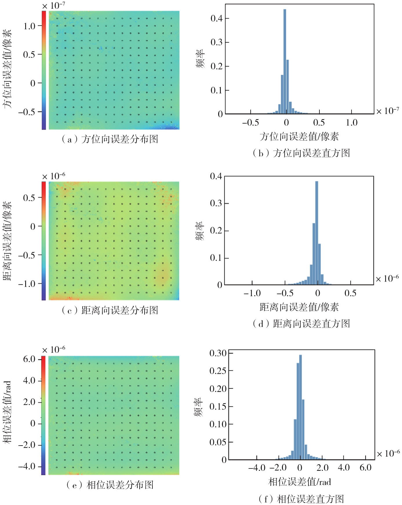
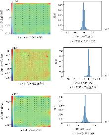
图8
数据3误差分布图和直方图"

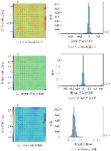
图9
数据5误差分布图和直方图"
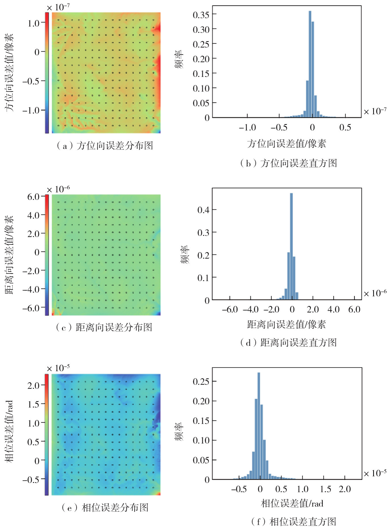
表6
不同地理编码方法的平均计算耗时"
| 方法 | 计算耗时/s |
|---|---|
| 基于严格成像模型的地理编码 | 1 188.124 |
| 基于有理函数模型的地理编码 | 218.909 |
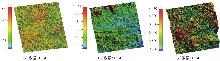
图10
地理编码结果"

| [1] | 靳国旺, 徐青, 张红敏. 合成孔径雷达干涉测量[M]. 北京: 国防工业出版社, 2014. |
| Jin Guowang, Xu Qing, Zhang Hongmin. Synthetic aperture radar interferometry[M]. Beijing: National Defense Industry Press, 2014. | |
| [2] |
楼良盛, 刘志铭, 张昊, 等. 天绘二号卫星工程设计与实现[J]. 测绘学报, 2020, 49(10): 1252-1264. DOI: .
doi: 10.11947/j.AGCS.2020.20200175 |
|
Lou Liangsheng, Liu Zhiming, Zhang Hao, et al. TH-2 satellite engineering design and implementation[J]. Acta Geodaetica et Cartographica Sinica, 2020, 49(10): 1252-1264. DOI: .
doi: 10.11947/j.AGCS.2020.20200175 |
|
| [3] | Toutin T. Path processing and block adjustment with RADARSAT-1 SAR images[J]. IEEE Transactions on Geoscience and Remote Sensing, 2003, 41(10): 2320-2328. |
| [4] | Cao Hui, Tao Pengjie, Li Haihong, et al. Bundle adjustment of satellite images based on an equivalent geometric sensor model with digital elevation model[J]. ISPRS Journal of Photogrammetry and Remote Sensing, 2019, 156: 169-183. |
| [5] | Rodriguez E, Martin J M. Theory and design of interferometric synthetic aperture radars[J]. IEE Proceedings F (Radar and Signal Processing), 1992, 139(2): 147-159. |
| [6] | 刘艳阳, 李真芳, 杨娟娟, 等. 分布式卫星InSAR目标定位近似闭式解[J]. 西安电子科技大学学报, 2012, 39(4): 87-93. |
| Liu Yanyang, Li Zhenfang, Yang Juanjuan, et al. Quasi-closed-form solution for distributed satellites InSAR geolocation[J]. Journal of Xidian University, 2012, 39(4): 87-93. | |
| [7] | Nico G. Exact closed-form geolocation for SAR interferometry[J]. IEEE Transactions on Geoscience and Remote Sensing, 2002, 40(1): 220-222. |
| [8] | Sansosti E. A simple and exact solution for the interferometric and stereo SAR geolocation problem[J]. IEEE Transactions on Geoscience and Remote Sensing, 2004, 42(8): 1625-1634. |
| [9] | 谷德峰, 易东云, 朱炬波, 等. 分布式InSAR三维定位的闭合形式解及其精度分析[J]. 电子学报, 2007, 35(6): 1026-1031. |
| Gu Defeng, Yi Dongyun, Zhu Jubo, et al. Closed-form solution of distributed InSAR geolocation and its precision analysis[J]. Acta Electronica Sinica, 2007, 35(6): 1026-1031. | |
| [10] | 张奔, 郑坚, 茅宁杰, 等. 分布式卫星InSAR系统的DEM定位方法[J]. 武汉大学学报(工学版), 2015, 48(6): 852-856. |
| Zhang Ben, Zheng Jian, Mao Ningjie, et al. Research on DEM calculation for distributed satellite InSAR system[J]. Engineering Journal of Wuhan University, 2015, 48(6): 852-856. | |
| [11] | 范炜康, 靳国旺, 龚志辉. 星载分布式InSAR目标定位模型研究[J]. 测绘科学技术学报, 2019, 36(6): 604-608. |
| Fan Weikang, Jin Guowang, Gong Zhihui. Research on target positioning model for the spaceborne distributed InSAR[J]. Journal of Geomatics Science and Technology, 2019, 36(6): 604-608. | |
| [12] |
李世忠, 叶宇, 范炜康, 等. 天绘二号卫星系统定位精度浅析[J]. 测绘学报, 2022, 51(12): 2481-2492. DOI: .
doi: 10.11947/j.AGCS.2022.20210397 |
|
Li Shizhong, Ye Yu, Fan Weikang, et al. A brief analysis of the positioning accuracy for the TH-2 satellite system[J]. Acta Geodaetica et Cartographica Sinica, 2022, 51(12): 2481-2492. DOI: .
doi: 10.11947/j.AGCS.2022.20210397 |
|
| [13] |
钱方明, 陈刚, 楼良盛, 等. 天绘二号卫星两种基线定标模型比较分析[J]. 测绘学报, 2022, 51(12): 2425-2432. DOI: .
doi: 10.11947/j.AGCS.2022.20210316 |
|
Qian Fangming, Chen Gang, Lou Liangsheng, et al. Comparison and analysis of two baseline calibration models for TH-2 satellite[J]. Acta Geodaetica et Cartographica Sinica, 2022, 51(12): 2425-2432. DOI: .
doi: 10.11947/j.AGCS.2022.20210316 |
|
| [14] |
陈刚, 钱方明, 刘志铭, 等. 天绘二号卫星双基成像几何模型改正算法[J]. 测绘学报, 2022, 51(12): 2417-2424. DOI: .
doi: 10.11947/j.AGCS.2022.20210328 |
|
Chen Gang, Qian Fangming, Liu Zhiming, et al. Algorithm to changing bistatic imaging geometric model for TH-2 satellite[J]. Acta Geodaetica et Cartographica Sinica, 2022, 51(12): 2417-2424. DOI: .
doi: 10.11947/j.AGCS.2022.20210328 |
|
| [15] | Gholinejad S, Naeini A A, Amiri-Simkooei A. Optimization of RFM problem using linearly programed ℓ1-regularization[J]. IEEE Transactions on Geoscience and Remote Sensing, 2022, 60: 5601009. |
| [16] | Pan Hongbo, Huang Tao, Zhou Ping, et al. Self-calibration dense bundle adjustment of multi-view Worldview-3 basic images[J]. ISPRS Journal of Photogrammetry and Remote Sensing, 2021, 176: 127-138. |
| [17] |
程春泉, 张继贤, 黄国满, 等. 考虑定向参数精度信息的TerraSAR-X和SPOT-5 HRS影像RFM联合定位[J]. 测绘学报, 2017, 46(2): 179-187. DOI: .
doi: 10.11947/j.AGCS.2017.20160138 |
|
Cheng Chunquan, Zhang Jixian, Huang Guoman, et al. Combined positioning of TerraSAR-X and SPOT-5 HRS images with RFM considering accuracy information of orientation parameters[J]. Acta Geodaetica et Cartographica Sinica, 2017, 46(2): 179-187. DOI: .
doi: 10.11947/j.AGCS.2017.20160138 |
|
| [18] | Zhang Guo, Li Zhen, Pan Hongbo, et al. Orientation of spaceborne SAR stereo pairs employing the RPC adjustment model[J]. IEEE Transactions on Geoscience and Remote Sensing, 2011, 49(7): 2782-2792. |
| [19] | 张过, 李德仁, 秦绪文, 等. 基于RPC模型的高分辨率SAR影像正射纠正[J]. 遥感学报, 2008, 12(6): 942-948. |
| Zhang Guo, Li Deren, Qin Xuwen, et al. Geometric rectification of high resolution spaceborne SAR image based on RPC model[J]. Journal of Remote Sensing, 2008, 12(6): 942-948. | |
| [20] | 魏晓红, 张路, 贺雪艳, 等. 基于有理函数模型的星载SAR影像几何校正[J]. 遥感学报, 2012, 16(5): 1089-1099. |
| Wei Xiaohong, Zhang Lu, He Xueyan, et al. Spaceborne SAR image geocoding with RFM model[J]. Journal of Remote Sensing, 2012, 16(5): 1089-1099. | |
| [21] | Zhang L, Balz T, Liao M S. Satellite SAR geocoding with refined RPC model[J]. ISPRS Journal of Photogrammetry and Remote Sensing, 2012, 69: 37-49. |
| [22] | Zhang Guo, Qiang Qiang, Luo Ying, et al. Application of RPC model in orthorectification of spaceborne SAR imagery[J]. The Photogrammetric Record, 2012, 27(137): 94-110. |
| [23] | Wang Taoyang, Li Xin, Zhang Guo, et al. Large-scale orthorectification of GF-3 SAR images without ground control points for China's land area[J]. IEEE Transactions on Geoscience and Remote Sensing, 2022, 60: 1-17. |
| [24] | 张过, 费文波, 李贞, 等. 用RPC替代星载SAR严密成像几何模型的试验与分析[J]. 测绘学报, 2010, 39(3): 264-270. |
| Zhang Guo, Fei Wenbo, Li Zhen, et al. Analysis and test of the substitutability of the RPC model for the rigorous sensor model of spaceborne SAR imagery[J]. Acta Geodaetica et Cartographica Sinica, 2010, 39(3): 264-270. | |
| [25] | Zhang L, He X Y, Balz T, et al. Rational function modeling for spaceborne SAR datasets[J]. ISPRS Journal of Photogrammetry and Remote Sensing, 2011, 66(1): 133-145. |
| [26] | Zhang Guo, Fei Wenbo, Li Zhen, et al. Evaluation of the RPC model for spaceborne SAR imagery[J]. Photogrammetric Engineering & Remote Sensing, 2010, 76(6): 727-733. |
| [27] | Wang Taoyang, Zhang Guo, Li Deren, et al. Planar block adjustment and orthorectification of Chinese spaceborne SAR YG-5 imagery based on RPC[J]. International Journal of Remote Sensing, 2018, 39(3): 640-654. |
| [28] | Zhang Guo, Wu Qingwei, Wang Taoyang, et al. Block adjustment without GCPs for Chinese spaceborne SAR GF-3 imagery[J]. Sensors, 2018, 18(11): 4023. |
| [29] | Zhang Guo, Fei Wenbo, Li Zhen, et al. Evaluation of the RPC model as a replacement for the spaceborne InSAR phase equation[J]. The Photogrammetric Record, 2011, 26(135): 325-338. |
| [30] | 费文波, 张过, 唐新明, 等. 基于有理多项式模型的星载InSAR影像制作数字高程模型的研究[J]. 测绘学报, 2014, 43(1): 83-88. |
| Fei Wenbo, Zhang Guo, Tang Xinming, et al. Research of DEM generation by spaceborne InSAR images based RFM model[J]. Acta Geodaetica et Cartographica Sinica, 2014, 43(1): 83-88. |
| [1] | 黄艳, 张笑微, 丛琳, 董小环. 天绘二号时间同步误差分析与评估验证[J]. 测绘学报, 2022, 51(12): 2455-2461. |
| [2] | 陈重华, 李楠, 完备, 杜耀珂, 王文妍, 孙英梅. InSAR卫星编队构形保持控制方法[J]. 测绘学报, 2022, 51(12): 2448-2454. |
| [3] | 李楠, 丛琳, 陈重华, 赵迪, 侯雨生, 陈熙之. 多约束条件分布式InSAR编队构形工程优化方法[J]. 测绘学报, 2022, 51(12): 2440-2447. |
| [4] | 陈力, 张德新, 陈筠力, 邵晓巍. 分布式InSAR卫星系统编队指标体系研究[J]. 测绘学报, 2022, 51(12): 2433-2439. |
| [5] | 钱方明, 陈刚, 楼良盛, 刘薇, 张昊, 孟欣. 天绘二号卫星两种基线定标模型比较分析[J]. 测绘学报, 2022, 51(12): 2425-2432. |
| [6] | 楼良盛, 刘志铭, 张昊, 钱方明, 张笑微. 天绘二号卫星关键技术[J]. 测绘学报, 2022, 51(12): 2403-2416. |
| [7] | 王赛, 孟欣, 楼良盛, 陈刚, 钱方明, 刘志铭. 天绘二号卫星单幅SAR影像定位性能评估[J]. 测绘学报, 2022, 51(12): 2501-2507. |
| [8] | 王伟, 李春艳, 孙韬, 杨戬峰, 喻夏琼, 务宇宽. 天绘二号01组SAR图像质量评价[J]. 测绘学报, 2022, 51(12): 2508-2516. |
| [9] | 刘鹏, 李真芳, 楼良盛, 杨伟明, 王震. 基于超像素分割与多信息融合的叠掩和阴影区域检测法[J]. 测绘学报, 2022, 51(12): 2517-2530. |
| [10] | 余俊鹏, 吴伟东, 孙佳明, 满益云, 沈刚. 附加傅里叶补偿项的卫星遥感影像RFM平差方法[J]. 测绘学报, 2022, 51(1): 127-134. |
| [11] | 邵凯, 张厚喆, 秦显平, 黄志勇, 易彬, 谷德峰. 分布式InSAR编队卫星精密绝对和相对轨道确定[J]. 测绘学报, 2021, 50(5): 580-588. |
| [12] | 伍洋, 张永生, 李凯, 于英, 赖广陵. 附加视线向量修正的卫星影像区域网平差[J]. 测绘学报, 2021, 50(1): 85-96. |
| [13] | 楼良盛, 刘志铭, 张昊, 钱方明, 黄艳. 天绘二号卫星工程设计与实现[J]. 测绘学报, 2020, 49(10): 1252-1264. |
| [14] | 杨幸彬, 吕京国, 江珊, 张丹璐. 高分辨率遥感影像DSM的改进半全局匹配生成方法[J]. 测绘学报, 2018, 47(10): 1372-1384. |
| [15] | 周平, 唐新明, 曹宁, 王霞, 李国元, 张恒. SRTM约束的无地面控制立体影像区域网平差[J]. 测绘学报, 2016, 45(11): 1318-1327. |
| 阅读次数 | ||||||
|
全文 |
|
|||||
|
摘要 |
|
|||||
