

Acta Geodaetica et Cartographica Sinica ›› 2026, Vol. 55 ›› Issue (8): 1496-1510.doi: 10.11947/j.AGCS.2026.20260164
• Cartography and Geographic Information • Previous Articles
Ke Zhang1( ), Wenyue Guo1(), Xin Chen2, Liuxin Ren1, Junming Chen1, Zheng Zhang1
Received:2026-05-12
Revised:2026-07-24
Published:2026-09-09
Contact:
Wenyue Guo
E-mail:kezhang214@163.com;guowyer@163.com
About author:Zhang Ke (2001—), male, postgraduate, majors in intelligent processing and expression of geographic information data. E-mail: kezhang214@163.com
Supported by:CLC Number:
Ke Zhang, Wenyue Guo, Xin Chen, Liuxin Ren, Junming Chen, Zheng Zhang. A method for restoring road centerlines based on semantic recognition of skeleton point topology[J]. Acta Geodaetica et Cartographica Sinica, 2026, 55(8): 1496-1510.
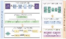
Fig. 1
Road centerline restoration technical roadmap"
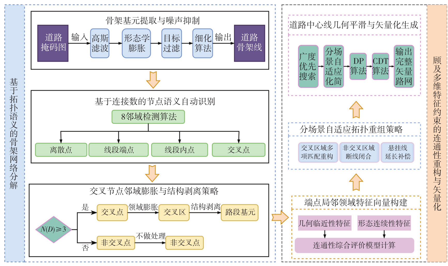
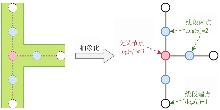
Fig. 2
The topological significance of road network nodes"
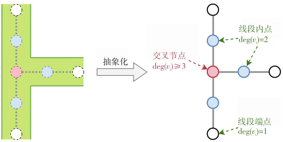
Fig. 3
Local map spots and refinement results"
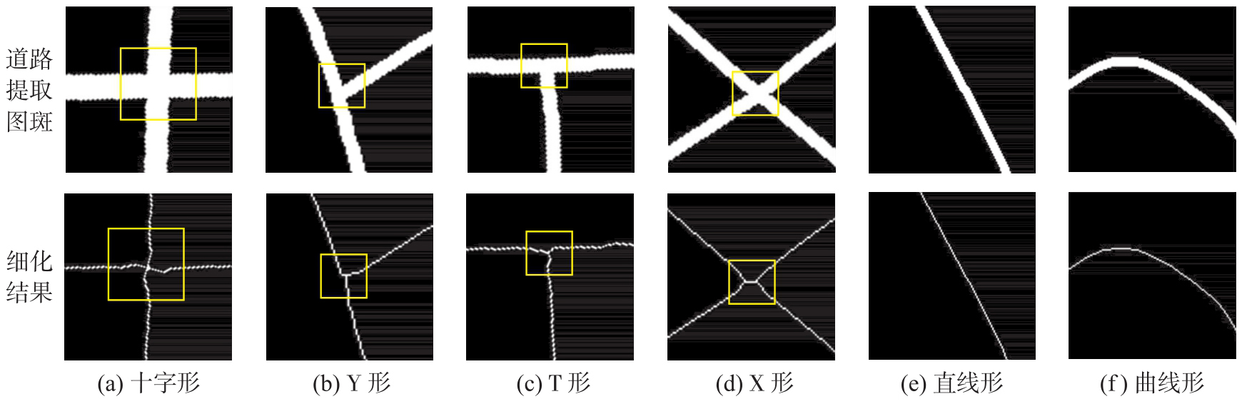
Fig. 4
The phenomenon of broken road patch"
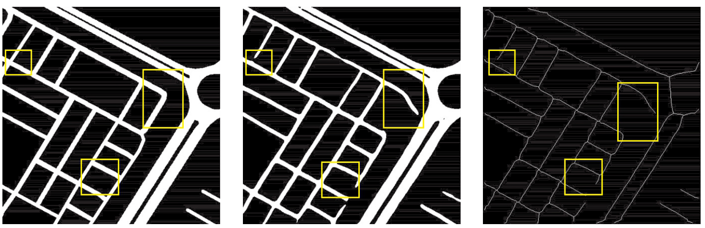
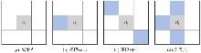
Fig. 5
Using the eight-neighborhood algorithm to classify nodes"
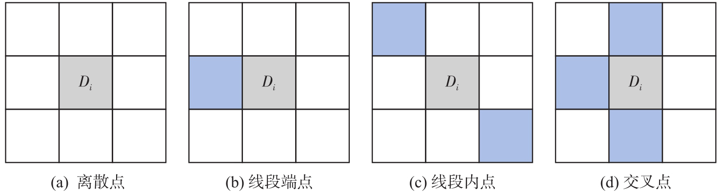
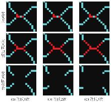
Fig. 6
The removal of overlapping areas at various iteration counts"
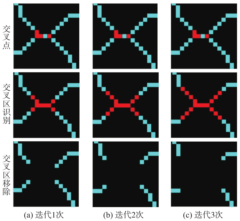
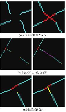
Fig. 7
Road connectivity reconstruction"
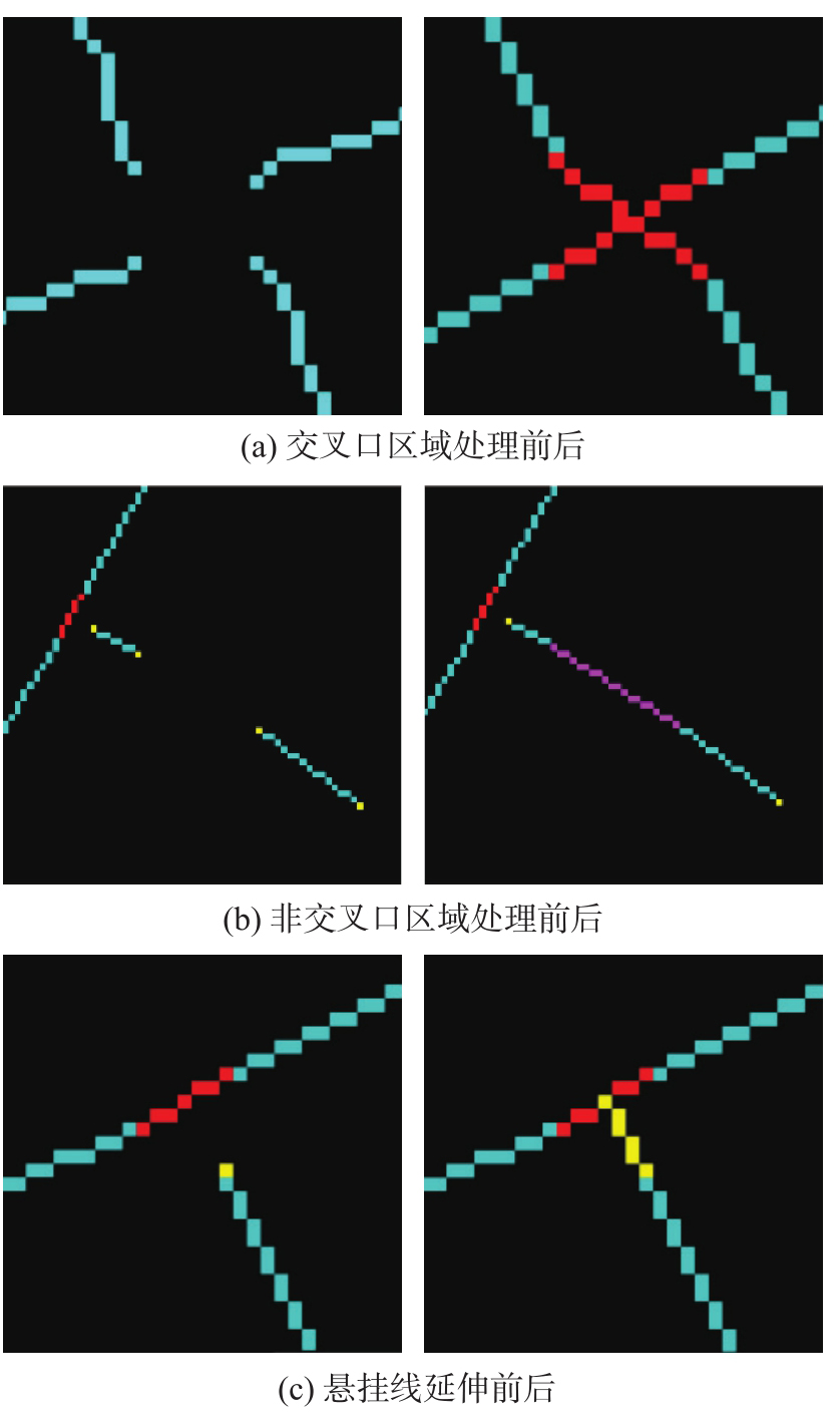
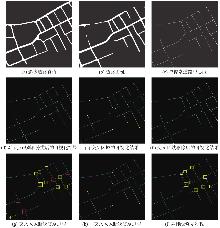
Fig. 8
Visualization of the repair process"

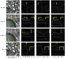
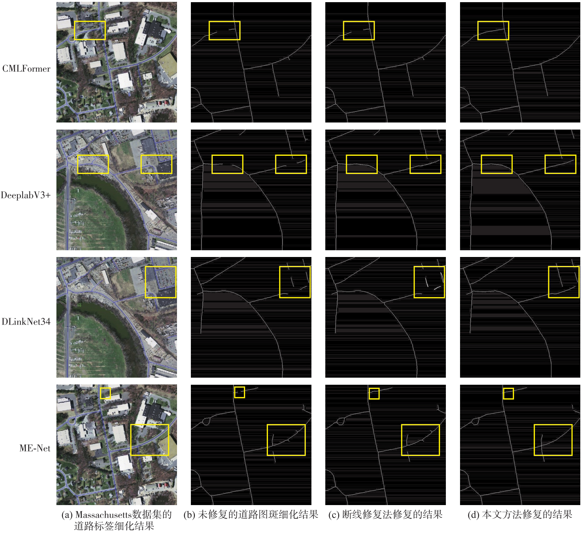
Fig. 9
Visualization of comparison test results of different models on the Massachusetts dataset"

Tab. 1
Quantitative results of different models on the Massachusetts dataset"
| 模型 | 方法 | 指标 | |||
|---|---|---|---|---|---|
| SN/m | SR/m | N/(%) | T/s | ||
| CMLFormer | 未修复 | 0.95 | 1.04 | 96.20 | 3.74 |
| 断线修复法 | 0.93 | 1.01 | 96.52 | 4.51 | |
| 本文方法 | 0.89 | 0.99 | 96.89 | 4.39 | |
| DeeplabV3+ | 未修复 | 1.91 | 1.99 | 93.90 | 3.88 |
| 断线修复法 | 1.90 | 1.97 | 94.52 | 4.12 | |
| 本文方法 | 1.82 | 1.91 | 94.92 | 3.86 | |
| DLinkNet34 | 未修复 | 1.10 | 1.18 | 96.21 | 3.70 |
| 断线修复法 | 1.08 | 1.17 | 96.35 | 3.79 | |
| 本文方法 | 1.06 | 1.15 | 96.68 | 3.89 | |
| ME-Net | 未修复 | 1.17 | 1.25 | 95.60 | 3.89 |
| 断线修复法 | 1.12 | 1.21 | 95.92 | 3.77 | |
| 本文方法 | 1.08 | 1.15 | 96.56 | 3.71 | |
Fig. 10
The impact of cross-regional parameters on experimental results"
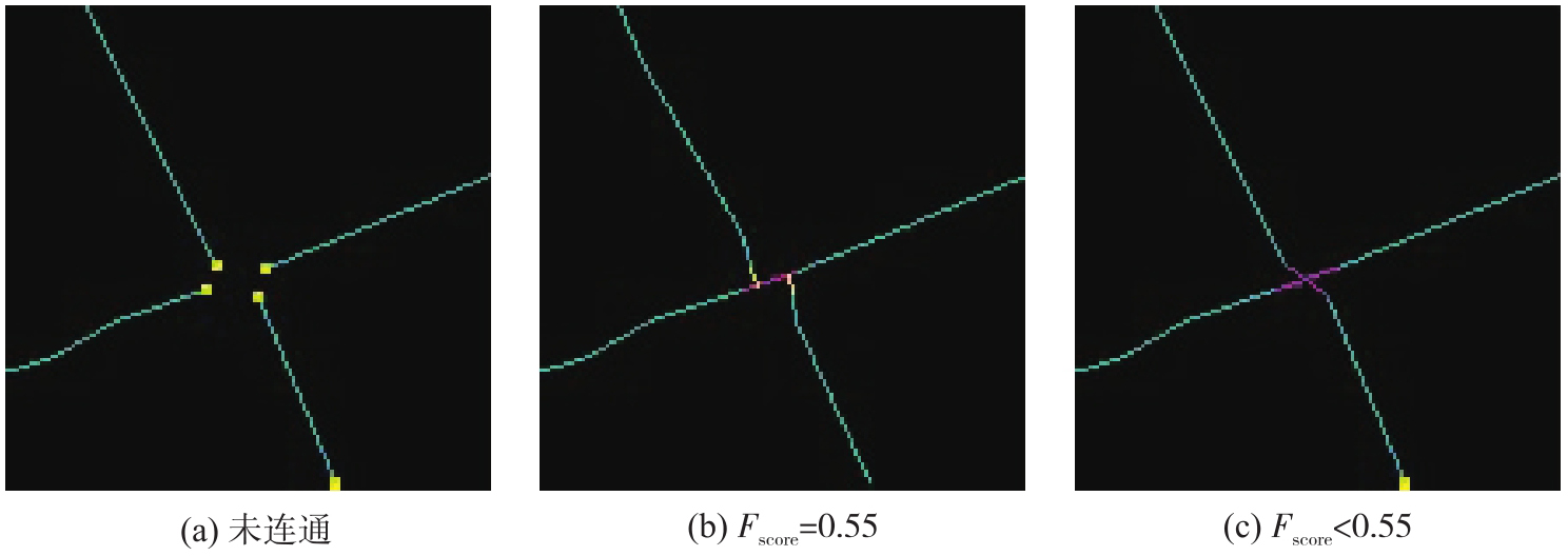
Fig. 11
The impact of non-overlapping area parameters on experimental results"
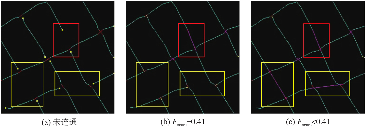
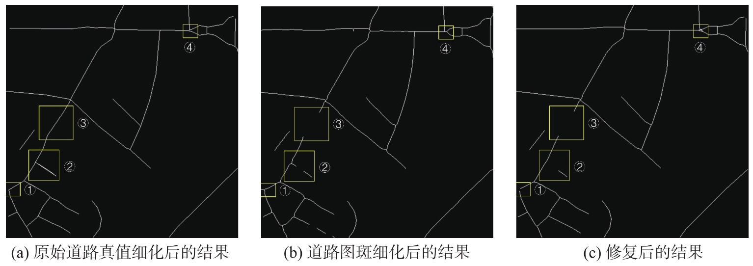
Fig. 12
Details of failure case errors"
| [1] |
孙群, 温伯威, 陈欣. 多源地理空间数据一致性处理研究进展[J]. 测绘学报, 2022, 51(7): 1561-1574. DOI: .
doi: 10.11947/j.AGCS.2022.20220151 |
|
Sun Qun, Wen Bowei, Chen Xin. Research on consistency processing of multi-source geospatial data[J]. Acta Geodaetica et Cartographica Sinica, 2022, 51(7): 1561-1574. DOI: .
doi: 10.11947/j.AGCS.2022.20220151 |
|
| [2] |
孙群, 任福, 龙毅, 等. 中国地图制图学与地理信息工程进展报告(2019—2023)[J]. 测绘学报, 2024, 53(3): 399-412. DOI: .
doi: 10.11947/j.AGCS.2024.20230562 |
|
Sun Qun, Ren Fu, Long Yi, et al. The progress and trend of cartography and geographic information engineering in China (2019—2023)[J]. Acta Geodaetica et Cartographica Sinica, 2024, 53(3): 399-412. DOI: .
doi: 10.11947/j.AGCS.2024.20230562 |
|
| [3] | 张永宏, 何静, 阚希, 等. 遥感图像道路提取方法综述[J]. 计算机工程与应用, 2018, 54(13): 1-10, 51. |
| Zhang Yonghong, He Jing, Kan Xi, et al. Summary of road extraction methods for remote sensing images[J]. Computer Engineering and Applications, 2018, 54(13): 1-10, 51. | |
| [4] | 戴激光, 王杨, 杜阳, 等. 光学遥感影像道路提取的方法综述[J]. 遥感学报, 2020, 24(7): 804-823. |
| Dai Jiguang, Wang Yang, Du Yang, et al. Development and prospect of road extraction method for optical remote sensing image[J]. Journal of Remote Sensing, 2020, 24(7): 804-823. | |
| [5] | Lian Renbao, Wang Weixing, Mustafa N, et al. Road extraction methods in high-resolution remote sensing images: a comprehensive review[J]. IEEE Journal of Selected Topics in Applied Earth Observations and Remote Sensing, 2020, 13: 5489-5507. |
| [6] | 寇曼曼, 王勤忠, 万娜. 栅格地图道路的快速矢量化方法研究与实现[J]. 计算机与现代化, 2014(9): 82-85. |
| Kou Manman, Wang Qinzhong, Wan Na. Study and implementation of fast vectorization for raster map road[J]. Computer and Modernization, 2014(9): 82-85. | |
| [7] | 刘帝佑, 孔赟珑, 陈静波, 等. 制图级矢量要素遥感智能解译的研究进展与展望[J]. 地球信息科学学报, 2025, 27(2): 285-304. |
| Liu Diyou, Kong Yunlong, Chen Jingbo, et al. Recent progress and prospects in remote sensing image intelligent extraction of cartographic-level vector elements[J]. Journal of Geo-Information Science, 2025, 27(2): 285-304. | |
| [8] | Chen Xin, Sun Qun, Guo Wenyue, et al. GA-Net: a geometry prior assisted neural network for road extraction[J]. International Journal of Applied Earth Observation and Geoinformation, 2022, 114: 103004. |
| [9] | Yu Lequan, Zhang Zhicheng, Li Xiaomeng, et al. Deep sinogram completion with image prior for metal artifact reduction in CT images[J]. IEEE Transactions on Medical Imaging, 2021, 40(1): 228-238. |
| [10] | Chen Xin, Yu Anzhu, Sun Qun, et al. Updating road maps at city scale with remote sensed images and existing vector maps[J]. IEEE Transactions on Geoscience and Remote Sensing, 2024, 62: 5616521. |
| [11] | 陈奕州, 韦春桃. 遥感影像道路断线修复方法研究[J]. 地理空间信息, 2024, 22(4): 34-38. |
| Chen Yizhou, Wei Chuntao. Repair method of road broke in remote sensing image[J]. Geospatial Information, 2024, 22(4): 34-38. | |
| [12] | Zhang Xinchang, Shi Qian, Sun Ying, et al. The review of land use/land cover mapping AI methodology and application in the era of remote sensing big data[J]. Journal of Geodesy and Geoinformation Science, 2024, 7(3): 1-23. |
| [13] | 郭威, 王立辉, 李洪堃. 基于圆形模板的遥感影像道路半自动提取方法[J]. 测绘与空间地理信息, 2021, 44(S1): 183-186, 191. |
| Guo Wei, Wang Lihui, Li Hongkun. Semi-automatic road extraction method from remote sensing image based on circular template[J]. Geomatics & Spatial Information Technology, 2021, 44(S1): 183-186, 191. | |
| [14] |
连仁包, 王卫星, 李娟. 自适应圆形模板及显著图的高分辨遥感图像道路提取[J]. 测绘学报, 2018, 47(7): 950-958. DOI: .
doi: 10.11947/j.AGCS.2018.20170596 |
|
Lian Renbao, Wang Weixing, Li Juan. Road extraction from high-resolution remote sensing images based on adaptive circular template and saliency map[J]. Acta Geodaetica et Cartographica Sinica, 2018, 47(7): 950-958. DOI: .
doi: 10.11947/j.AGCS.2018.20170596 |
|
| [15] | Miao Zelang, Wang Bin, Shi Wenzhong, et al. A semi-automatic method for road centerline extraction from VHR images[J]. IEEE Geoscience and Remote Sensing Letters, 2014, 11(11): 1856-1860. |
| [16] |
连仁包, 张振敏, 廖一鹏, 等. 结合测地距离场与曲线平滑的遥感图像道路中心线快速提取[J]. 测绘学报, 2023, 52(8): 1317-1329. DOI: .
doi: 10.11947/j.AGCS.2023.20220002 |
|
Lian Renbao, Zhang Zhenmin, Liao Yipeng, et al. A quick road centreline extraction method from remote sensing images combining with geodesic distance field and curve smoothing[J]. Acta Geodaetica et Cartographica Sinica, 2023, 52(8): 1317-1329. DOI: .
doi: 10.11947/j.AGCS.2023.20220002 |
|
| [17] | 赵金奇, 杨杰, 李平湘, 等. 改进剖面匹配和EKF对SAR影像道路半自动提取[J]. 武汉大学学报(信息科学版), 2017, 42(8): 1144-1150. |
| Zhao Jinqi, Yang Jie, Li Pingxiang, et al. Semi-automatic road extraction from SAR images using an improved profile matching and EKF[J]. Geomatics and Information Science of Wuhan University, 2017, 42(8): 1144-1150. | |
| [18] | 丁磊, 张保明, 郭海涛, 等. 矢量数据辅助的高分辨率遥感影像道路自动提取[J]. 遥感学报, 2017, 21(1): 84-95. |
| Ding Lei, Zhang Baoming, Guo Haitao, et al. Automatic road extraction from high-resolution remote sensing images assisted by vector data[J]. National Remote Sensing Bulletin, 2017, 21(1): 84-95. | |
| [19] | Vincze M, Kövári B. Comparative survey of thinning algorithms[C]//Proceedings of the 10th International Symposium of Hungarian Researchers on Computational Intelligence and Informatics. Budapest: Budapest Tech, 2009: 173-184. |
| [20] | Zhang T Y, Suen C Y. A fast parallel algorithm for thinning digital patterns[J]. Communications of the ACM, 1984, 27(3): 236-239. |
| [21] | 陈品, 王涛, 张德港. 一种基于模板的二阶段ZS细化算法[J]. 计算机技术与发展, 2023, 33(2): 44-49, 56. |
| Chen Pin, Wang Tao, Zhang Degang. A two-stage ZS thinning algorithm based on template[J]. Computer Technology and Development, 2023, 33(2): 44-49, 56. | |
| [22] | 韩建峰, 宋丽丽. 改进的字符图像细化算法[J]. 计算机辅助设计与图形学学报, 2013, 25(1): 62-66. |
| Han Jianfeng, Song Lili. An improved thinning algorithm for character image[J]. Journal of Computer-Aided Design & Computer Graphics, 2013, 25(1): 62-66. | |
| [23] | 常庆贺, 吴敏华, 骆力明. 基于改进ZS细化算法的手写体汉字骨架提取[J]. 计算机应用与软件, 2020, 37(7): 107-113, 164. |
| Chang Qinghe, Wu Minhua, Luo Liming. Handwritten Chinese character skeleton extraction based on improved ZS thinning algorithm[J]. Computer Applications and Software, 2020, 37(7): 107-113, 164. | |
| [24] | Su Zhewen, Cao Zhongsheng, Wang Yuanzhen. Stroke extraction based on ambiguous zone detection: a preprocessing step to recover dynamic information from handwritten Chinese characters[J]. International Journal on Document Analysis and Recognition (IJDAR), 2009, 12(2): 109-121. |
| [25] | Cheng Tao, Zhang Yang, Haworth J. Network SpaceTime AI: concepts, methods and applications[J]. Journal of Geodesy and Geoinformation Science, 2022, 5(3): 78-92. |
| [26] | Fan D L, Wang B, Chen Z L, et al. Research on broken road connection method after road extraction from high-resolution remote sensing image[J]. The International Archives of the Photogrammetry, Remote Sensing and Spatial Information Sciences, 2020: 387-395. |
| [27] | Duan L Y, Mapurisa W, Leras M, et al. BrightEarth roads: towards fully automatic road network extraction from satellite imagery[C]//Proceedings of 2024 IEEE International Geoscience and Remote Sensing Symposium. Athens: IEEE, 2024: 9192-9196. |
| [28] | Teng Zixuan, Zheng Zezhong, Sun Xiangyang, et al. Topology-aware road extraction from remote sensing images using deep learning and graph-based connectivity refinement[J]. ISPRS International Journal of Geo-Information, 2026, 15(5): 208. |
| [29] | Deng Ligao, Deng Yupeng, Meng Yu, et al. GLD-Road: a global-local decoding road network extraction model for remote sensing images[J]. ISPRS Journal of Photogrammetry and Remote Sensing, 2025, 228: 741-755. |
| [30] | Bag S, Harit G. An improved contour-based thinning method for character images[J]. Pattern Recognition Letters, 2011, 32(14): 1836-1842. |
| [31] | 周正扬, 詹恩奇, 郑建彬, 等. 局部关联度最优的手写汉字骨架提取[J]. 中国图象图形学报, 2017, 22(6): 833-841. |
| Zhou Zhengyang, Zhan Enqi, Zheng Jianbin, et al. Skeleton extraction algorithm based on optimum local correlation degree for handwritten Chinese characters[J]. Journal of Image and Graphics, 2017, 22(6): 833-841. | |
| [32] | Douglas D H, Peucker T K. Algorithms for the reduction of the number of points required to represent a digitized line or its caricature[J]. The Canadian Cartographer, 1973, 10(2): 112-122. |
| [33] | Demir I, Koperski K, Lindenbaum D, et al. DeepGlobe 2018: a challenge to parse the Earth through satellite images[C]//Proceedings of 2018 IEEE/CVF Conference on Computer Vision and Pattern Recognition Workshops. Salt Lake City: IEEE, 2018. |
| [34] | Mnih V. Machine learning for aerial image labeling[D]. Toronto: University of Toronto, 2013. |
| [35] | Chen L C, Zhu Yukun, Papandreou G, et al. Encoder-decoder with atrous separable convolution for semantic image segmentation[C]//Proceedings of 2018 Computer Vision. Cham: Springer International Publishing, 2018: 833-851. |
| [36] | Wu Honglin, Zhang Min, Huang Peng, et al. CMLFormer: CNN and multiscale local-context transformer network for remote sensing images semantic segmentation[J]. IEEE Journal of Selected Topics in Applied Earth Observations and Remote Sensing, 2024, 17: 7233-7241. |
| [37] | Zhou Lichen, Zhang Chuang, Wu Ming. D-LinkNet: LinkNet with pretrained encoder and dilated convolution for high resolution satellite imagery road extraction[C]//Proceedings of 2018 IEEE/CVF Conference on Computer Vision and Pattern Recognition Workshops. Salt Lake City: IEEE, 2018: 192-196. |
| [38] | Zhang Ke, Guo Wenyue, Yu Anzhu, et al. Road extraction network for remote sensing images based on multiscale feature fusion and edge-guided attention[J]. IEEE Journal of Selected Topics in Applied Earth Observations and Remote Sensing, 2025, 18: 24399-24414. |
| [1] | YAO Zhipeng, PENG Cheng, TANG Jianbo, LIU Guoping, YANG Xuexi, LIU Huimin, DENG Min. An adaptive road centerline extraction method for different trajectory data scenarios based on combinatorial optimization [J]. Acta Geodaetica et Cartographica Sinica, 2024, 53(2): 379-390. |
| [2] | LIAN Renbao, ZHANG Zhenmin, LIAO Yipeng, ZOU Changzhong, HUANG Liqin. A quick road centreline extraction method from remote sensing images combining with geodesic distance field and curve smoothing [J]. Acta Geodaetica et Cartographica Sinica, 2023, 52(8): 1317-1329. |
| [3] | CAO Fanzhi, ZHU Shulong, ZHU Baoshan, LI Runsheng, MENG Weican. Tracking Road Centerlines from Remotely Sensed Imagery Using Mean Shift and Kalman Filtering [J]. Acta Geodaetica et Cartographica Sinica, 2016, 45(2): 205-212. |
| Viewed | ||||||
|
Full text |
|
|||||
|
Abstract |
|
|||||
