

Acta Geodaetica et Cartographica Sinica ›› 2026, Vol. 55 ›› Issue (8): 1331-1342.doi: 10.11947/j.AGCS.2026.20260305
• Express paper •
Fei Guo1( ), Qinyu Guo1(), Guoji Hu1, Xiaohong Zhang1,2, Qi Tang3
Received:2026-07-29
Revised:2026-08-14
Published:2026-09-09
Contact:
Qinyu Guo
E-mail:fguo@whu.edu.cn;qinyuguo@whu.edu.cn
About author:Guo Fei (1984—), male, professor, majors in GNSS reflectometry. E-mail: fguo@whu.edu.cn
Supported by:CLC Number:
Fei Guo, Qinyu Guo, Guoji Hu, Xiaohong Zhang, Qi Tang. Rapid monitoring and analysis of sea surface wind fields and flooding processes associated with Typhoon Bavi (2026) based on multi-source GNSS-R observations[J]. Acta Geodaetica et Cartographica Sinica, 2026, 55(8): 1331-1342.
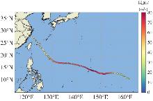
Fig. 1
Track and intensity of Typhoon Bavi from July 2 to July 12, 2026"
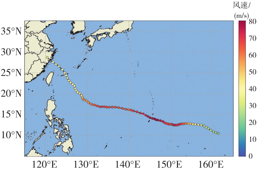
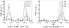
Fig. 2
Time series of rainfall over Zhejiang province and Fujian province from July 2 to July 14, 2026"
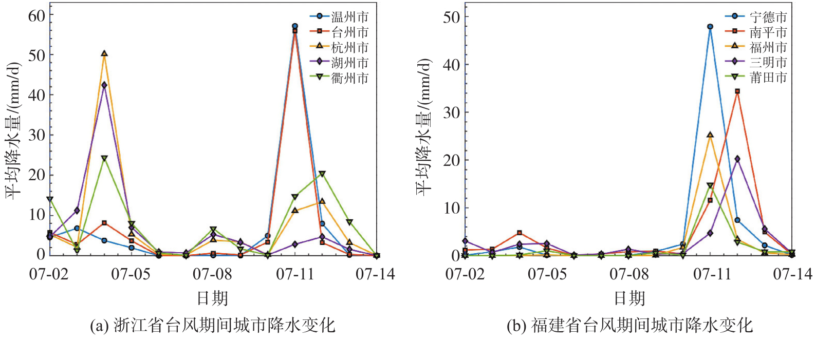
Fig. 3
Spatial distribution of rainfall over Zhejiang province and Fujian province before and after the peak precipitation"
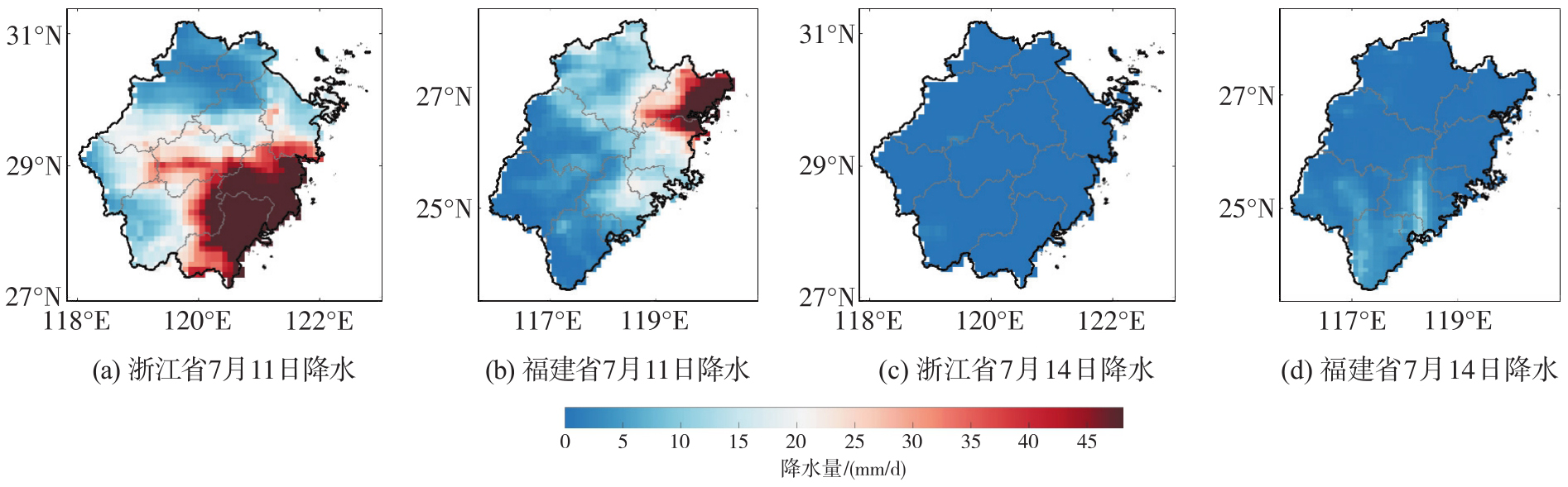
Fig. 4
Observational coverage comparison of SMAP, ASCAT, and multi-source GNSS-R over the sea area affected by Typhoon Bavi on July 3, 2026"
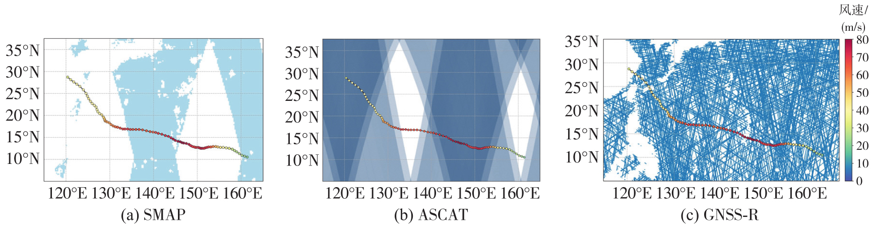
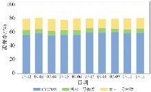
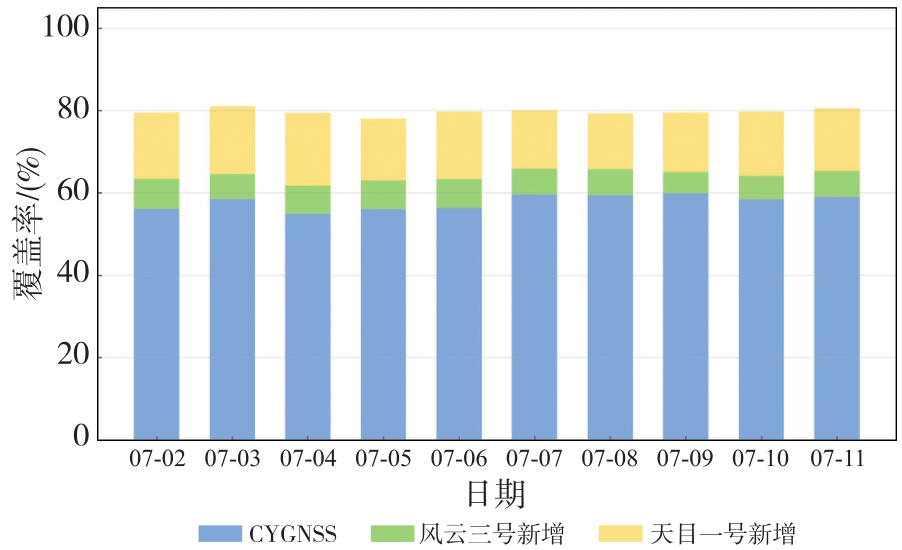
Fig. 5
Improvement in spatial coverage enabled by joint multi-source GNSS-R observations"

Tab. 1
Main characteristic parameters of multi-source GNSS-R data products"
| 卫星任务 | 卫星数量 | 轨道倾角 | 平均重访时间/h | 空间覆盖范围 | 监测日期 | 本文所用产品 |
|---|---|---|---|---|---|---|
| CYGNSS | 8 | 35° | 约7.2 | 38°S-38°N | 07-02—07-14 | 一级科学数据;二级海面风速产品 |
| 风云三号E/F/G | 3 | 98.7°/98.7°/50° | 约12 | 全球 | 07-02—07-14 | 一级科学数据;二级海面风速产品 |
| 天目一号 | 22 | 97.4° | 约3 | 全球 | 07-02—07-14 | 二级海面风速产品 |
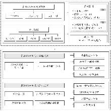
Fig. 6
Overall technical workflow"

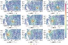
Fig. 7
Daily spatial distribution of sea surface wind speed from multi-source GNSS-R during Typhoon Bavi"

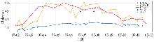
Fig. 8
Time series comparison of maximum wind speeds from multiple wind products"
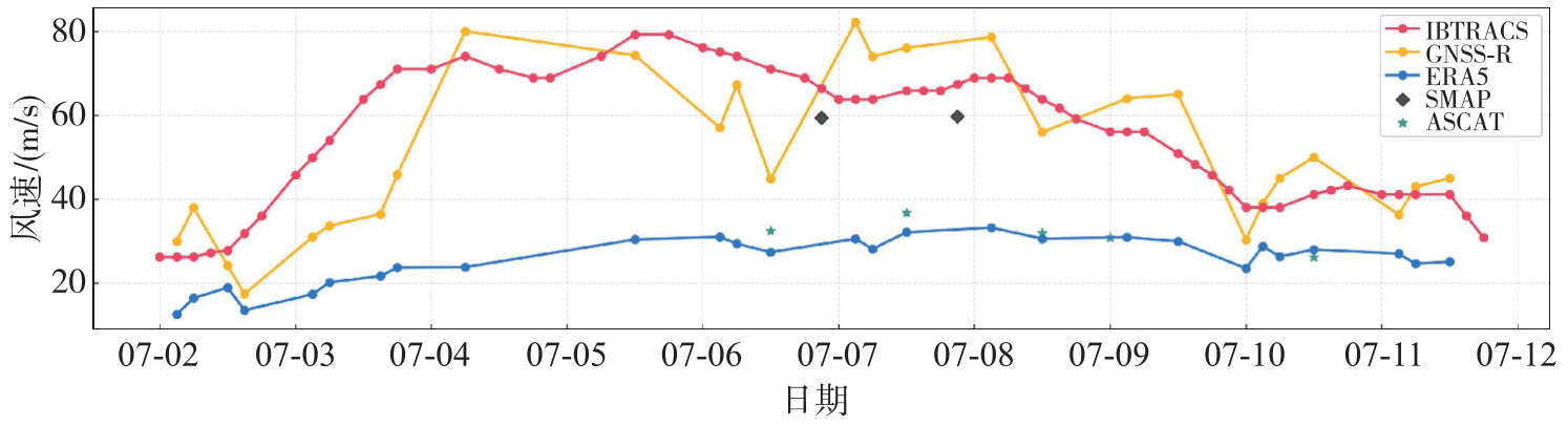
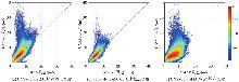
Fig. 9
Density scatterplots of GNSS-R versus reference wind products"
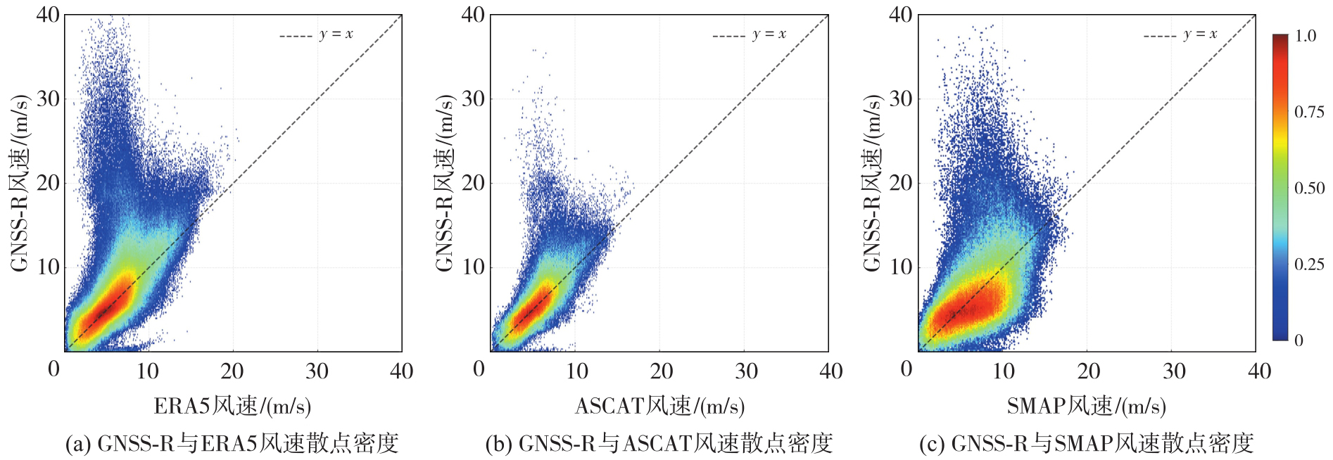
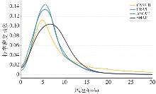
Fig. 10
Comparison of wind speed frequency distributions among different wind products"
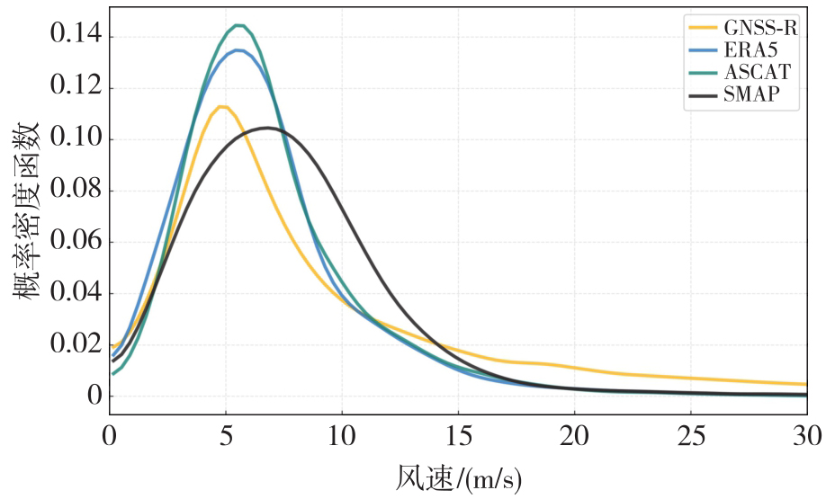
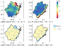
Fig. 11
Spatial distribution of brightness temperature and water body identification results over Zhejiang province and Fujian province on July 13, 2026"
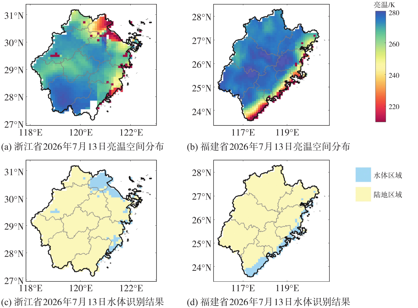
Fig. 12
Spatial distribution of surface reflectivity and water body identification results over Zhejiang province and Fujian province on July 13, 2026"
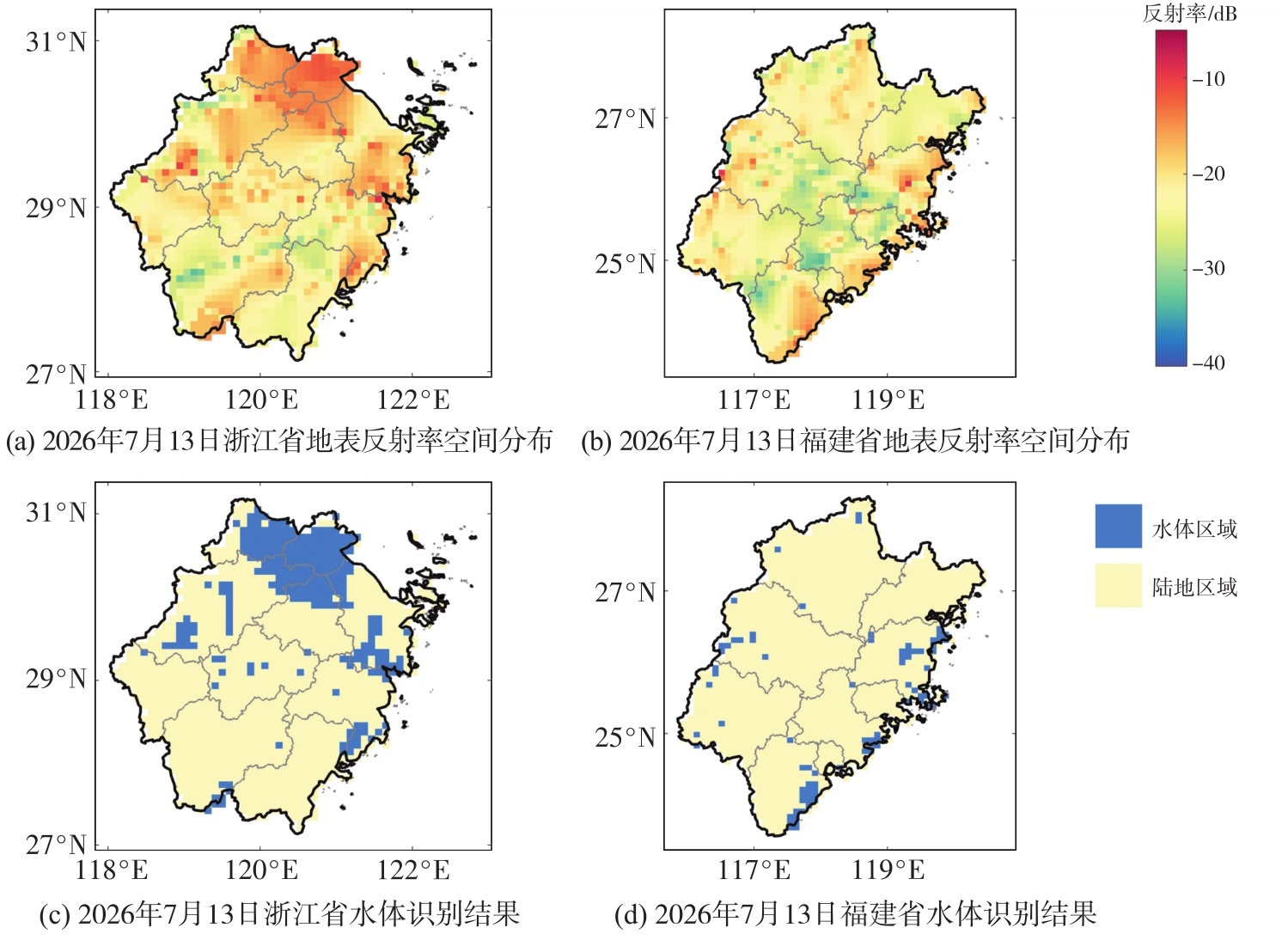
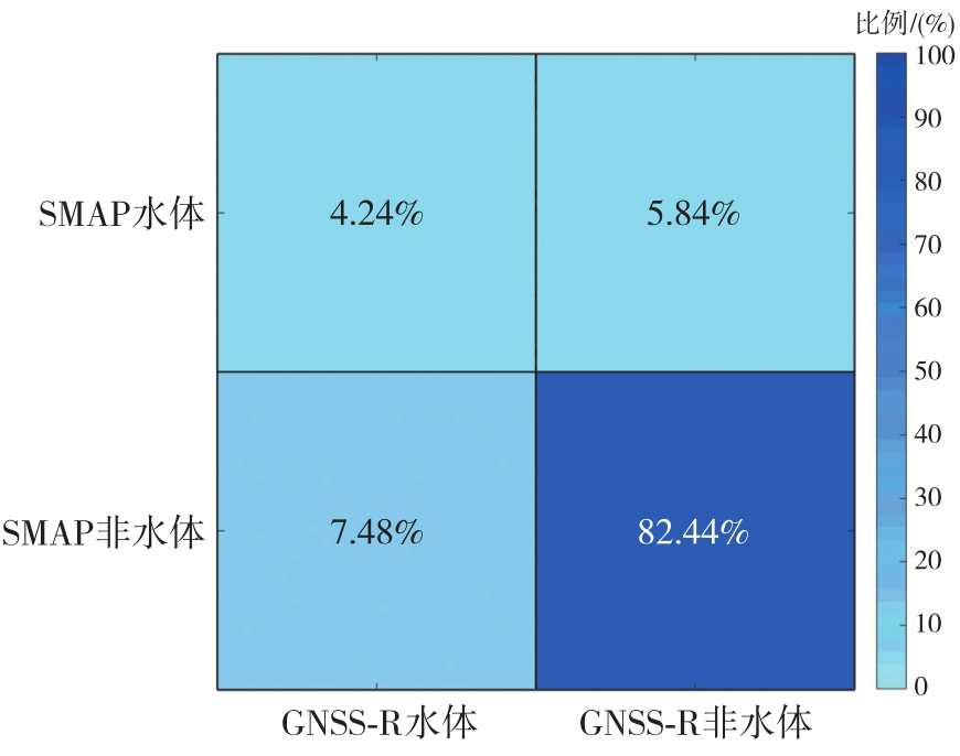
Fig. 13
Confusion matrix of water body identification between GNSS-R and SMAP"
| [1] | Liu Jincan, Ding Jie, Wang Jichao. Tropical cyclone-affected ocean surface winds: a comparison of atmospheric reanalysis with altimeter, scatterometer, radiometer, and buoy measurements[J]. IEEE Transactions on Geoscience and Remote Sensing, 2025, 63: 4103411. |
| [2] | Qian Chuanhai, Li Ying, Xu Yinglong, et al. Tropical cyclone monitoring and analysis techniques: a review[J]. Journal of Meteorological Research, 2024, 38(2): 351-367. |
| [3] |
杨飞, 汪莹莹, 李志才, 等. 基于GNSS观测的2023北京特大暴雨分析[J]. 测绘学报, 2025, 54(1): 14-25. DOI: .
doi: 10.11947/j.AGCS.2025.20230548 |
|
Yang Fei, Wang Yingying, Li Zhicai, et al. Analysis of heavy rainstorm in Beijing in 2023 based on GNSS observa-tions[J]. Acta Geodaetica et Cartographica Sinica, 2025, 54(1): 14-25. DOI: .
doi: 10.11947/j.AGCS.2025.20230548 |
|
| [4] | Knaff J A, Sampson C R, Kucas M E, et al. Estimating tropical cyclone surface winds: current status, emerging technologies, historical evolution, and a look to the future[J]. Tropical Cyclone Research and Review, 2021, 10(3): 125-150. |
| [5] | Slocum C J, Razin M N, Knaff J A, et al. Does ERA5 mark a new era for resolving the tropical cyclone environment?[J]. Journal of Climate, 2022, 35(21): 7147-7164. |
| [6] | Tamizi A, Young I R, Ribal A, et al. Global scatterometer observations of the structure of tropical cyclone wind fields[J]. Monthly Weather Review, 2020, 148(11): 4673-4692. |
| [7] | 刘经南, 邵连军, 张训械. GNSS-R研究进展及其关键技术[J]. 武汉大学学报(信息科学版), 2007, 32(11): 955-960. |
| Liu Jingnan, Shao Lianjun, Zhang Xunxie. Advances in GNSS-R studies and key technologies[J]. Geomatics and Information Science of Wunan University, 2007, 32(11): 955-960. | |
| [8] | 万玮, 陈秀万, 彭学峰, 等. GNSS遥感研究与应用进展和展望[J]. 遥感学报, 2016, 20(5): 858-874. |
| Wan Wei, Chen Xiuwan, Peng Xuefeng, et al. Overview and outlook of GNSS remote sensing technology and applications[J]. Journal of Remote Sensing, 2016, 20(5): 858-874. | |
| [9] |
金双根, 张勤耘, 钱晓东. 全球导航卫星系统反射测量(GNSS+R)最新进展与应用前景[J]. 测绘学报, 2017, 46(10): 1389-1398. DOI: .
doi: 10.11947/j.AGCS.2017.20170282 |
|
Jin Shuanggen, Zhang Qinyun, Qian Xiaodong. New progress and application prospects of global navigation satellite system reflectometry (GNSS+R)[J]. Acta Geodaetica et Cartographica Sinica, 2017, 46(10): 1389-1398. DOI: .
doi: 10.11947/j.AGCS.2017.20170282 |
|
| [10] | 吴学睿, 宋少辉, 马文骁, 等. 典型水循环参数星载GNSS-R/SoOP-R遥感探测的研究现状[J]. 武汉大学学报(信息科学版), 2024, 49(1): 1-14. |
| Wu Xuerui, Song Shaohui, Ma Wenxiao, et al. A review of GNSS-R/SoOP-R for essential hydrological climate variables detection[J]. Geomatics and Information Science of Wuhan University, 2024, 49(1): 1-14. | |
| [11] |
马中民, 张双成, 周昕, 等. 顾及地表反射率不确定性的风云三号GNSS-R洪涝监测方法:以8•2广东极端暴雨灾害为例[J]. 测绘学报, 2026, 55(3): 451-464. DOI: .
doi: 10.11947/j.AGCS.2026.20250365 |
|
Ma Zhongmin, Zhang Shuangcheng, Zhou Xin, et al. A flood monitoring method using FY-3 GNSS-R accounting for surface reflectivity uncertainty: a case study of the August 2 Guangdong rainstorm disaster[J]. Acta Geodaetica et Cartographica Sinica, 2026, 55(3): 451-464. DOI: .
doi: 10.11947/j.AGCS.2026.20250365 |
|
| [12] |
陶庭叶, 李江洋, 朱勇超, 等. 阶段模型修正的星载GNSS-R土壤湿度反演方法[J]. 测绘学报, 2022, 51(9): 1942-1950. DOI: .
doi: 10.11947/j.AGCS.2022.20210026 |
|
Tao Tingye, Li Jiangyang, Zhu Yongchao, et al. Spaceborne GNSS-R for retrieving soil moisture based on the correction of stage model[J]. Acta Geodaetica et Cartographica Sinica, 2022, 51(9): 1942-1950. DOI: .
doi: 10.11947/j.AGCS.2022.20210026 |
|
| [13] | 刘奇, 张双成, 南阳, 等. 利用星载GNSS-R相干信号探测南亚洪水[J]. 武汉大学学报(信息科学版), 2021, 46(11): 1641-1648. |
| Liu Qi, Zhang Shuangcheng, Nan Yang, et al. Flood detection of south Asia using spaceborne GNSS-R coherent signals[J]. Geomatics and Information Science of Wuhan University, 2021, 46(11): 1641-1648. | |
| [14] |
杨文涛, 郭斐, 张小红, 等. 利用GNSS反射计和SMAP辐射计反演青藏高原土壤湿度和冻融状态[J]. 测绘学报, 2025, 54(4): 725-735. DOI: .
doi: 10.11947/j.AGCS.2025.20240360 |
|
Yang Wentao, Guo Fei, Zhang Xiaohong, et al. Soil moisture and freeze-thaw map using GNSS reflectometer and SMAP radiometer for Qinghai-Xizang Plateau[J]. Acta Geodaetica et Cartographica Sinica, 2025, 54(4): 725-735. DOI: .
doi: 10.11947/j.AGCS.2025.20240360 |
|
| [15] |
布金伟, 余科根, 汪秋兰, 等. 融合星载GNSS-R数据和多变量参数全球海洋有效波高深度学习反演法[J]. 测绘学报, 2024, 53(7): 1321-1335. DOI: .
doi: 10.11947/j.AGCS.2024.20230050 |
|
Bu Jinwei, Yu Kegen, Wang Qiulan, et al. Deep learning retrieval method for global ocean significant wave height by integrating spaceborne GNSS-R data and multivariable parameters[J]. Acta Geodaetica et Cartographica Sinica, 2024, 53(7): 1321-1335. DOI: .
doi: 10.11947/j.AGCS.2024.20230050 |
|
| [16] |
朱勇超. 星载GNSS-R海冰检测与海冰密集度反演方法研究[J]. 测绘学报, 2020, 49(12): 1643. DOI: .
doi: 10.11947/j.AGCS.2020.20190473 |
|
Zhu Yongchao. Study of spaceborne GNSS-R for sea ice detection and sea ice concentration retrieval methods[J]. Acta Geodaetica et Cartographica Sinica, 2020, 49(12): 1643. DOI: .
doi: 10.11947/j.AGCS.2020.20190473 |
|
| [17] |
布金伟, 余科根, 韩帅. 星载GNSS-R海浪有效波高反演模型构建[J]. 测绘学报, 2022, 51(9): 1920-1930. DOI: .
doi: 10.11947/j.AGCS.2022.20210284 |
|
Bu Jinwei, Yu Kegen, Han Shuai. Construction of spaceborne GNSS-R ocean waves significant wave height retrieval model[J]. Acta Geodaetica et Cartographica Sinica, 2022, 51(9): 1920-1930. DOI: .
doi: 10.11947/j.AGCS.2022.20210284 |
|
| [18] |
宋敏峰, 何秀凤, 王笑蕾, 等. 顾及地球曲率及椭球高的GNSS-R几何计算方法[J]. 测绘学报, 2023, 52(6): 884-894. DOI: .
doi: 10.11947/j.AGCS.2023.20210563 |
|
Song Minfeng, He Xiufeng, Wang Xiaolei, et al. A GNSS-R geometry computation method considering the Earth's curvature and ellipsoidal height[J]. Acta Geodaetica et Cartographica Sinica, 2023, 52(6): 884-894. DOI: .
doi: 10.11947/j.AGCS.2023.20210563 |
|
| [19] |
布金伟, 刘淑慧, 徐顺双, 等. 星载GNSS-R全球海浪波周期估计的经验模型构建[J]. 测绘学报, 2026, 55(4): 684-697. DOI: .
doi: 10.11947/j.AGCS.2026.20250239 |
|
Bu Jinwei, Liu Shuhui, Xu Shunshuang, et al. Construction of an empirical model for estimating the global wave period of spaceborne GNSS-R[J]. Acta Geodaetica et Cartographica Sinica, 2026, 55(4): 684-697. DOI: .
doi: 10.11947/j.AGCS.2026.20250239 |
|
| [20] | Li Weiqiang, Cardellach E, Fabra F, et al. Assessment of spaceborne GNSS-R ocean altimetry performance using CYGNSS mission raw data[J]. IEEE Transactions on Geoscience and Remote Sensing, 2020, 58(1): 238-250. |
| [21] | Ruf C, Unwin M, Dickinson J, et al. CYGNSS: enabling the future of hurricane prediction [remote sensing satellites[J]. IEEE Geoscience and Remote Sensing Magazine, 2013, 1(2): 52-67. |
| [22] | Yang Guanglin, Bai Weihua, Wang Jinsong, et al. FY3E GNOS II GNSS reflectometry: mission review and first results[J]. Remote Sensing, 2022, 14(4): 988. |
| [23] | Huang Feixiong, Yin Cong, Liu Yan, et al. Tianmu-1 constellation GNSS-R in-orbit performance: spatiotemporal characteristics, product applications, and polarimetric features[J]. IEEE Transactions on Geoscience and Remote Sensing, 2025, 63: 5802020. |
| [24] | Xie Yunjian, Yan Qingyun. Retrieval of sea ice thickness using FY-3E/GNOS-II data[J]. Satellite Navigation, 2024, 5(1): 17. |
| [25] | Li Xiaohui, Yang Jingsong, Wang Jiuke, et al. Tropical cyclone winds retrieval algorithm for the cyclone global navigation satellite system mission[J]. IEEE Geoscience and Remote Sensing Letters, 2023, 20: 4501105. |
| [26] | Ma Xiangchao, Yang Dongkai, Wang Feng, et al. Tropical cyclone detection and tracking using spatial-temporal characteristics of regional wind speed from CYGNSS: proof of concept and assessment[J]. IEEE Transactions on Geoscience and Remote Sensing, 2026, 64: 1-19. |
| [27] | Du H, Fablet R, Nguyen T T N, et al. Gap-free GNSS-R wind field reconstruction: a neural mapping scheme and initial validation[J]. Remote Sensing of Environment, 2026, 334: 115218. |
| [28] | Warnock A M, Ruf C S, Russel A, et al. CYGNSS level 3 merged wind speed data product for storm force and surrounding environmental winds[J]. IEEE Journal of Selected Topics in Applied Earth Observations and Remote Sensing, 2024, 17: 6189-6200. |
| [29] | Ricciardulli L, Mears C, Manaster A, et al. Assessment of CYGNSS wind speed retrievals in tropical cyclones[J]. Remote Sensing, 2021, 13(24): 5110. |
| [30] | Rahman M S, Di Liping, Yu E, et al. Rapid flood progress monitoring in cropland with NASA SMAP[J]. Remote Sensing, 2019, 11(2): 191. |
| [31] | Chou K H, Wu C C, Lin Shuzheng. Assessment of the ASCAT wind error characteristics by global dropwindsonde observations[J]. Journal of Geophysical Research: Atmospheres, 2013, 118(16): 9011-9021. |
| [32] | Molina M O, Gutiérrez C, Sánchez E. Comparison of ERA5 surface wind speed climatologies over Europe with observations from the HadISD dataset[J]. International Journal of Climatology, 2021, 41(10): 4864-4878. |
| [33] | Huffman G J, Bolvin D T, Braithwaite D, et al. NASA global precipitation measurement (GPM) integrated multi-satellite retrievals for GPM (IMERG)[J]. Algorithm theoretical basis document (ATBD) version, 2015, 4(26): 30. |
| [34] | Knapp K R, Kruk M C, Levinson D H, et al. The international best track archive for climate stewardship (IBTrACS): unifying tropical cyclone data[J]. Bulletin of the American Meteorological Society, 2010, 91(3): 363-376. |
| [35] | Yin Cong, Huang Feixiong, Xia Junming, et al. Soil moisture retrieval from multi-GNSS reflectometry on FY-3E GNOS-II by land cover classification[J]. Remote Sensing, 2023, 15(4): 1097. |
| [36] | Yang Wentao, Gao Fan, Xu Tianhe, et al. Daily flood monitoring based on spaceborne GNSS-R data: a case study on Henan, China[J]. Remote Sensing, 2021, 13(22): 4561. |
| [1] | Jinwei BU, Shuhui LIU, Shunshuang XU, Tongsu XIANG, Qiulan WANG, Chaoying JI, Xiaoqing ZUO. Construction of an empirical model for estimating the global wave period of spaceborne GNSS-R [J]. Acta Geodaetica et Cartographica Sinica, 2026, 55(4): 684-697. |
| [2] | Zhongmin MA, Shuangcheng ZHANG, Xin ZHOU, Qi LIU, Ning LIU, Hengli WANG. A flood monitoring method using FY-3 GNSS-R accounting for surface reflectivity uncertainty: a case study of the August 2 Guangdong rainstorm disaster [J]. Acta Geodaetica et Cartographica Sinica, 2026, 55(3): 451-464. |
| [3] | RUAN Rengui, JIA Xiaolin, FENG Laiping. Analysis on BDS Satellite Internal Multipath and Its Impact on Wide-lane FCB Estimation [J]. Acta Geodaetica et Cartographica Sinica, 2017, 46(8): 961-970. |
| [4] | KAN Xi, ZHANG Yonghong, CAO Ting, WANG Jiangeng, TIAN Wei. Snow Cover Recognition for Qinghai-Tibetan Plateau Using Deep Learning and Multispectral Remote Sensing [J]. Acta Geodaetica et Cartographica Sinica, 2016, 45(10): 1210-1221. |
| Viewed | ||||||
|
Full text |
|
|||||
|
Abstract |
|
|||||
