

Acta Geodaetica et Cartographica Sinica ›› 2026, Vol. 55 ›› Issue (8): 1400-1413.doi: 10.11947/j.AGCS.2026.20260730
• Photogrammetry and Remote Sensing • Previous Articles
Jianmei Wang1( ), Yu Duan1, Shaoming Zhang1(), Xinyan Li2,3
Received:2026-03-19
Revised:2026-08-10
Published:2026-09-09
Contact:
Shaoming Zhang
E-mail:jianmeiw@tongji.edu.cn;zhangshaoming@tongji.edu.cn
About author:Wang Jianmei (1971—), female, PhD, associate professor, majors in computer vision and remote sensing, and spatial data mining. E-mail: jianmeiw@tongji.edu.cn
Supported by:CLC Number:
Jianmei Wang, Yu Duan, Shaoming Zhang, Xinyan Li. Land use classification from evidence photos via the integration of vision foundation models and graph neural networks[J]. Acta Geodaetica et Cartographica Sinica, 2026, 55(8): 1400-1413.
Fig. 1
Evidence photo collection"
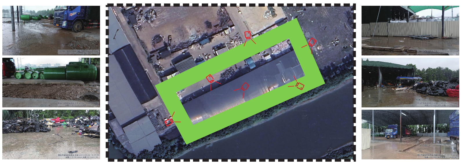
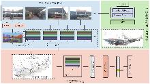
Fig. 2
Overall flowchart of the proposed method"


Tab. 1
Multi-level classification and definitions of selected land use categories"
| 一级建设用地 | 二级建设用地 | 含义 |
|---|---|---|
| 商服用地 | 零售商业用地 | 以零售功能为主的商铺和加油加气、充换电站等的用地 |
| 商务金融用地 | 指商务服务用地,以及经营性的办公场所用地 | |
| 娱乐用地 | 指剧院、音乐厅、电影院、歌舞厅、网吧、影视城以及绿地率<65%的大型游乐等设施用地 | |
| 其他商业服务业用地 | 指其他商服用地,含洗浴场所、废旧物资回收站,机动车、电子产品维修网点、物流营业网点 | |
| 工矿仓储用地 | 仓储用地 | 指用于物资储备、中转的场所用地。包括物流仓储设施、配送中心、转运中心等 |
| 公共管理与公共服务用地 | 公园与绿地 | 指城镇、村庄范围内的公园和用于休憩、美化环境及防护的绿化用地 |
| 交通运输用地 | 城镇村道路用地 | 指城镇、村庄范围内公用道路及行道树用地 |
| 水域及水利设施用地 | 河流水面 | 指天然形成或人工开挖河流常水位岸线之间的水面 |
| 沟渠 | 指人工修建用于引、排、灌的渠道 | |
| 其他土地 | 空闲地 | 指城镇、村庄、工矿范围内尚未使用的土地 |
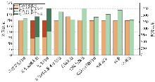
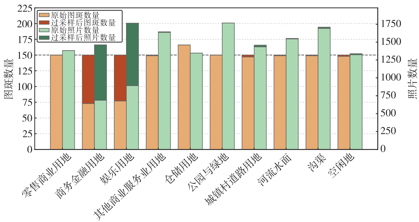
Fig. 3
Category distribution of the training set before and after random oversampling"
Tab. 2
Effects of graph convolutional network architecture parameters on validation OA"
| 隐藏维度 | OA | |||
|---|---|---|---|---|
| L=2 | L=3 | L=4 | L=5 | |
| H=256 | 75.5 | 76.8 | 75.1 | 74.4 |
| H=512 | 74.5 | 75.8 | 75.1 | 73.5 |
| H=1024 | 74.4 | 75.1 | 73.0 | 71.1 |
| H=2048 | 65.1 | 73.3 | 66.5 | 70.4 |
Tab. 3
Effects of neighborhood node ratio on validation classification performance"
| 邻近节点比例ρ | 5% | 10% | 15% | 20% |
|---|---|---|---|---|
| OA/(%) | 72.5 | 74.1 | 76.8 | 75.7 |
Tab. 4
Comparison of mean classification performance of different methods over 20 test splits"
| 方法 | OA | MP | MR | MF1 |
|---|---|---|---|---|
| 决策级融合ResNet-50 | 61.86 | 61.02 | 62.82 | 60.51 |
| 决策级融合ViT-B/16 | 60.71 | 60.23 | 61.75 | 59.34 |
| 特征级融合ResNet-50 | 63.56 | 62.58 | 64.98 | 62.27 |
| 特征级融合ViT-B/16 | 62.34 | 61.62 | 63.95 | 61.23 |
| 本文方法 | 73.43 | 73.75 | 73.88 | 73.73 |
Tab. 5
Category-level performance comparison between the baseline and the proposed method"
| 土地利用类别 | 特征级融合ResNet-50 | 本文方法 | ||||
|---|---|---|---|---|---|---|
| 精确率 | 召回率 | F1值 | 精确率 | 召回率 | F1值 | |
| 零售商业用地 | 33.82 | 20.91 | 25.84 | 62.65 | 60.23 | 61.41 |
| 商务金融用地 | 45.18 | 74.55 | 56.26 | 67.49 | 74.55 | 70.84 |
| 娱乐用地 | 36.46 | 79.55 | 50.00 | 82.24 | 80.00 | 81.11 |
| 其他商服用地 | 64.97 | 46.36 | 54.11 | 55.26 | 60.91 | 57.95 |
| 仓储用地 | 61.34 | 58.40 | 59.84 | 76.16 | 69.00 | 72.40 |
| 公园与绿地 | 82.35 | 85.91 | 84.09 | 85.24 | 87.95 | 86.58 |
| 城镇村道路用地 | 65.59 | 59.77 | 62.54 | 76.77 | 71.36 | 73.97 |
| 河流水面 | 77.85 | 77.50 | 77.68 | 81.65 | 78.86 | 80.23 |
| 沟渠 | 71.29 | 66.59 | 68.86 | 74.49 | 74.32 | 74.40 |
| 空闲地 | 86.95 | 80.23 | 83.45 | 75.58 | 81.59 | 78.47 |
Fig. 4
Row-normalized confusion matrices of the baseline method and the proposed method"
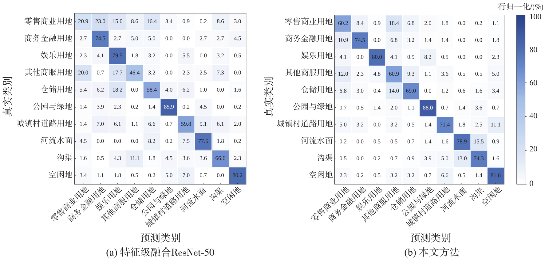
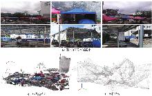
Fig. 5
Example of retail commercial land use"
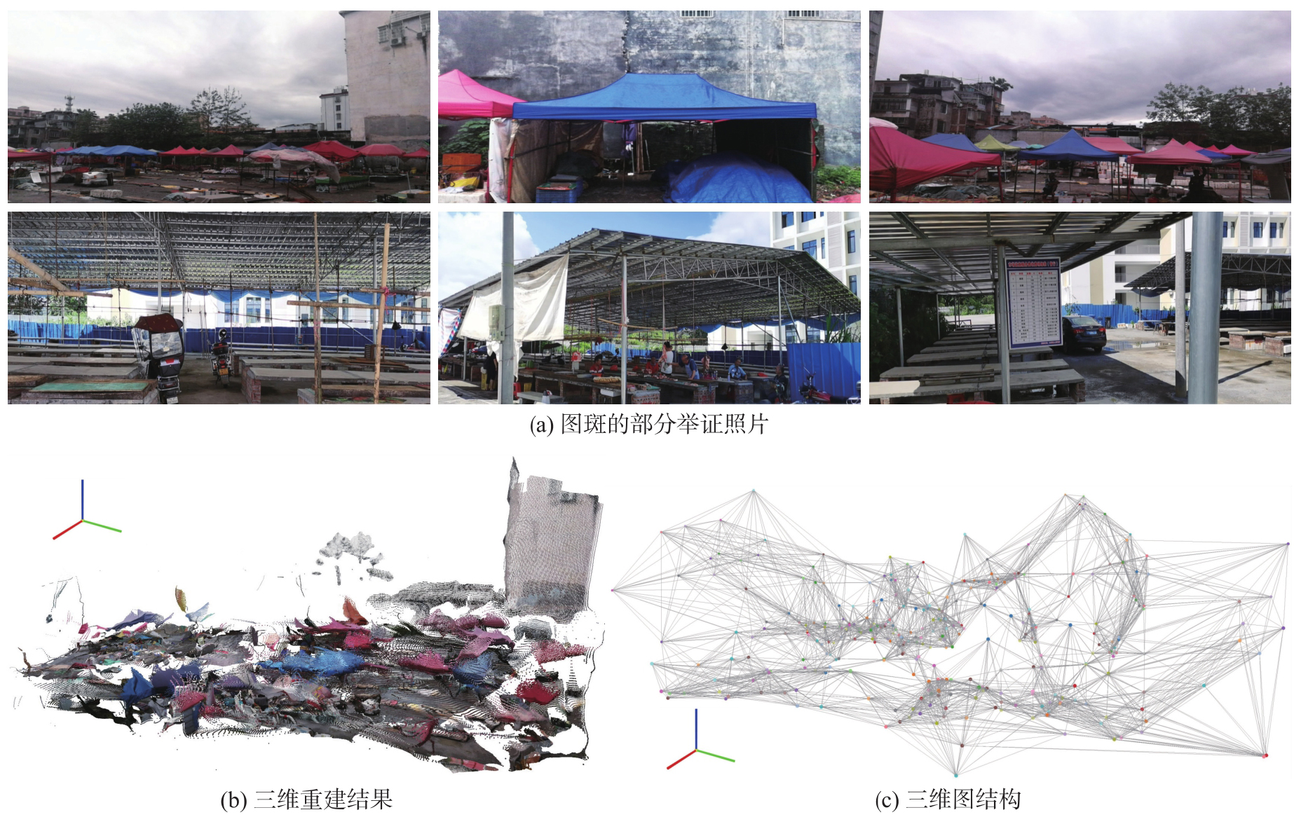
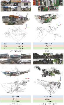
Fig. 6
Examples misclassified by the baseline but correctly classified by the proposed method"

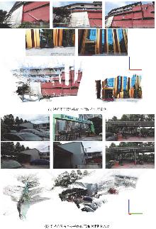
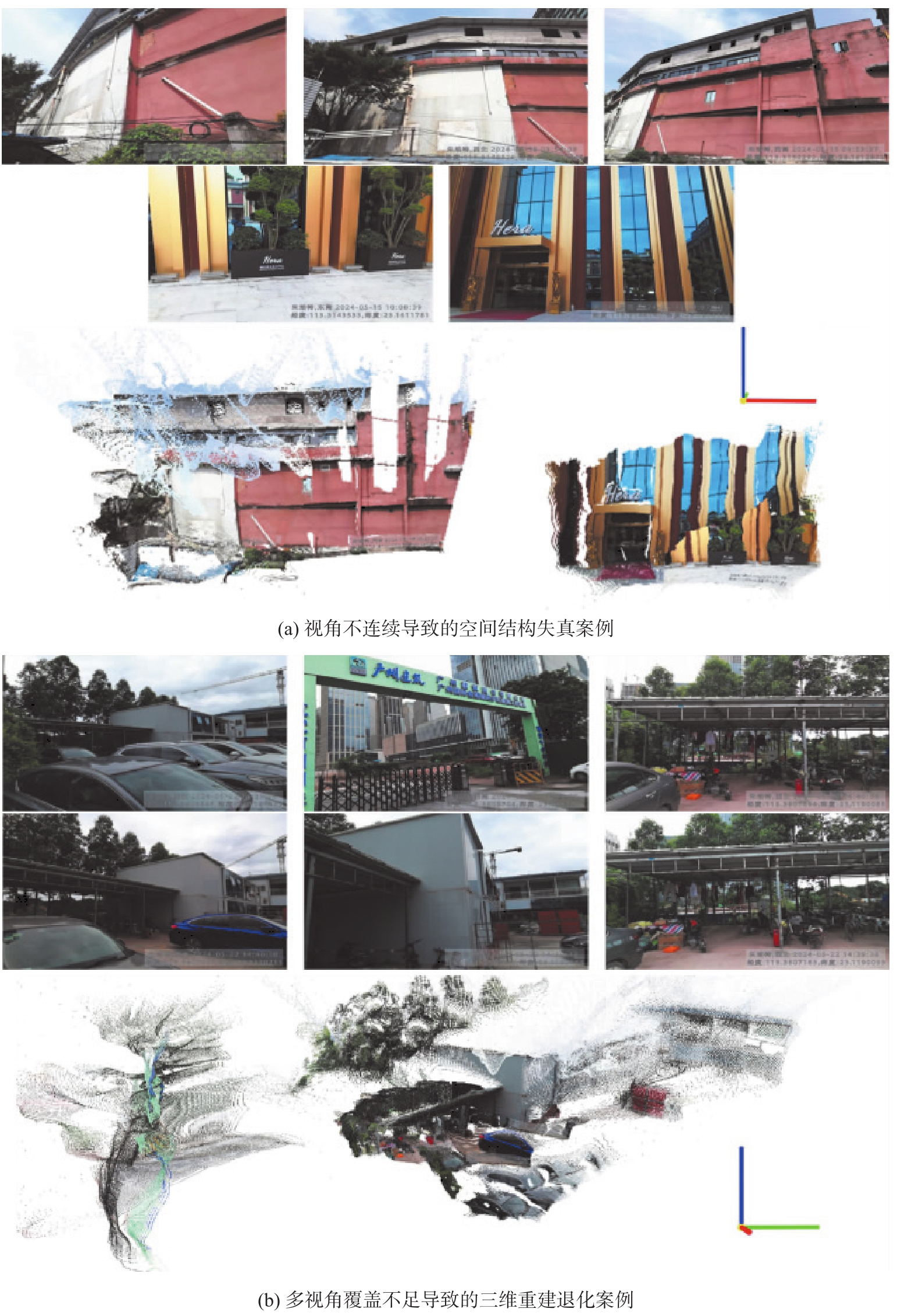
Fig. 7
Misclassification examples of the proposed method caused by insufficient 3D reconstruction quality"
Tab. 6
Classification results of ablation experiments on core modules"
| DINOv3 | SAM | VGGT+GCN | OA | MF1 |
|---|---|---|---|---|
| √ | × | × | 67.63 | 67.05 |
| × | √ | × | 13.82 | 5.72 |
| √ | √ | × | 68.65 | 68.40 |
| √ | × | √ | 69.57 | 69.48 |
| × | √ | √ | 20.68 | 18.00 |
| √ | √ | √ | 73.43 | 73.73 |
Tab. 7
Classification results obtained by different visual encoders"
| 编码器 | OA | MF1 |
|---|---|---|
| ResNet-50 | 68.59 | 67.03 |
| ViT-B/16 | 69.08 | 68.36 |
| DINOv2 ViT-L/14 | 72.46 | 71.95 |
| DINOv3 ViT-L/16 | 73.43 | 73.73 |
Tab. 8
Classification results of different spatial relation modeling strategies"
| 类型图 | 无权邻接 | 距离赋权邻接 | ||
|---|---|---|---|---|
| OA | MF1 | OA | MF1 | |
| 二维投影图 | 66.18 | 66.03 | 69.15 | 68.68 |
| 三维空间图 | 70.64 | 69.86 | 73.43 | 73.73 |
| [1] | 中国国家标准化管理委员会. 土地利用现状分类:GB/T 21010—2017[S]. 北京: 中国标准出版社, 2017. |
| Standardization Administration of China. Current land use classification: GB/T 21010—2017[S]. Beijing: Standards Pressof China, 2017. | |
| [2] |
吴田军, 李曼嘉, 骆剑承, 等. 耦合空间分布模式的复杂山区地块作物遥感分类方法[J]. 测绘学报, 2025, 54(7): 1215-1229. DOI: .
doi: 10.11947/j.AGCS.2025.20240440 |
|
Wu Tianjun, Li Manjia, Luo Jiancheng, et al. Farmland-parcel-based crop remote sensing classification method in com-plex mountainous areas via coupling spatial distribution patterns[J]. Acta Geodaetica et Cartographica Sinica, 2025, 54(7): 1215-1229. DOI: .
doi: 10.11947/j.AGCS.2025.20240440 |
|
| [3] |
孙一帆, 刘冰, 余旭初, 等. 图像级高光谱影像高分辨率特征网络分类方法[J]. 测绘学报, 2024, 53(1): 50-64. DOI: .
doi: 10.11947/j.AGCS.2024.20220058 |
|
Sun Yifan, Liu Bing, Yu Xuchu, et al. A high-resolution feature network image-level classification method for hyper-spectral image[J]. Acta Geodaetica et Cartographica Sinica, 2024, 53(1): 50-64. DOI: .
doi: 10.11947/j.AGCS.2024.20220058 |
|
| [4] |
胡鑫, 王心宇, 钟燕飞. 基于自适应上下文聚合网络的双高遥感影像分类[J]. 测绘学报, 2023, 52(7): 1175-1186. DOI: .
doi: 10.11947/j.AGCS.2023.20220237 |
|
Hu Xin, Wang Xinyu, Zhong Yanfei. Adaptive context aggregation network for H2 remote sensing imagery classification[J]. Acta Geodaetica et Cartographica Sinica, 2023, 52(7): 1175-1186. DOI: .
doi: 10.11947/j.AGCS.2023.20220237 |
|
| [5] |
赵一鸣, 胡克林, 涂可龙, 等. 基于SAR与光学遥感影像融合的多标签场景分类方法[J]. 测绘学报, 2025, 54(5): 911-923. DOI: .
doi: 10.11947/j.AGCS.2025.20240281 |
|
Zhao Yiming, Hu Kelin, Tu Kelong, et al. Multi-label scene classification method based on fusion of SAR and optical remote sensing images[J]. Acta Geodaetica et Cartographica Sinica, 2025, 54(5): 911-923. DOI: .
doi: 10.11947/j.AGCS.2025.20240281 |
|
| [6] | Liu Zhen. Identifying urban land use social functional units: a case study using OSM data[J]. International Journal of Digital Earth, 2021, 14(12): 1798-1817. |
| [7] | Biljecki F, Ito K. Street view imagery in urban analytics and GIS: a review[J]. Landscape and Urban Planning, 2021, 215: 104217. |
| [8] |
李佳铃, 齐霁, 鲁伟鹏, 等. 面向城市功能区分类的光学遥感影像-OSM数据联合自监督学习方法[J]. 测绘学报, 2025, 54(1): 154-164. DOI: .
doi: 10.11947/j.AGCS.2025.20240067 |
|
Li Jialing, Qi Ji, Lu Weipeng, et al. Self-supervised learning based urban functional zone classification by integrating optical remote sensing image-OSM data[J]. Acta Geodaetica et Cartographica Sinica, 2025, 54(1): 154-164. DOI: .
doi: 10.11947/j.AGCS.2025.20240067 |
|
| [9] | Zhao Kun, Li Juan, Xie Shuai, et al. Self-supervised learning with trilateral redundancy reduction for urban functional zone identification using street-view imagery[J]. Sensors, 2025, 25(5): 1504. |
| [10] | Huang Weiming, Wang Jing, Cong Gao. Zero-shot urban function inference with street view images through prompting a pretrained vision-language model[J]. International Journal of Geographical Information Science, 2024, 38(7): 1414-1442. |
| [11] | Li Hongsheng, Zhu Guangming, Zhang Liang, et al. Scene graph generation: a comprehensive survey[J]. Neurocomputing, 2024, 566: 127052. |
| [12] | Li Ziming, Chen Bin, Wu Shengbiao, et al. Deep learning for urban land use category classification: a review and experimental assessment[J]. Remote Sensing of Environment, 2024, 311: 114290. |
| [13] | Zhang Yan, Li Yong, Zhang Fan. Multi-level urban street representation with street-view imagery and hybrid semantic graph[J]. ISPRS Journal of Photogrammetry and Remote Sensing, 2024, 218: 19-32. |
| [14] | Yang Jianwei, Lu Jiasen, Lee S, et al. Graph R-CNN for scene Graph Generation[C]//Proceedings of 2018 Computer Vision (ECCV 2018). Cham: Springer, 2018: 690-706. |
| [15] | Chen Gongwei, Song Xinhang, Zeng Haitao, et al. Scene recognition with prototype-agnostic scene layout[J]. IEEE Transactions on Image Processing, 2020, 29: 5877-5888. |
| [16] | Zeng Haitao, Song Xinhang, Chen Gongwei, et al. Amorphous region context modeling for scene recognition[J]. IEEE Transactions on Multimedia, 2022, 24: 141-151. |
| [17] | Liang Jiali, Deng Yufan, Zeng Dan. A deep neural network combined CNN and GCN for remote sensing scene classification[J]. IEEE Journal of Selected Topics in Applied Earth Observations and Remote Sensing, 2020, 13: 4325-4338. |
| [18] | Peng Jingquan, Sun Xian, Yu Hongfeng, et al. An instance-based multitask graph network for complex facility recognition in remote sensing imagery[J]. IEEE Transactions on Geoscience and Remote Sensing, 2022, 60: 5615015. |
| [19] | Zhang Yan, Liu Pengyuan, Biljecki F. Knowledge and topology: a two layer spatially dependent graph neural networks to identify urban functions with time-series street view image[J]. ISPRS Journal of Photogrammetry and Remote Sensing, 2023, 198: 153-168. |
| [20] | Kong Bo, Ai Tinghua, Zou Xinyan, et al. A graph-based neural network approach to integrate multi-source data for urban building function classification[J]. Computers, Environment and Urban Systems, 2024, 110: 102094. |
| [21] | Krishna R, Zhu Yuke, Groth O, et al. Visual genome: connecting language and vision using crowdsourced dense image annotations[J]. International Journal of Computer Vision, 2017, 123(1): 32-73. |
| [22] | Li Weijia, Yu Jinhua, Chen Dairong, et al. Fine-grained building function recognition with street-view images and GIS map data via geometry-aware semi-supervised learning[J]. International Journal of Applied Earth Observation and Geoinformation, 2025, 137: 104386. |
| [23] | Dietterich T G, Lathrop R H, Lozano-Pérez T. Solving the multiple instance problem with axis-parallel rectangles[J]. Artificial Intelligence, 1997, 89(1/2): 31-71. |
| [24] | Ilse M, Tomczak J M, Welling M. Attention-based deep multiple instance learning[C]//Proceedings of the 35th International Conference on Machine Learning. Stockholm: PMLR, 2018, 80: 2127-2136. |
| [25] | Siméoni O, Vo H V, Seitzer M, et al. DINOv3[PP/OL]. arXiv (2025-08-13) [2026-01-10]. https://doi.org/10.48550/arXiv.2508.10104. |
| [26] | Kirillov A, Mintun E, Ravi N, et al. Segment anything[C]//Proceedings of 2023 IEEE/CVF International Conference on Computer Vision. Paris: IEEE, 2023: 4015-4026. |
| [27] | Wang Jianyuan, Chen Minghao, Karaev N, et al. VGGT: visual geometry grounded transformer[C]//Proceedings of 2025 IEEE/CVF Conference on Computer Vision and Pattern Recognition. Nashville: IEEE, 2025: 5294-5306. |
| [28] | Kipf T N, Welling M. Semi-supervised classification with graph convolutional networks[C]//Proceedings of the 5th International Conference on Learning Representations. Toulon: IEEE, 2017. |
| [29] | Cheng Bowen, Misra I, Schwing A G, et al. Masked-attention mask transformer for universal image segmentation[C]//Proceedings of 2022 IEEE/CVF Conference on Computer Vision and Pattern Recognition. New Orleans: IEEE, 2022: 1290-1299. |
| [1] | Xusheng ZHOU, Yongbin TAN, Zhonghai YU, Wei WANG, Qingyun XIAO. A complex building shape recognition method integrating vector structural features [J]. Acta Geodaetica et Cartographica Sinica, 2026, 55(5): 838-849. |
| [2] | Fubing ZHANG, Qun SUN, Qing XU, Jingzhen MA, Wenjun HUANG, Ruoxu CHEN. An automatic river classification and selection method supported by random forest and graph neural network [J]. Acta Geodaetica et Cartographica Sinica, 2025, 54(9): 1697-1711. |
| [3] | Zhekun HUANG, Haizhong QIAN, Zhongxiang CAI, Xiao WANG, Junwei WANG, Linghui KONG. A multi-scale mesh river system classification matching method based on graph neural network [J]. Acta Geodaetica et Cartographica Sinica, 2025, 54(2): 371-384. |
| [4] | Jiayi TANG, Xiaochong TONG, Chunping QIU, Yaxian LEI, Yi LEI, Haoshuai SONG. Remote sensing scene retrieval method based on scene graph [J]. Acta Geodaetica et Cartographica Sinica, 2025, 54(1): 123-135. |
| [5] | Bo KONG, Tinghua AI, Min YANG, Hao WU, Huafei YU, Tianyuan XIAO. Identification of loess landform types jointly affected by contour morphological knowledge and the graph neural network [J]. Acta Geodaetica et Cartographica Sinica, 2024, 53(6): 1154-1164. |
| [6] | Zhanlong CHEN, Xiechun LU, Yongyang XU. A building aggregation method based on deep clustering of graph vertices [J]. Acta Geodaetica et Cartographica Sinica, 2024, 53(4): 736-749. |
| Viewed | ||||||
|
Full text |
|
|||||
|
Abstract |
|
|||||
