

Acta Geodaetica et Cartographica Sinica ›› 2025, Vol. 54 ›› Issue (1): 52-63.doi: 10.11947/j.AGCS.2025.20240273
• Photogrammetry and Remote Sensing • Previous Articles Next Articles
Zuxun ZHANG( ), Xinbo ZHAO, Yansong DUAN()
Received:2024-07-03
Revised:2024-12-29
Online:2025-02-17
Published:2025-02-17
Contact:
Yansong DUAN
E-mail:zhangzx@cae.cn;ysduan@whu.edu.cn
About author:ZHANG Zuxun (1937—), male, professor, PhD supervisor, academician of Chinese Academy of Engineering, majors in digital photogrammetry and remote sensing. E-mail: zhangzx@cae.cn
Supported by:CLC Number:
Zuxun ZHANG, Xinbo ZHAO, Yansong DUAN. A block-wise polynomial distortion model for airborne composite large-format camera[J]. Acta Geodaetica et Cartographica Sinica, 2025, 54(1): 52-63.
Tab. 1
Technological parameters of AFC-900"
| 属性 | 值 |
|---|---|
| 全色幅面/像素 | 30 480×28 820 |
| 全色像素大小/μm | 4.6 |
| 全色焦距/mm | 142 |
| 多光谱幅面/像素 | 7920×6004 |
| 多光谱像素大小/μm | 4.6 |
| 多光谱焦距/mm | 37 |
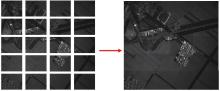
Fig. 1
From sub-images to stitched full frame image"

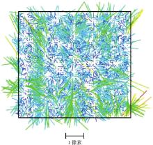
Fig. 2
Residual vectors derived from calibration by Brown model"
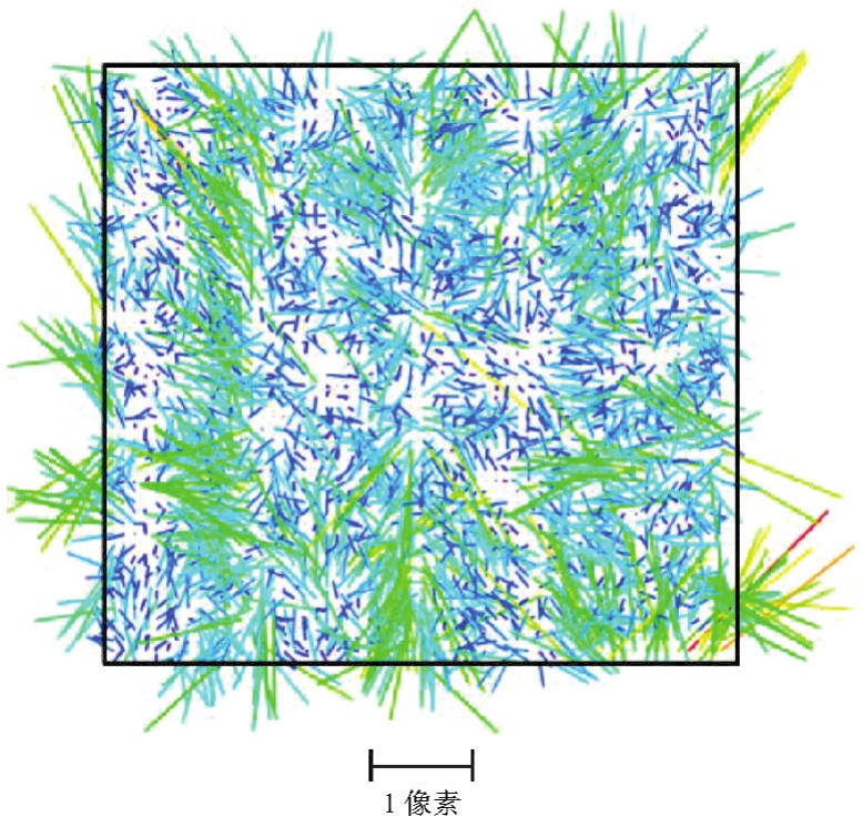
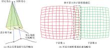
Fig. 3
Potential distortion sources"
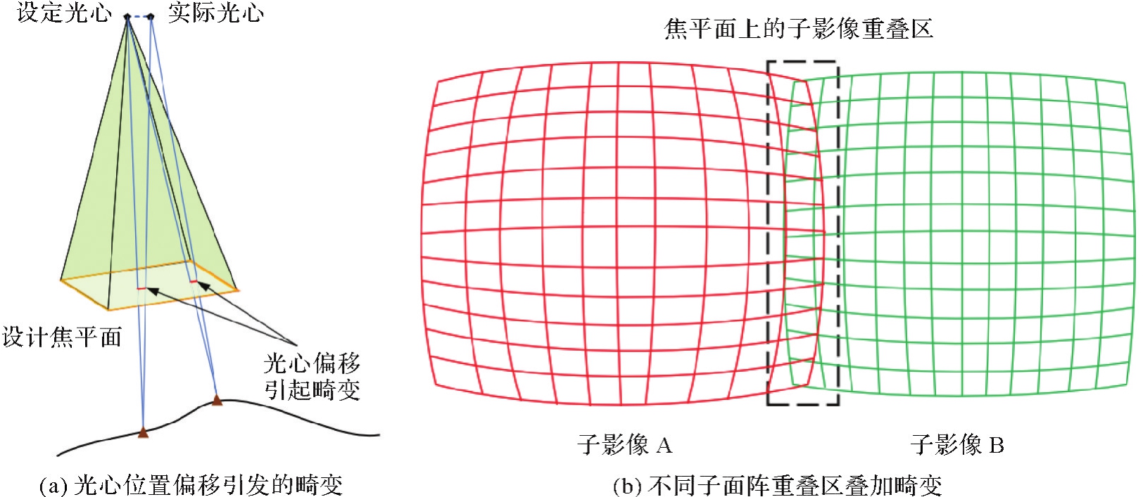

Fig. 4
Flowchart of solving the parameters of block-wise polynomial distortion model"
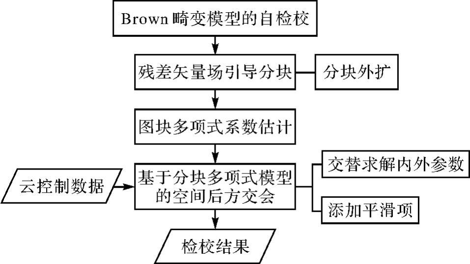
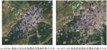
Fig. 5
The survey area and distribution of GCPs of Zhaodong image block"

Tab. 2
Accuracy of the existing bundled images by SWDC"
| 属性 | 参数值 | |
|---|---|---|
| 航带数 | 7 | |
| 成功平差影像数 | 413 | |
| 连接点中误差/像素 | 0.5 | |
| 控制点重投影中误差/像素 | 0.3 | |
| 检查点精度 | 平面精度/m | 0.048 |
| 高程精度/m | 0.05 | |
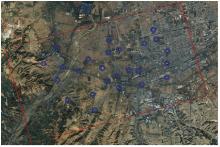
Fig. 6
The survey area and distribution of GCPs of Jiexiu image block"

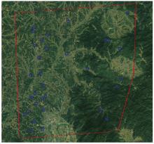
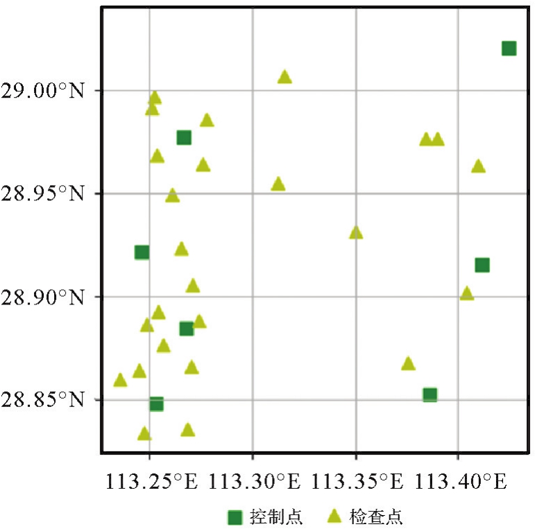
Fig. 7
The survey area and distribution of GCPs of Miluo image block"
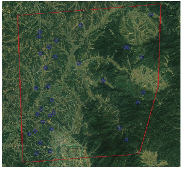
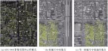
Fig. 8
Matched cloud control points"

Tab. 3
Calibration results of rigorous model and block-wise polynomial model on Zhaodong cloud control dataset"
| 模型 | 参数数量 | 迭代次数 | 重投影误差/像素 |
|---|---|---|---|
| 严密模型 | 102 | 34 | 1.202 |
| 分块模型 | 216 060 | 12 | 0.462 |
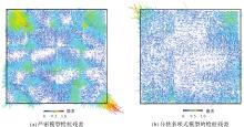
Fig. 9
Comparison of residual vectors with two models"

Tab. 4
Calibration precision comparison on different image block sizes"
| 肇东测区 | 分块大小 | |||
|---|---|---|---|---|
| 32 | 64 | 128 | 256 | |
| 云控制检校重投影误差 | 0.83 | 0.63 | 0.46 | 0.86 |
| 区域网平差重投影误差 | 1.01 | 1.05 | 0.51 | 0.98 |
Tab. 5
Calibration precision comparison of block-wise polynomial model using 1-order and 2-order polynomial under a constant block size 128 pixels"
| 肇东测区 | 多项式阶数 | |
|---|---|---|
| 1 | 2 | |
| 云控制检校重投影误差 | 0.46 | 0.44 |
| 区域网平差重投影误差 | 0.51 | 0.75 |
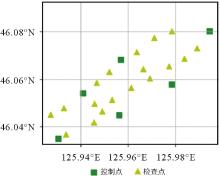
Fig. 10
Control points and check points configuration of Zhaodong images block"
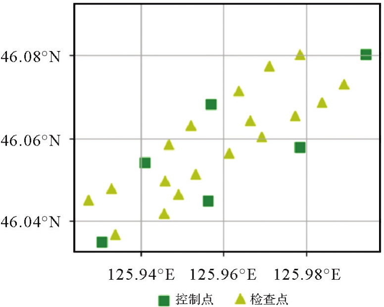
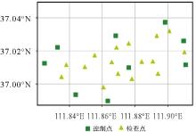
Fig. 11
Control points and check points configuration of Jiexiu images block"
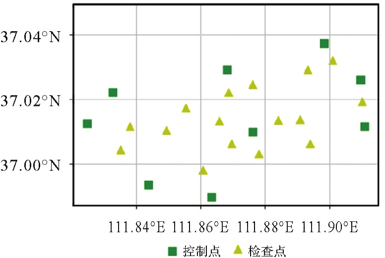
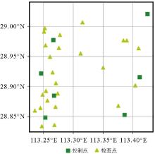
Fig. 12
Control points and check points configuration of Miluo images block"
Tab. 6
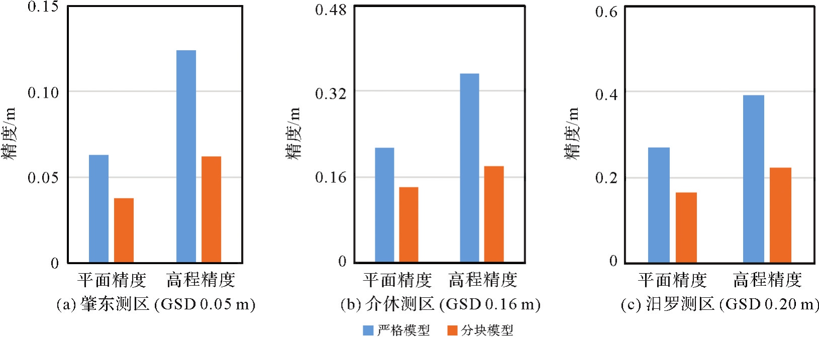
Root mean squared re-projection error and accuracy of two models on the three blocks"
| 数据集 | 控制点数/检查点数 | 畸变模型 | 重投影误差RMS/像素 | 检查点平面RMS/m | 检查点高程RMS/m |
|---|---|---|---|---|---|
| 黑龙江肇东(0.05 m) | 6/18 | 严密模型 | 1.01 | 0.063 | 0.124 |
| 分块模型 | 0.51 | 0.038 | 0.062 | ||
| 山西介休(0.16 m) | 9/16 | 严密模型 | 1.12 | 0.214 | 0.352 |
| 分块模型 | 0.42 | 0.141 | 0.180 | ||
| 湖南汨罗(0.20 m) | 7/25 | 严密模型 | 1.15 | 0.269 | 0.391 |
| 分块模型 | 0.39 | 0.165 | 0.223 |
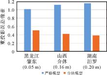
Fig. 13
RMS re-projection error comparison of the blocks"

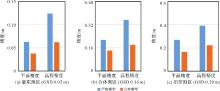
Fig. 14
Accuracy of the three blocks via rigorous model and block-wise polynomial model"
Tab. 7
Specifications for check points under map scale 1∶500 and 1∶2000"
| 成图比例尺 | 平面 | 高程 | ||
|---|---|---|---|---|
| 中误差 | 限差 | 中误差 | 限差 | |
| 1∶500 | 0.175 | 0.175 | 0.15 | 0.15 |
| 1∶2000 | 0.7 | 1.0 | 0.28 | 0.28 |
| [1] |
张永军, 张祖勋, 龚健雅. 天空地多源遥感数据的广义摄影测量学[J]. 测绘学报, 2021, 50(1): 1-11. DOI:.
doi: 10.11947/j.AGCS.2021.20200245 |
|
ZHANG Yongjun, ZHANG Zuxun, GONG Jianya. Generalized photogrammetry of spaceborne, airborne and terrestrial multi-source remote sensing datasets[J]. Acta Geodaetica et Cartographica Sinica, 2021, 50(1): 1-11. DOI:.
doi: 10.11947/j.AGCS.2021.20200245 |
|
| [2] | XU Z, QU L. A skeletal camera network for close-range images with a data driven approach in analyzing stereo configuration[J]. Journal of Geodesy and Geoinformation Science, 2022, 5(4): 23-37. |
| [3] | LI J, WANG C, JIA C, et al. A hybrid conjugate gradient algorithm for solving relative orientation of big rotation angle stereo pair[J]. Journal of Geodesy and Geoinformation Science, 2020, 3(2): 62-70. |
| [4] | ABDI G, SAMADZADEGAN F, KURZ F. Poseestimation of unmanned aerial vehicles based on a vision-aided multi-sensor fusion[EB/OL]. [2024-05-25]. https://elib.dlr.de/103817/. |
| [5] | FANG Yong, HU Haiyan, GAO Li, et al. A geometric calibration model for the new ultra-large frame aerial mapping camera DMZ II[J]. The Photogrammetric Record, 2020, 35(170): 289-312. |
| [6] | JACOBSEN K, NEUMANN K. Property of the large format digital aerial camera DMC Ⅱ[J]. The International Archives of the Photogrammetry, Remote Sensing and Spatial Information Sciences, 2012, 39B1: 21-25. |
| [7] | GORDON P. Systematic oblique aerial photography using multiple digital frame cameras[J]. Photogrammetric Engineering and Remote Sensing, 2009, 75(2): 102-107. |
| [8] | ZEITLER W, DOERSTEL C, JACOBSEN K. Geometric calibration of the DMC: method and results[J]. International Archives of Photogrammetry Remote Sensing and Spatial Information Sciences, 2002, 34(1): 324-332. |
| [9] | LUHMANN T, FRASER C, MAAS H G. Sensor modelling and camera calibration for close-range photogrammetry[J]. ISPRS Journal of Photogrammetry and Remote Sensing, 2016, 115: 37-46. |
| [10] | QTAISHAT K. Assessing the performance of different large format digital cameras by investigating the geometric accuracy and camera calibration[C]//Proceedings of 2015 International Archives of the Photogrammetry. [S.l.]: Scopus, 2015. |
| [11] | FRASER C S. Digital camera self-calibration[J]. ISPRS Journal of Photogrammetry and Remote Sensing, 1997, 52(4): 149-159. |
| [12] | SUN H, ZHANG Y. A self-calibration bundle adjustment algorithm based on block matrix cholesky decomposition technology[J]. Journal of Geodesy and Geoinformation Science, 2023, 6(1): 11-30. |
| [13] | MUELLER C, NEUMANN K. Leica DMC Ⅲ calibration and geometric sensor accuracy[J]. The International Archives of the Photogrammetry, Remote Sensing and Spatial Information Sciences, 2016, XL-3/W4: 1-9. |
| [14] | GRUBER M, LADSTADTER R. Calibrating the digital large format aerial camera UltraCamX[C]//Proceedings of 2007 International Calibration and Orientation Workshop. [S.l.]: IEEE, 2007. |
| [15] | WIECHERT A, GRUBER M, PONTICELLI M. Ultracam: the new super-large format digital aerial camera[C]//Proceedings of 2011 American Society for Photogrammetry and Remote Sensing Annual Conference 2011. [S.l.]: Scopus, 2011: 519-525. |
| [16] | MANSHOLT U, LADSTADTER R. Geometric analysis of vexcel imaging ultracamx test flights[C]//Proceedings of 2008 International Archives of the Photogrammetry. [S.l.]: ISPRS, 2008: 647-652. |
| [17] | MA L, CHEN Y Q, MOORE K L. Analytical piecewise radial distortion model for precision camera calibration[J]. IEE Proceedings-Vision, Image, and Signal Processing, 2006, 153(4): 468. |
| [18] | WU Ruiqing, LIU Jian, CHEN Wei, et al. Adaptive wide-lens distortion correction based on piecewise polynomial optimization[J]. Procedia Computer Science, 2019, 154: 573-580. |
| [19] | 张春森, 严露, 于振. 一种Kannala模型的鱼眼相机标定方法优化[J]. 西安科技大学学报, 2019, 39(6): 1026-1032. |
| ZHANG Chunsen, YAN Lu, YU Zhen. A fisheye camera calibration optimization method based on Kannala model[J]. Journal of Xi'an University of Science and Technology, 2019, 39(6): 1026-1032. | |
| [20] | TANG Rongfu, FRITSCH D, CRAMER M. New rigorous and flexible Fourier self-calibration models for airborne camera calibration[J]. ISPRS Journal of Photogrammetry and Remote Sensing, 2012, 71: 76-85. |
| [21] | BABAPOUR H, MOKHTARZADE M, VALADAN ZOEJ M J. Self-calibration of digital aerial camera using combined orthogonal models[J]. ISPRS Journal of Photogrammetry and Remote Sensing, 2016, 117: 29-39. |
| [22] | TECKLENBURG W, LUHMANN T, HASTEDT H. Camera modelling with image-variant parameters and finite elements[J]. Optical 3D measurement techniques V, 2001: 328-335. |
| [23] | CRAMER M. Eurosdr network on digital camera calibration[J]. Official Publication-EuroSDR, 2004, 70(55): 61447189. |
| [24] | CHEN Tianen, SHIBASAKI R, LIN Zongjian. A rigorous laboratory calibration method for interior orientation of an airborne linear push-broom camera[J]. Photogrammetric Engineering & Remote Sensing, 2007, 73(4): 369-374. |
| [25] | ZHANG Z. A flexible new technique for camera calibration[J]. IEEE Transactions on Pattern Analysis and Machine Intelligence, 2000, 22(11): 1330-1334. |
| [26] |
PI Yingdong, XIE Baorong, YANG Bo, et al. On-orbit geometric calibration of linear push-broom optical satellite based on sparse GCPs[J]. Journal of Geodesy and Geoinformation Science, 2020, 3(1): 64-75. doi:.
doi: 10.11947/j.JGGS.2020.0107 |
| [27] |
王涛, 张艳, 张永生, 等. 国产机载大视场三线阵CCD相机GNSS偏心矢量和IMU视轴偏心角标定技术[J]. 测绘学报, 2018, 47(11): 1474-1486. DOI:.
doi: 10.11947/J.AGCS.2018.20170679 |
|
WANG Tao, ZHANG Yan, ZHANG Yongsheng, et al. Investigation on GNSS lever arms and IMU boresight misalignment calibration of domestic airborne wide-field three CCD camera[J]. Acta Geodaetica et Cartographica Sinica, 2018, 47(11): 1474-1486. DOI:.
doi: 10.11947/j.AGCS.2018.20170679 |
|
| [28] | TAO Pengjie, LU Luping, ZHANG Yong, et al. On-orbit geometric calibration of the panchromatic/multispectral camera of the ZY-1 02C satellite based on public geographic data[J]. Photogrammetric Engineering & Remote Sensing, 2014, 80(6): 505-517. |
| [29] |
张祖勋, 陶鹏杰. 谈大数据时代的“云控制”摄影测量[J]. 测绘学报, 2017, 46(10): 1238-1248. DOI:.
doi: 10.11947/J.AGCS.2017.20170337 |
|
ZHANG Zuxun, TAO Pengjie. An overview on “cloud control” photogrammetry in big data era[J]. Acta Geodaetica et Cartographica Sinica, 2017, 46(10): 1238-1248. DOI:.
doi: 10.11947/j.AGCS.2017.20170337 |
|
| [30] | 张祖勋, 段延松, 陶鹏杰. 从控制点到控制片[J]. 武汉大学学报(信息科学版), 2023, 48(11): 1715-1723. |
| ZHANG Zuxun, DUAN Yansong, TAO Pengjie. From ground control point to digital control photo[J]. Geomatics and Information Science of Wuhan University, 2023, 48(11): 1715-1723. | |
| [31] | 国家质量监督检验检疫总局, 中国国家标准化管理委员会. 数字航空摄影测量 空中三角测量规范:GB/T 23236—2009[S]. 北京: 中国标准出版社, 2009. |
| General Administration of Quality Supervision, Inspection and Quarantine of the People's Republic of China, Standardization Administration of the People's Republic of China. Specifications for aerotriangulation of digital aerophotogrammetry: GB/T 23236—2009[S]. Beijing: Standards Press of China, 2009. |
| [1] | Youli DING. Semantic segmentation of multi-view 3D reconstructed point cloud scenes [J]. Acta Geodaetica et Cartographica Sinica, 2025, 54(10): 1913-1913. |
| [2] | Chaoyang WANG, Yishao SU, Jiancheng LUO, Xiaodong HU, Liegang XIA. Segmentation method of high-score remote sensing target based on road neighborhood relationship [J]. Acta Geodaetica et Cartographica Sinica, 2025, 54(7): 1294-1304. |
| [3] | Chen ZHANG, Biao HE, Weixi WANG, Ding MA, Xi KUAI, Renzhong GUO. From component to scene: basic concept, framework and application of scene construction [J]. Acta Geodaetica et Cartographica Sinica, 2025, 54(6): 1122-1138. |
| [4] | Xing ZHANG, Zhanpeng HUANG, Qingquan LI, Baoding ZHOU, Qipei LI. 3D tunnel mapping method combining registration compensation and spatial constraint [J]. Acta Geodaetica et Cartographica Sinica, 2025, 54(2): 297-307. |
| [5] | Yongjun ZHANG, Changjun ZHU, Siyuan ZOU, Xinyi LIU, Qingzhou MAO, Yi WAN. Registration of aerial images and LiDAR point clouds based on distance field and plane constraints [J]. Acta Geodaetica et Cartographica Sinica, 2025, 54(1): 64-74. |
| [6] | Genyun SUN, Chao SUN, Aizhu ZHANG. Road extraction networks fusing multiscale and edge features [J]. Acta Geodaetica et Cartographica Sinica, 2024, 53(12): 2233-2243. |
| [7] | HE Haiqing, CHEN Min, CHEN Ting, LI Dajun, CHEN Xiaoyong. Single and multiple rotation averaging iterative optimization coupled 3D reconstruction for low-altitude images using SfM algorithm [J]. Acta Geodaetica et Cartographica Sinica, 2019, 48(6): 688-697. |
| [8] | ZHANG Yi, JIANG Ting, JIANG Gangwu, YU Anzhu, YU Ying. 3D reconstruction with inverse depth filter of feature-based visual SLAM [J]. Acta Geodaetica et Cartographica Sinica, 2019, 48(6): 708-717. |
| [9] | NAN Ke, QI Hua, YE Yuanxin. A template matching method of multimodal remote sensing images based on deep convolutional feature representation [J]. Acta Geodaetica et Cartographica Sinica, 2019, 48(6): 727-736. |
| [10] | ZHOU Fan. Research on registration and rendering method of video to enhance 3D scene [J]. Acta Geodaetica et Cartographica Sinica, 2019, 48(6): 801-801. |
| [11] | YU Ying, ZHANG Yongsheng, XUE Wu, WANG Tao. A incremental structure from motion method of robustness enhancement and accuracy improvement [J]. Acta Geodaetica et Cartographica Sinica, 2019, 48(2): 207-215. |
| [12] | PI Yingdong, XIE Baorong, YANG Bo, ZHANG Yiling, LI Xin, WANG Mi. On-orbit geometric calibration of linear push-broom optical satellite only using sparse GCPs [J]. Acta Geodaetica et Cartographica Sinica, 2019, 48(2): 216-225. |
| [13] | LI Bin, WEI Junbo, MA Bochao, WANG Lu, XU Mingxia. Slicing 3D laser point cloud method for volume caloulation of irregular object [J]. Acta Geodaetica et Cartographica Sinica, 2019, 48(1): 42-52. |
| [14] | WANG Dandi, XU Qing, XING Shuai, LIN Yuzhun, LI Pengcheng. A Coarse-to-fine Signal Detection Method for Airborne LiDAR Bathymetry [J]. Acta Geodaetica et Cartographica Sinica, 2018, 47(8): 1148-1159. |
| [15] | JIN Guowang, XIONG Xin, ZHANG Hongmin, XU Qing, LIU Hui, WANG Xintian. Tie Point Extraction for SAR Images with Same Side-looking Direction from Different Trajectories Based on Differential Constraints [J]. Acta Geodaetica et Cartographica Sinica, 2018, 47(1): 91-101. |
| Viewed | ||||||
|
Full text |
|
|||||
|
Abstract |
|
|||||