

Acta Geodaetica et Cartographica Sinica ›› 2026, Vol. 55 ›› Issue (6): 1087-1100.doi: 10.11947/j.AGCS.2026.20250428
• Large-scale Engineering Infrastructure Surveying and Mapping and Underground Space Intelligent Perception • Previous Articles
Zhipeng CHEN1,2,3,4( ), Shiwang LÜ5, Xinyi WANG1,2,3,4()
Received:2025-10-11
Revised:2026-05-21
Published:2026-07-28
Contact:
Xinyi WANG
E-mail:chenzp1990@szu.edu.cn;854756740@qq.com
About author:CHEN Zhipeng (1990—), male, PhD, associate professor, majors in integrated positioning and dynamic precision engineering surveying. E-mail: chenzp1990@szu.edu.cn
Supported by:CLC Number:
Zhipeng CHEN, Shiwang LÜ, Xinyi WANG. Error simulation and accuracy evaluation method for integrated inertial alignment measurement[J]. Acta Geodaetica et Cartographica Sinica, 2026, 55(6): 1087-1100.
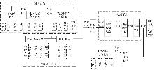
Fig. 1
Technical route of simulation and prediction method for linear measurement based on Monte Carlo"
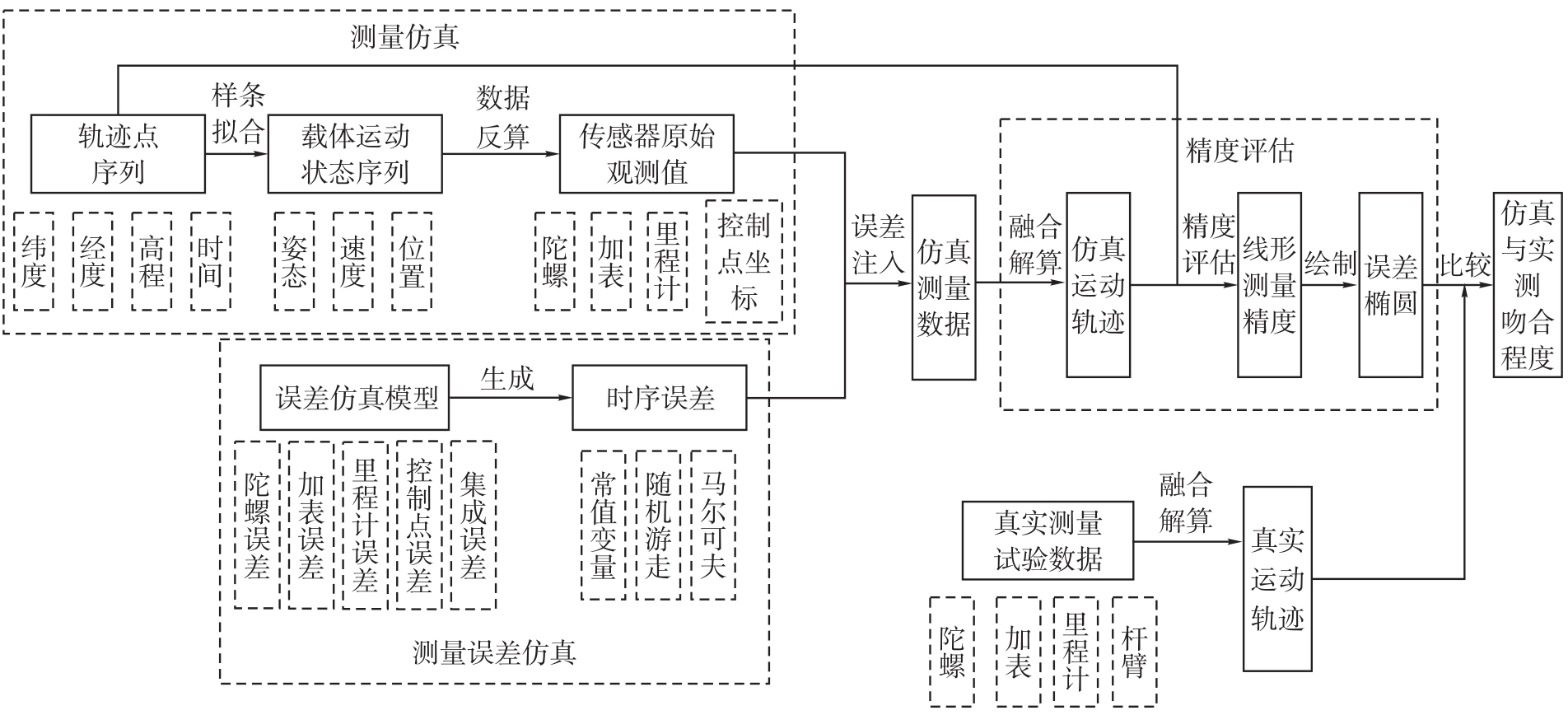

Fig. 2
Presupposition theory measurement trajectory generation method"


Tab. 1
Coordinate definition"
| 坐标系符号 | 坐标系符号 |
|---|---|
| 地心惯性坐标系 | i系 |
| 载体坐标系 | b系 |
| 当地水平导航坐标系 | n系 |
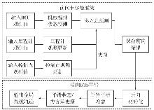
Fig. 3
Flowchart of forward Kalman filtering-backward RTS smoothing fusion algorithm"
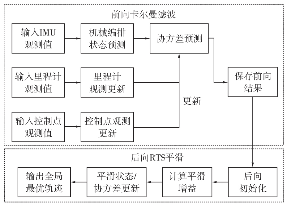
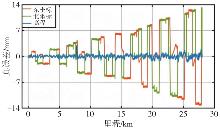
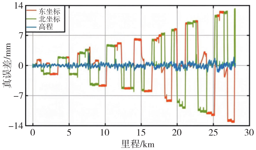
Fig. 4
Mileage-trajectory true error map of KF-GINS data set"
Tab. 2
KF-GINS trajectory linear errors"
| 统计值 | 东坐标 | 北坐标 | 高程 |
|---|---|---|---|
| 最大值 | 12.64 | 13.22 | 2.93 |
| 最小值 | -13.23 | -11.17 | -1.52 |
| 平均值 | -0.04 | -0.15 | 0.01 |
Tab. 3
Comparison of fidelity of simulation data"
| 方法 | 东坐标RMSE/mm | 北坐标RMSE/mm | 高程RMSE/mm | 相对精度 |
|---|---|---|---|---|
| 本文方法 | 3.21 | 3.57 | 0.89 | 0.23×10⁻⁶ |
| 方法1 | 28.65 | 31.24 | 5.72 | 2.17×10⁻⁶ |
| 方法2 | 15.32 | 16.87 | 3.24 | 1.12×10⁻⁶ |
Tab. 4
Comparison of engineering applicability"
| 对比维度 | 本文方法 | 方法1 | 方法2 |
|---|---|---|---|
| 复杂形状线性工程仿真 | 是 | 否 | 是(但精度低) |
| 多源误差耦合建模 | 是 | 否 | 是(但线性近似) |
| 误差空间分布可视化 | 是 | 否 | 否 |
| 测量方案优化 | 是 | 否 | 有限 |
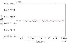
Fig. 5
Linear trajectory simulation of plane error ellipse"
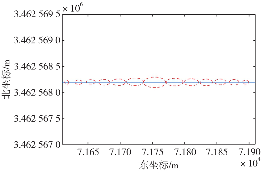
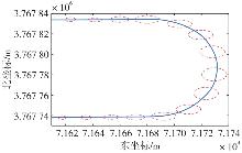
Fig. 6
The U-shaped trajectory simulates the plane error ellipse"
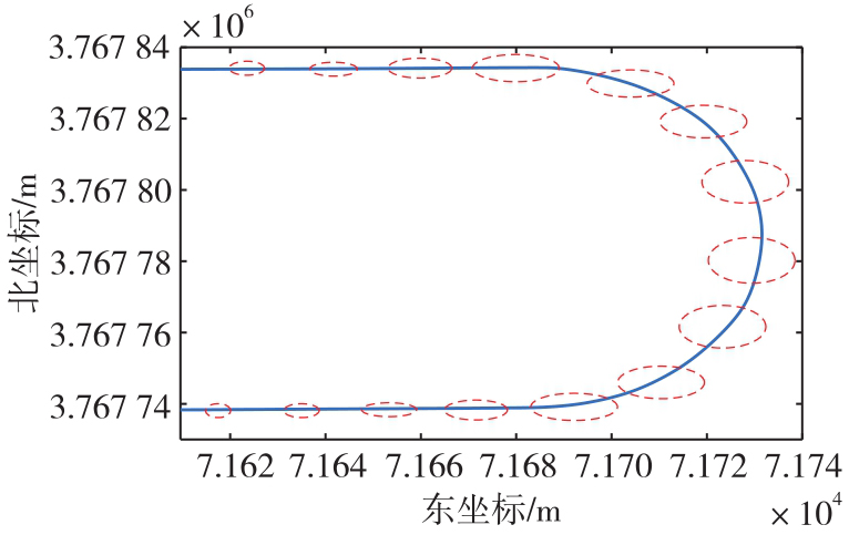
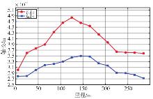
Fig. 7
The variation trend of the long and short axes of the linear trajectory error ellipse"
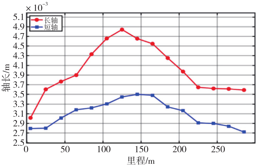
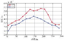
Fig. 8
The variation trend of the long and short axes of the U-shaped trajectory error ellipse"
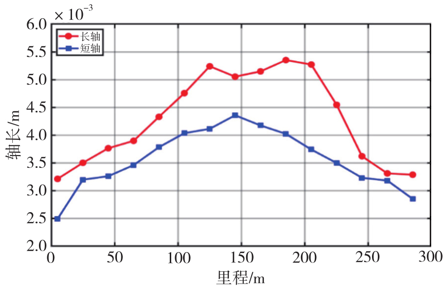
Tab. 5
Simulation trajectory plane error ellipse long and short axis parameters"
| 线形 | 管长/m | 有效椭圆数 | 轴 | 平均轴长/m | 最大轴长/m |
|---|---|---|---|---|---|
| 直线形 | 300 | 15 | 长轴 | 0.004 0 | 0.004 8 |
| 短轴 | 0.003 1 | 0.003 5 | |||
| U形 | 300 | 15 | 长轴 | 0.004 2 | 0.005 3 |
| 短轴 | 0.003 5 | 0.004 3 |
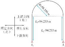
Fig. 9
Linearity of experimental pipeline"
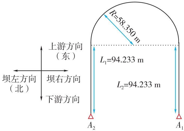
Fig. 10
Pipeline simulation linear mileage-east coordinate error"
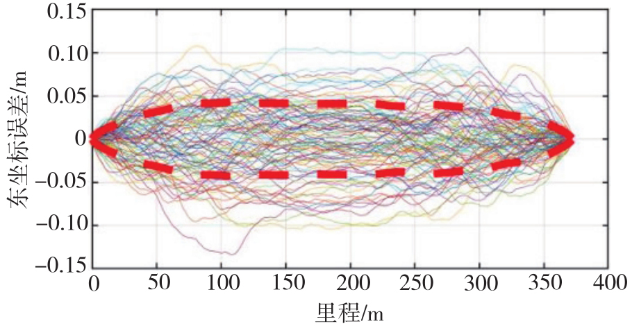
Fig. 11
Pipeline simulation linear mileage-north coordinate error"
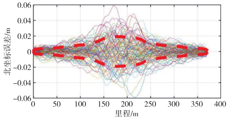
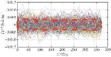
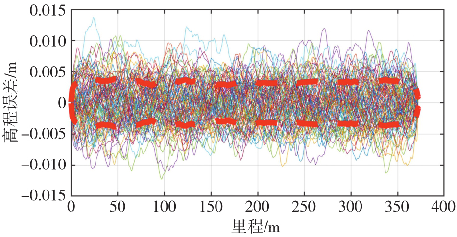
Fig. 12
Pipeline simulation linear mileage-elevation error"
Tab. 6
Comparison of measured-simulated pipeline alignment accuracy"
| 方向 | 实测线形重复性/mm | 仿真线形重复性/mm | 实测-仿真相关性/(%) |
|---|---|---|---|
| 东方向 | 34.58 | 29.81 | 86.2 |
| 北方向 | 12.22 | 10.24 | 83.9 |
| 高程方向 | 4.16 | 3.82 | 91.8 |
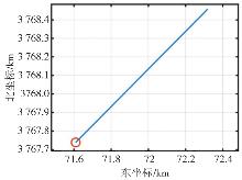
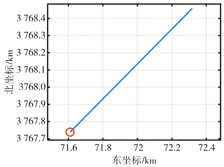
Fig. 13
Simulation straight line trajectory plan"
Tab. 7
Different accuracy grades of IMU, odometers, and orifice control points"
| 精度分级 | IMU(型号) | 里程计速度中误差/(m/s) | 控制点坐标中误差/m |
|---|---|---|---|
| 高精度 | 导航级(kz50) | 0.005 | [0.001 0.001 0.001] |
| 中精度 | 战术级(stim300 10g) | 0.05 | [0.01 0.01 0.01] |
| 低精度 | 工业级(i300BA50) | 0.5 | [0.3 0.3 0.05] |
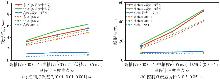
Fig. 14
Linear accuracy of navigation-grade IMUs with varied odometer and control point precision"
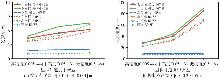
Fig. 15
Linear accuracy of tactical-grade IMUs with varied odometer and control point precision"
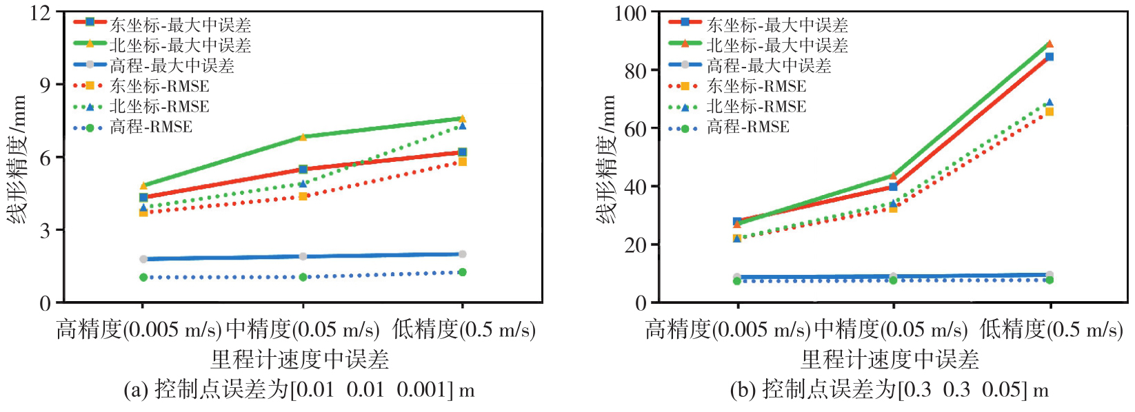
Fig. 16
Linear accuracy of industrial-grade IMUs with varied odometer and control point precision"
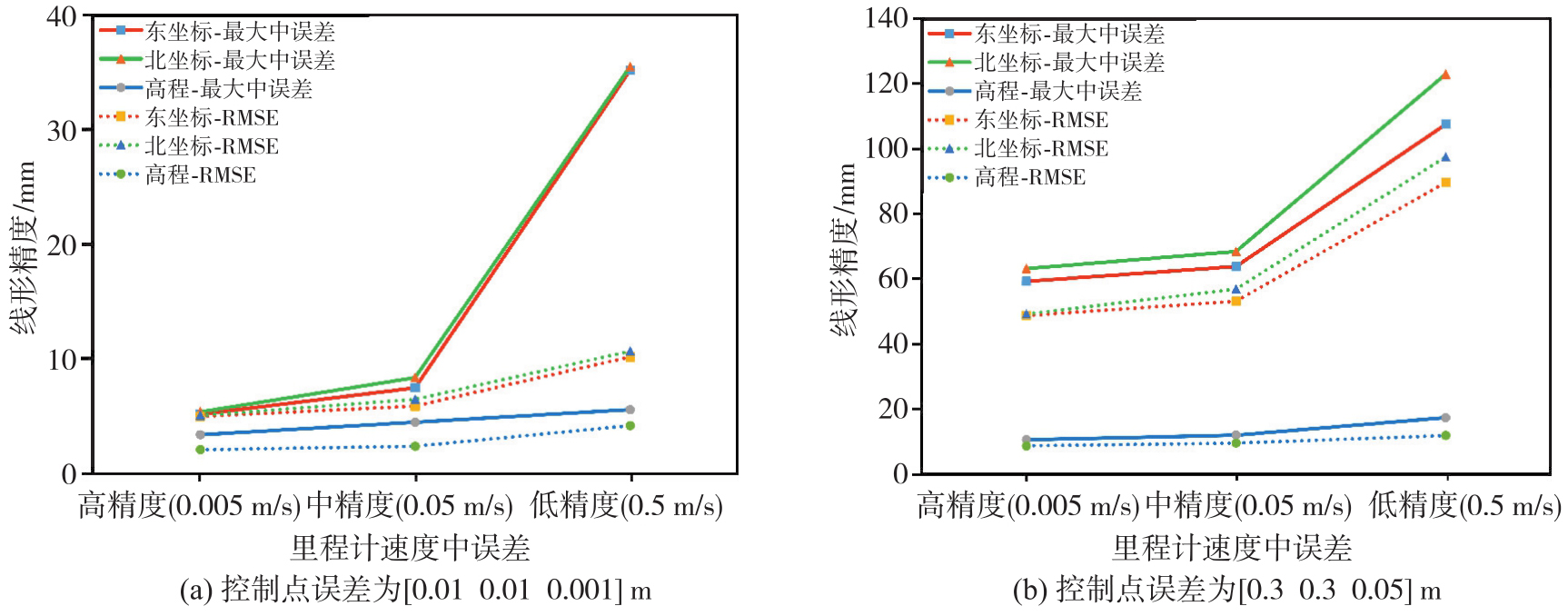
Fig. 17
Maximum motion velocity versus alignment accuracy relationship"
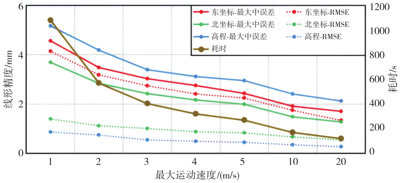
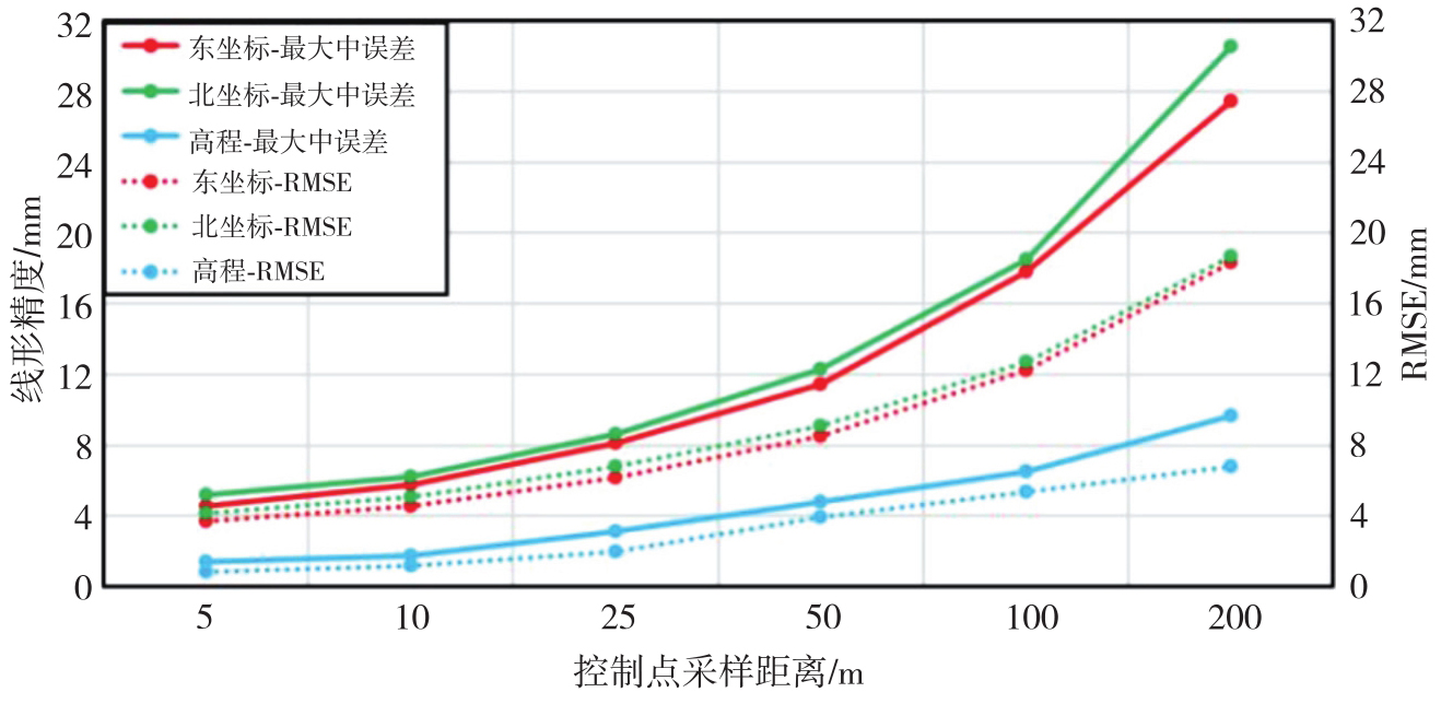
Fig. 18
Relationship between control point sampling interval and alignment accuracy"
| [1] | 许俊伟, 刘永胜, 吴达, 等. 隧道与地下工程监控量测技术的发展与展望[J]. 测绘地理信息, 2023, 48(3): 7-13. |
| XU Junwei, LIU Yongsheng, WU Da, et al. Development and outlook of monitoring and measuring technologies of tunnel and underground engineering[J]. Journal of Geomatics, 2023, 48(3): 7-13. | |
| [2] | 钮新强. 高面板堆石坝安全与思考[J]. 水力发电学报, 2017, 36(1): 104-111. |
| NIU Xinqiang. Security of high concrete face rockfill dam consideration and conclusion[J]. Journal of Hydroelectric Engineering, 2017, 36(1): 104-111. | |
| [3] | 邹青, 谭志伟, 张礼兵, 等. 200 m级高面板堆石坝安全监测技术调查与总结报告[EB/OL]. [2025-10-03]. https://max.book118.com/html/2015/0829/24279761.shtm. |
| ZOU Qing, TAN Zhiwei, ZHANG Libing, et al. Investigation and summary report on safety monitoring technology for 200 m high CFRD[EB/OL]. [2025-10-03]. https://max.book118.com/html/2015/0829/24279761.shtm. | |
| [4] | 贾金生, 郦能惠, 徐泽平. 高混凝土面板坝安全关键技术研究[M]. 北京: 中国水利水电出版社, 2014. |
| JIA Jinsheng, LI Nenghui, XU Zeping. Research on key safety technologies of high concrete face rockfill dams[M]. Beijing: China Water & Power Press, 2014. | |
| [5] | 邹青. 中国高面板堆石坝安全监测关键技术进展与展望[J]. 大坝与安全, 2016(1): 50-56. |
| ZOU Qing. Progress and prospect of key technologies in safety monitoring of high face slab rockfill dams in China[J]. Dam & Safety, 2016(1): 50-56. | |
| [6] | 李之中, 刘冠军. 引张线式水平位移计系统误差分析[J]. 水电自动化与大坝监测, 2009(6): 62-64. |
| LI Zhizhong, LIU Guanjun. System error analysis of alignment horizontal displacement equipment[J]. Hydropower Automation and Dam Monitoring, 2009(6): 62-64. | |
| [7] | 陈起金. 基于A-INS组合导航的铁路轨道几何状态精密测量技术研究[D]. 武汉: 武汉大学, 2016. |
| CHEN Qijin. Research on precise measurement technology of railway track geometric state based on A-INS integrated navigation[D]. Wuhan: Wuhan University, 2016. | |
| [8] | 李清泉, 陈智鹏, 殷煜, 等. 一种管道三维曲线测量机器人及其实现方法: CN109780370B[P]. 2020-05-26. |
| LI Qingquan, CHEN Zhipeng, YIN Yu, et al. A pipeline 3D curve measurement robot and its implementation method: CN109780370B[P]. 2020-05-26. | |
| [9] | 殷煜, 陈智鹏, 李清泉, 等. 高精度管线测量机器人多传感器集成方法[J]. 电子测量技术, 2019, 42(2): 23-27. |
| YIN Yu, CHEN Zhipeng, LI Qingquan, et al. Multi sensor integration method for high precision pipeline survey robot[J]. Electronic Measurement Technology, 2019, 42(2): 23-27. | |
| [10] | 殷煜. 高精度管道测量机器人多传感器集成系统设计与实现[D]. 武汉: 华中师范大学, 2019. |
| YIN Yu. Design and implementation of multi-sensor integrated system for high precision pipeline measurement robot[D]. Wuhan: Central China Normal University, 2019. | |
| [11] | 李清泉, 吕世望, 陈智鹏, 等. 冬奥会国家速滑馆超大地坪平整度快速测量[J]. 武汉大学学报(信息科学版), 2022, 47(3): 325-333. |
| LI Qingquan, LÜ Shiwang, CHEN Zhipeng, et al. Rapid measurement of flatness of oversized floor of speed skating oval in winter Olympic games[J]. Geomatics and Information Science of Wuhan University, 2022, 47(3): 325-333. | |
| [12] | 张绍成, 殷飞, 胡俊亮, 等. GPS/BDS-RTK与惯导组合实现大型桥梁垂向线形测量[J]. 测绘科学, 2022, 47(6): 1-7. |
| ZHANG Shaocheng, YIN Fei, HU Junliang, et al. Large bridge vertical alignment surveying with GPS/BDS-RTK and INS integration[J]. Science of Surveying and Mapping, 2022, 47(6): 1-7. | |
| [13] | 林朋皓. 基于惯性导航系统的非开挖铺管轨迹测量技术研究与应用[D]. 武汉: 中国地质大学, 2023. |
| LIN Penghao. Research and application of trenchless pipeline trajectory mapping technology based on inertial navigation system[D]. Wuhan: China University of Geosciences, 2023. | |
| [14] | GROVES P D. Principles of GNSS, inertial, and multisensor integrated navigation systems[M]. Boston: Artech House, 2013. |
| [15] | LASHLEY M, BEVLY D M, HUNG J Y. Analysis of deeply integrated and tightly coupled architectures[C]//Proceedings of 2010 IEEE/ION Position Location and Navigation Symposium. Indian Wells: IEEE, 2010: 382-393. |
| [16] | CADENA C, CARLONE L, CARRILLO H, et al. Past, present, and future of simultaneous localization and mapping: toward the robust-perception age[J]. IEEE Transactions on Robotics, 2016, 32(6): 1309-1332. |
| [17] | BARSHAN B, DURRANT-WHYTE H F. Inertial navigation systems for mobile robots[J]. IEEE Transactions on Robotics and Automation, 1995, 11(3): 328-342. |
| [18] | FOXLIN E. Pedestrian tracking with shoe-mounted inertial sensors[J]. IEEE Computer Graphics and Applications, 2005, 25(6): 38-46. |
| [19] | NAKASHIMA R, SEKI A. Uncertainty-based adaptive sensor fusion for visual-inertial odometry under various motion characteristics[C]//Proceedings of 2020 IEEE International Conference on Robotics and Automation. Paris: IEEE, 2020: 3210-3216. |
| [20] | 严恭敏, WANG Jinling, 周馨怡. 基于实测轨迹的高精度捷联惯导模拟器[J]. 导航定位学报, 2015, 3(4): 27-31, 37. |
| YAN Gongmin, WANG Jinling, ZHOU Xinyi. High-precision simulator for strapdown inertial navigation systems based on real dynamics[J]. Journal of Navigation and Positioning, 2015, 3(4): 27-31, 37. | |
| [21] | 张春熹, 徐美宝, 林铁, 等. MEMS惯性测量组合的整体误差建模与标定[J]. 导航与控制, 2014, 13(6): 1-5, 49. |
| ZHANG Chunxi, XU Meibao, LIN Tie, et al. Integral error modeling and calibration of inertial measurement unit utilizing MEMS inertial sensors[J]. Navigation and Control, 2014, 13(6): 1-5, 49. | |
| [22] | 蒋浩淼, 陈渡, 白海乐, 等. 面向传感器阵列的并行采集系统研究与实现[J]. 导航与控制, 2025, 24(2): 85-93. |
| JIANG Haomiao, CHEN Du, BAI Haile, et al. Research and implementation of parallel acquisition system for sensor array[J]. Navigation and Control, 2025, 24(2): 85-93. | |
| [23] | SUN Jian, SUN Wei, ZHENG Jin, et al. UWB-IMU-odometer fusion for simultaneous calibration and localization[J]. IEEE Internet of Things Journal, 2025, 12(1): 950-963. |
| [24] | SUN Wenzhou, YIN Xiaodong, BAO Jingyang, et al. Semi-parametric adjustment model methods for positioning of seafloor control point[J]. Journal of Geodesy and Geoinformation Science, 2020, 3(1): 85-92. |
| [25] | 窦文龙. 基于IMU和GNSS的车载融合定位[D]. 徐州: 中国矿业大学, 2023. |
| DOU Wenlong. Vehicle fusion positioning based on IMU and GNSS[D]. Xuzhou: China University of Mining and Technology, 2023. | |
| [26] |
卞鸿巍, 文者, 马恒, 等. 惯导极区模拟测试船用IMU转换修正误差公式简化与分析[J]. 测绘学报, 2022, 51(9): 1890-1898. DOI: .
doi: 10.11947/j.AGCS.2022.20210239 |
|
BIAN Hongwei, WEN Zhe, MA Heng, et al. Simplification and analysis of IMU conversion error formula for inertial navigation polar simulation test[J]. Acta Geodaetica et Cartographica Sinica, 2022, 51(9): 1890-1898. DOI: .
doi: 10.11947/j.AGCS.2022.20210239 |
|
| [27] | 龙星宇. INS/GNSS组合导航函数模型误差补偿研究[D]. 北京: 中国地质大学(北京), 2021. |
| LONG Xingyu. Research on compensating functional error of INS/GNSS integrated navigation[D]. Beijing: China University of Geosciences, 2021. | |
| [28] | 陈智鹏. 复杂环境中辅助惯导定位方法及其在精密移动测量中的应用[D]. 武汉: 武汉大学, 2018. |
| CHEN Zhipeng. Aided INS positioning method in complex environments and its application in precision mobile mapping[D]. Wuhan: Wuhan University, 2018. | |
| [29] | LIU Pengpeng, ZHANG Zhili, ZHOU Zhaofa, et al. Adaptive fuzzy control algorithm for an integrated navigation of SINS and the odometer[M]//Theory, methodology, tools and applications for modeling and simulation of complex systems. Singapore: Springer Nature Singapore, 2016: 577-584. |
| [30] | ZHAO Hongsong, MIAO Lingjuan, SHAO Haijun. Adaptive two-stage Kalman filter for SINS/odometer integrated navigation systems[J]. Journal of Navigation, 2017, 70(2): 242-261. |
| [31] | 严恭敏, 翁浚. 捷联惯导算法与组合导航原理[M]. 西安: 西北工业大学出版社, 2019. |
| YAN Gongmin, WENG Jun. Strapdown inertial navigation algorithm and integrated navigation principle[M]. Xi’an: Northwestern Polytechnical University Press, 2019. | |
| [32] | 熊振宇. 基于惯性导航系统的水下重力测量关键技术研究[D]. 长沙: 国防科技大学, 2021. |
| XIONG Zhenyu. Research on key technology for underwater gravimetry based on inertial navigation system[D]. Changsha: National University of Defense Technology, 2021. | |
| [33] | 罗宇锋, 刘勇. 基于轨迹发生器的捷联惯导算法仿真研究[J]. 河南理工大学学报(自然科学版), 2015, 34(6): 867-871. |
| LUO Yufeng, LIU Yong. Simulation research on the strap-down inertial navigation algorithm based on trajectory generator[J]. Journal of Henan Polytechnic University (Natural Science), 2015, 34(6): 867-871. | |
| [34] | 文钢. 一种基于Matlab的捷联惯导系统仿真轨迹发生器设计[J]. 舰船电子工程, 2016, 36(5): 87-91, 155. |
| WEN Gang. A kind of SINS simulation trajectory generator based on Matlab[J]. Ship Electronic Engineering, 2016, 36(5): 87-91, 155. | |
| [35] | 庞钰宁, 李春雨, 周立新, 等. 捷联惯性组合导航轨迹发生器设计与仿真[C]//2021年中国航空工业技术装备工程协会年会论文集. 青岛: [s.n.], 2021. |
| PANG Yuning, LI Chunyu, ZHOU Lixin, et al. Design and simulation of trajectory generator for strapdown inertial integrated navigation[C]//Proceedings of 2021 Annual Conference of China Aviation Industry Technology and Equipment Engineering Association. Qingdao: [s.n.], 2021. | |
| [36] | 严恭敏, 陈浩然, 李静, 等. 一种基于实测飞行轨迹的惯导误差分析方法研究[J]. 导航定位与授时, 2024, 11(3): 58-65. |
| YAN Gongmin, CHEN Haoran, LI Jing, et al. Covariance analysis for INS errors based on in-field measured flight trajectory[J]. Navigation Positioning and Timing, 2024, 11(3): 58-65. | |
| [37] | 刘建业, 杭义军, 李荣冰, 等. MEMS微惯性姿态系统的环境适应性优化设计技术[J]. 南京航空航天大学学报, 2012, 44(5): 669-676. |
| LIU Jianye, HANG Yijun, LI Rongbing, et al. Optimization design technology of environmental worthiness for MEMS inertial attitude reference system[J]. Journal of Nanjing University of Aeronautics & Astronautics, 2012, 44(5): 669-676. | |
| [38] | BAR-SHALOM Y, LI X R, KIRUBARAJAN T. Estimation with applications to tracking and navigation: theory, algorithms and software[M]. New York: Wiley, 2002. |
| [1] | Weilian LI, Jun ZHU, Qing ZHU, Jialuo LI. A 3D modelling method for temperature field of mountain bridges coupled with numerical simulation and spatio-temporal interpolation fusion [J]. Acta Geodaetica et Cartographica Sinica, 2025, 54(4): 749-759. |
| [2] | Wei PENG, Jing YANG, Haiqiang FU, Jianjun ZHU, Dong ZENG. UAV-borne repeat-pass InSAR data processing method considering motion error characteristics [J]. Acta Geodaetica et Cartographica Sinica, 2025, 54(11): 1954-1967. |
| [3] | Hongfa WAN, Shanshan LI, Xinxing LI, Haopeng FAN, Xuli TAN. Simulation and accuracy analysis of real-time underwater gravity measurement data [J]. Acta Geodaetica et Cartographica Sinica, 2025, 54(1): 40-51. |
| [4] | CAO Xingwen, ZHENG Hongwei, LIU Ying, WU Mengquan, WANG Lingyue, BAO Anming, CHEN Xi. Multi-pedestrian trajectory prediction method based on multi-view 3D simulation video learning [J]. Acta Geodaetica et Cartographica Sinica, 2023, 52(9): 1595-1608. |
| [5] | ZHAO Bingbing, TAN Xiaoyong, YANG Xuexi, SHI Yan, DENG Min. A cellular automata model incorporating geographical condition-driven effects and graph convolutional network for land use evolution simulation [J]. Acta Geodaetica et Cartographica Sinica, 2023, 52(5): 831-842. |
| [6] | ZHU Ningning, YANG Bisheng, CHEN Chi, DONG Zhen. Position-attitude calculation of panoramic image based on point-line feature combination [J]. Acta Geodaetica et Cartographica Sinica, 2023, 52(2): 218-229. |
| [7] | BIAN Hongwei, WEN Zhe, MA Heng, WANG Rongying. Simplification and analysis of IMU conversion error formula for inertial navigation polar simulation test [J]. Acta Geodaetica et Cartographica Sinica, 2022, 51(9): 1890-1898. |
| [8] | LIN Hui, WU Xianyu, PAN Jiayi, ZOU Haibo. Real-time forecast of urban flood in China: past, present and future [J]. Acta Geodaetica et Cartographica Sinica, 2022, 51(7): 1306-1316. |
| [9] | FENG Yongjiu, LI Pengshuo, TONG Xiaohua, XI Mengrong, LIU Sicong, XU Xiong. Key technologies for remote sensing intelligent monitoring and simulation of urban spatial elements [J]. Acta Geodaetica et Cartographica Sinica, 2022, 51(4): 577-586. |
| [10] | LIU Peng, LI Zhenfang, LOU Liangsheng, YANG Weiming, WANG Zhen. Layover and shadow regions detection based on superpixel segmentation and multi-information fusion [J]. Acta Geodaetica et Cartographica Sinica, 2022, 51(12): 2517-2530. |
| [11] | GUO Shuren, WANG Wei, GAO Weiguang, LU Jun, CHAI Qiang, LIU Wenxiang, CHEN Ying. Design and implementation of the ground test and verification bed for BeiDou navigation satellite system [J]. Acta Geodaetica et Cartographica Sinica, 2020, 49(9): 1073-1083. |
| [12] | XIE Zhiwen, WANG Haijun, ZHANG Bin, HUANG Xinxin. Urban expansion cellular automata model based on multi-structures convolutional neural networks [J]. Acta Geodaetica et Cartographica Sinica, 2020, 49(3): 375-385. |
| [13] | CHEN Zhanglei, LI Chonghui, ZHENG Yong, CHEN Bing, HE Donghan. The minimum analysis of geometric dilution of precision in celestial positioning [J]. Acta Geodaetica et Cartographica Sinica, 2019, 48(7): 879-888. |
| [14] | GONG Jianhua, LI Wenhang, ZHANG Guoyong, SHEN Shen, HUANG Lin, SUN Jun. An Augmented Geographic Environment for Geo-process Visualization-A Case of Crowd Evacuation Simulation [J]. Acta Geodaetica et Cartographica Sinica, 2018, 47(8): 1089-1097. |
| [15] | TAO Hong, YUE Songshan, XIAO Dawei, SUN Lingzhi, LU Yuchen, WANG Lingshan, ZHENG Peibei, LÜ Guonian. A Scenario Modeling-based Data Organization Method for Analyzing and Simulating Urban Residential Regions [J]. Acta Geodaetica et Cartographica Sinica, 2018, 47(8): 1080-1088. |
| Viewed | ||||||
|
Full text |
|
|||||
|
Abstract |
|
|||||
