

Acta Geodaetica et Cartographica Sinica ›› 2026, Vol. 55 ›› Issue (7): 1141-1157.doi: 10.11947/j.AGCS.2026.20260043
• Frontiers in AI-Driven Geodesy and Satellite Gravity Inversion •
Cheng Zhang( ), Bao Zhang(), Yibin Yao, Chengchang Zhu
Received:2026-01-27
Revised:2026-05-19
Published:2026-08-18
Contact:
Bao Zhang
E-mail:sgg_zhangcheng@whu.edu.cn;sggzb@whu.edu.cn
About author:Zhang Cheng (1997—), male, PhD candidate, majors in hydrogeodesy. E-mail: sgg_zhangcheng@whu.edu.cn
Supported by:CLC Number:
Cheng Zhang, Bao Zhang, Yibin Yao, Chengchang Zhu. GNSS-based terrestrial water storage inversion using physics-informed neural networks[J]. Acta Geodaetica et Cartographica Sinica, 2026, 55(7): 1141-1157.
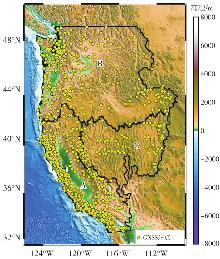
Fig. 1
Geographic extent of the study area and distribution of GNSS stations"

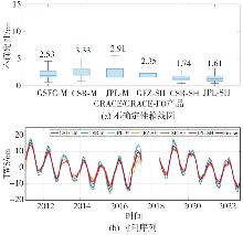
Fig. 2
Uncertainty boxplots and time series of multiple GRACE/GRACE-FO products"
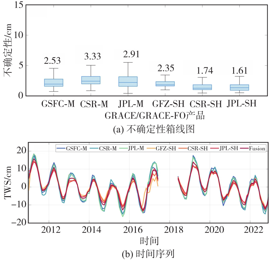
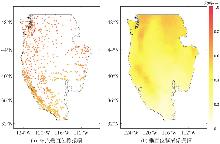
Fig. 3
Spatial distribution of the amplitudes of GNSS station time series before and after imaging"
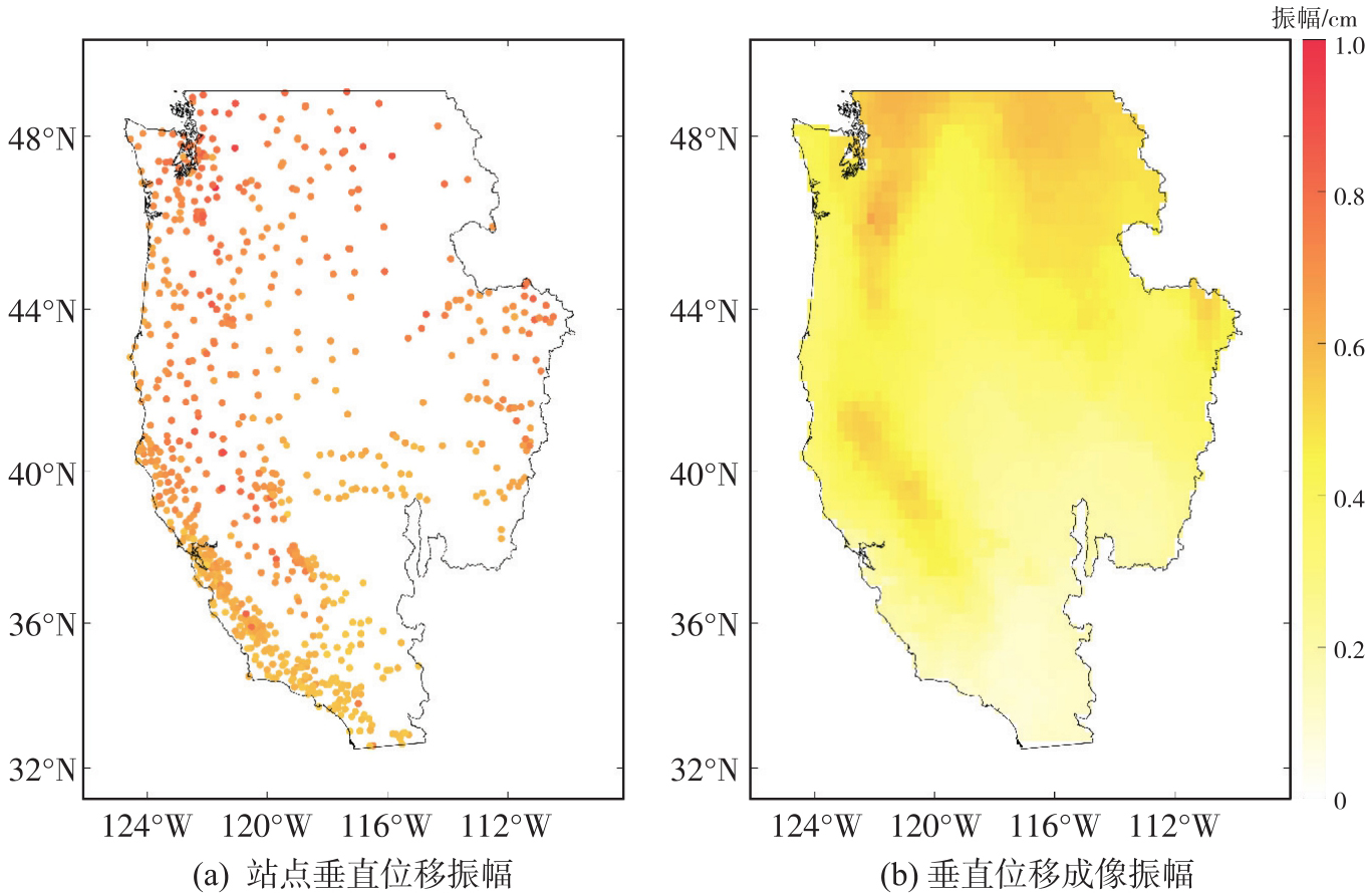
Fig. 4
Neural network framework constrained by the physical model"
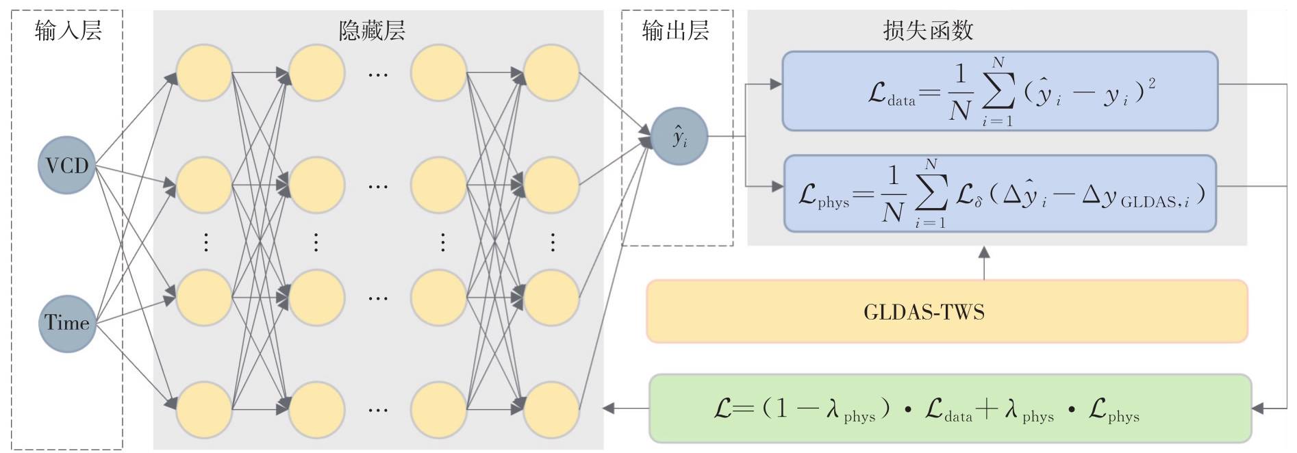
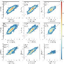
Fig. 5
Comparison of TWS reconstruction performance among PINN, BPNN and RF for the full sample, training set, and test set"
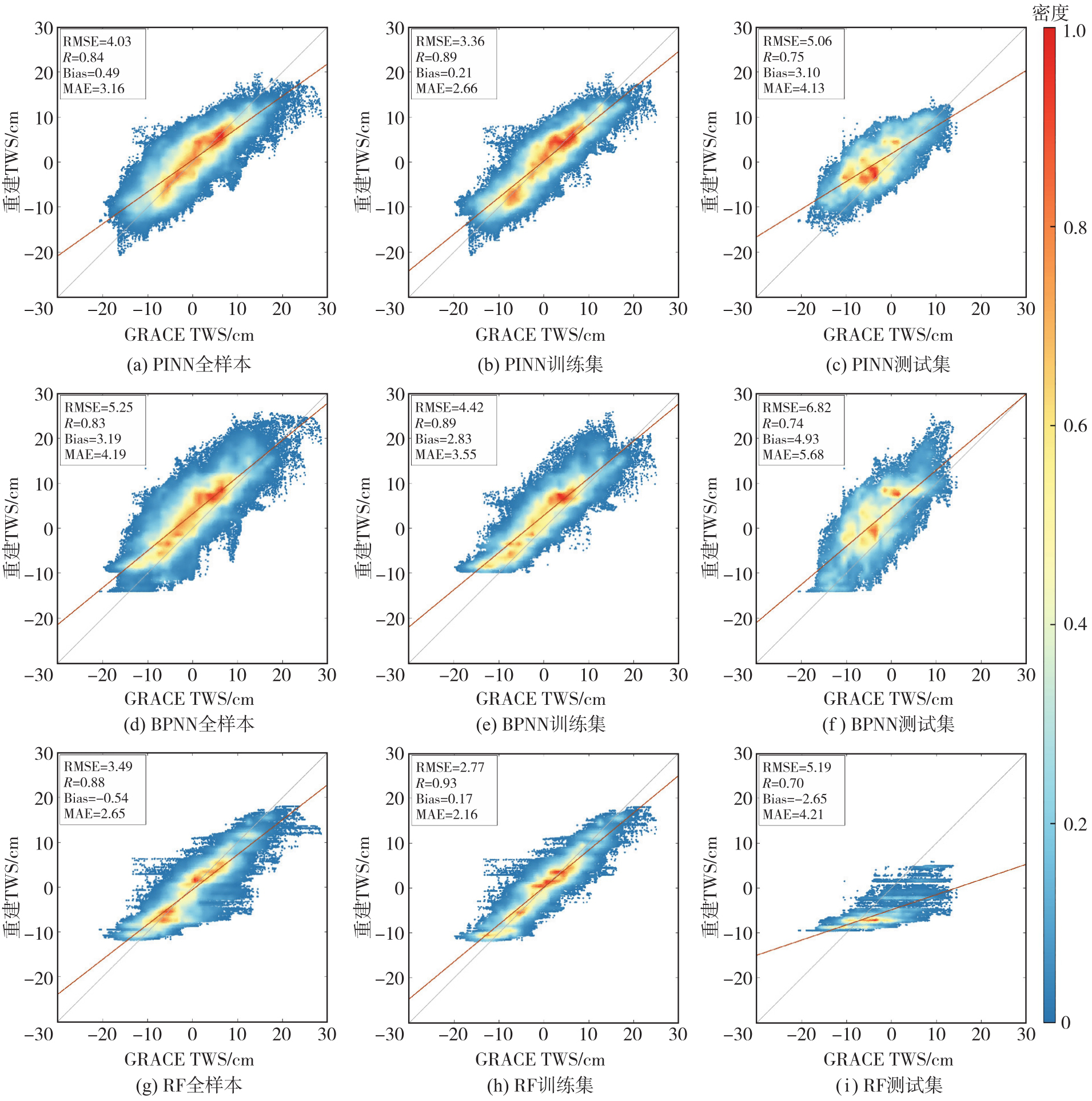

Tab. 1
Performance changes of PINN relative to BPNN and RF"
| 数据集 | 模型 | RMSE | R | Bias | MAE |
|---|---|---|---|---|---|
| 全样本 | BPNN | 23.24 | 1.20 | 84.64 | 24.58 |
| RF | -15.47 | -4.55 | 9.26 | -19.25 | |
| 训练集 | BPNN | 23.98 | 0.00 | 92.58 | 25.07 |
| RF | -21.30 | -4.30 | -23.53 | -23.15 | |
| 测试集 | BPNN | 25.81 | 1.35 | 37.12 | 27.29 |
| RF | 2.50 | 7.14 | -16.98 | 1.90 |
Fig. 6
Spatial distribution of TWS reconstruction performance of PINN and BPNN"
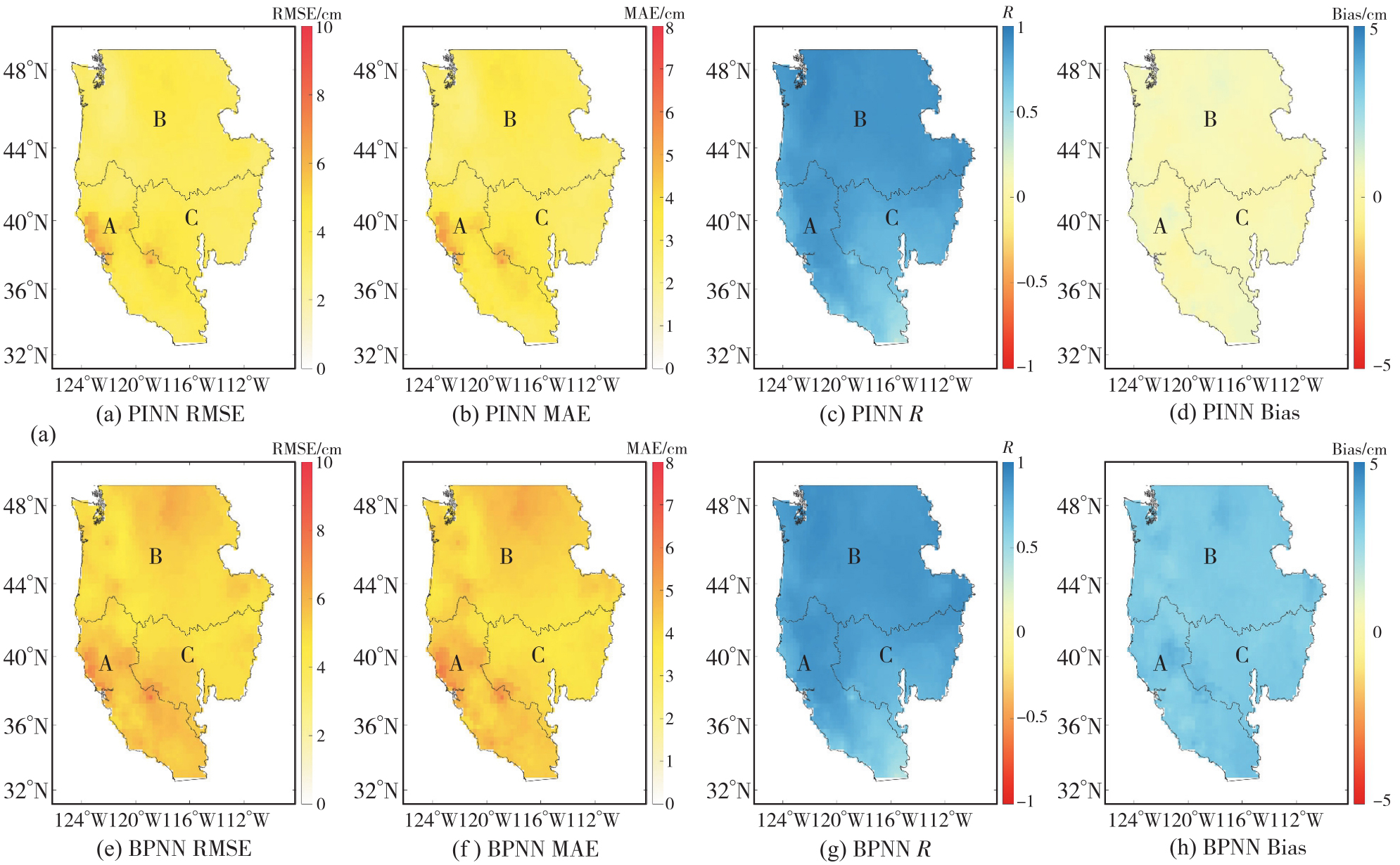
Tab. 2
Mean accuracy metrics of PINN and BPNN in the sub-basins"
| 流域 | 模型 | RMSE/cm | MAE/cm | R | Bias/cm |
|---|---|---|---|---|---|
| 加利福尼亚 | PINN | 4.36 | 3.52 | 0.76 | 0.50 |
| 流域 | BPNN | 5.56 | 4.44 | 0.76 | 3.24 |
| 太平洋 | PINN | 3.80 | 2.99 | 0.88 | 0.49 |
| 西北流域 | BPNN | 5.12 | 4.17 | 0.87 | 3.17 |
| 大盆地 | PINN | 4.01 | 3.12 | 0.79 | 0.45 |
| 流域 | BPNN | 5.12 | 3.94 | 0.80 | 3.18 |
Fig. 7
Spatial distribution of the long-term trend and amplitude of model-reconstructed TWS and GRACE TWS"

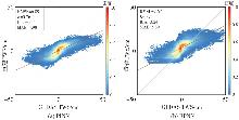
Fig. 8
Comparison of the consistency between PINN and BPNN reconstructed results and GLDAS"
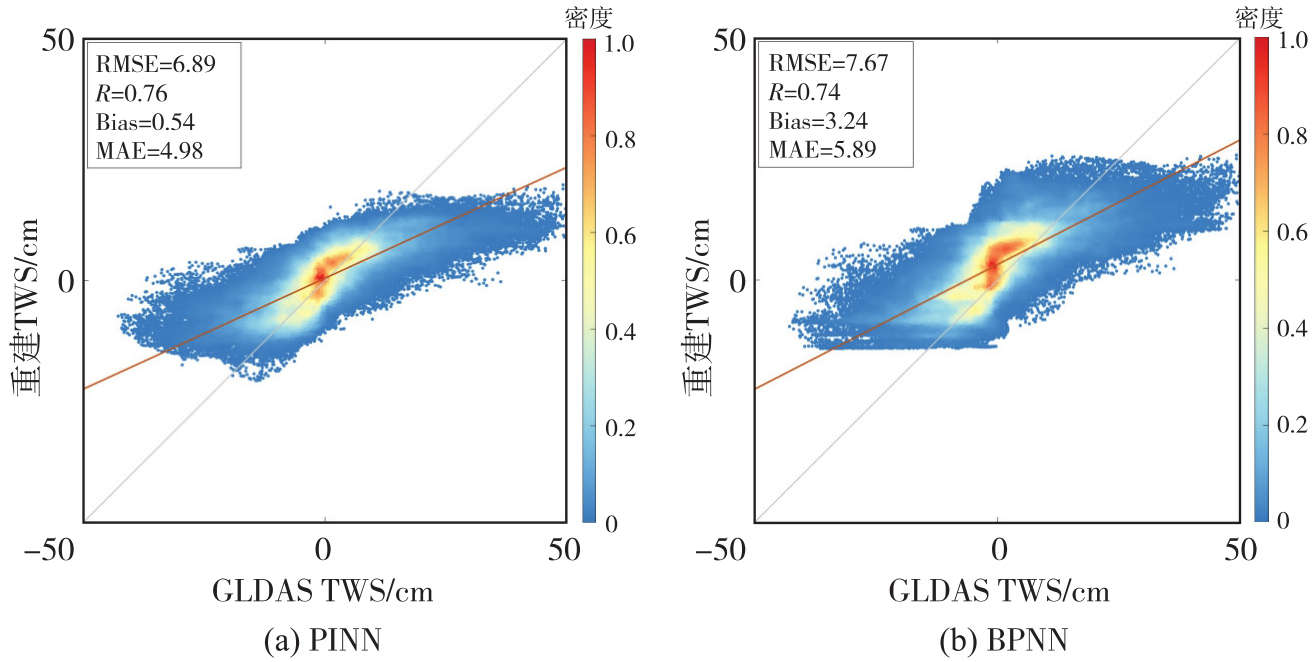
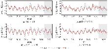
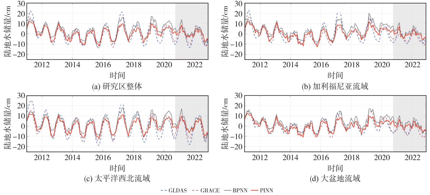
Fig. 9
Comparison of TWS time series for the entire study area and the sub-basins"
Tab. 3
RMSE of PINN and BPNN with respect to GRACE"
| 模型 | 研究区整体 | 加利福尼亚流域 | 太平洋西北流域 | 大盆地流域 |
|---|---|---|---|---|
| PINN | 3.28 | 3.60 | 3.28 | 3.76 |
| BPNN | 4.50 | 4.73 | 4.62 | 4.83 |
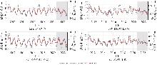
Fig. 10
Time series of TWS and vertical crustal displacement for the entire study area and the sub-basins"
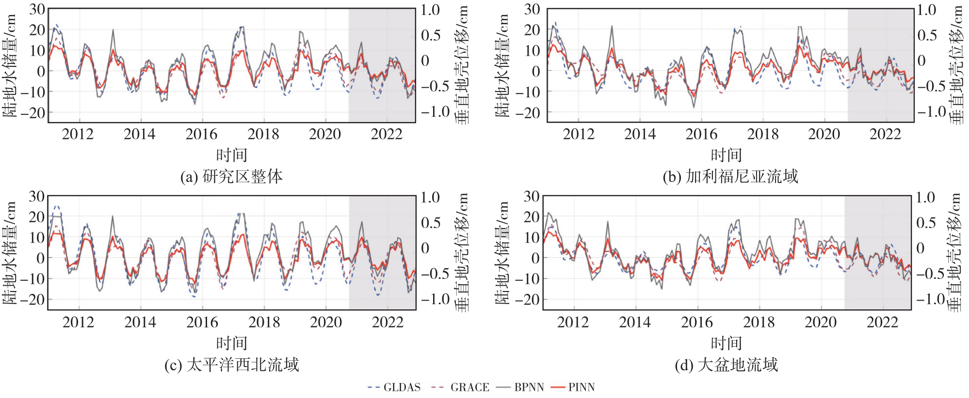
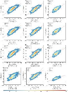
Fig. 11
Comparison of the agreement of PINN reconstructions with GRACE under different fixed physical weights"

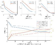
Fig. 12
Loss convergence curves and contribution ratio variations during PINN training"
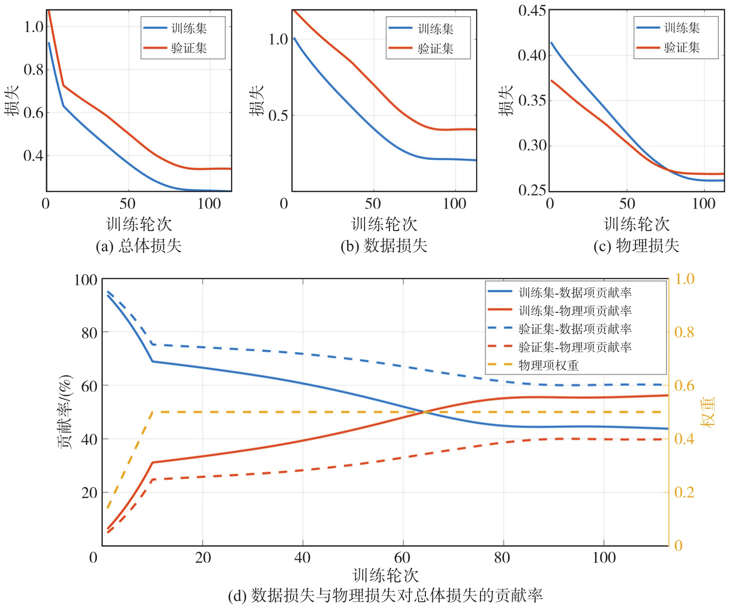
Fig. 13
Original scale ratios between TWS states and monthly variations"
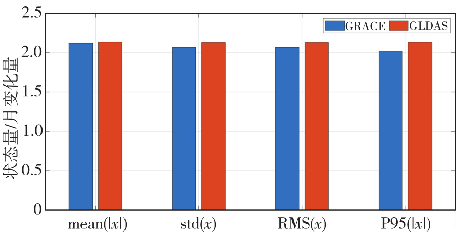
Fig. 14
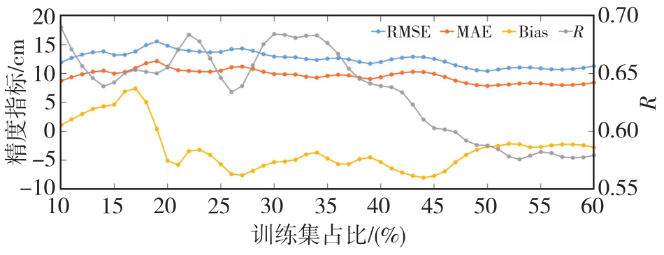
Comparison of TWS inversion results between PINN and the conventional method under different training-set proportions"
| [1] | Rodell M, Famiglietti J S, Wiese D N, et al. Emerging trends in global freshwater availability[J]. Nature, 2018, 557(7707): 651-659. |
| [2] | 许厚泽, 陆洋, 钟敏, 等. 卫星重力测量及其在地球物理环境变化监测中的应用[J]. 中国科学(地球科学), 2012, 42(6): 843-853. |
| Xu Houze, Lu Yang, Zhong Min, et al. Satellite gravity and its application to monitoring geophysical environmental change[J]. Scientia Sinica (Terrae), 2012, 42(6): 843-853. | |
| [3] | Wahr J, Molenaar M, Bryan F. Time variability of the Earth's gravity field: hydrological and oceanic effects and their possible detection using GRACE[J]. Journal of Geophysical Research: Solid Earth, 1998, 103(B12): 30205-30229. |
| [4] | Landerer F W, Flechtner F M, Save H, et al. Extending the global mass change data record: GRACE Follow-On instrument and science data performance[J]. Geophysical Research Letters, 2020, 47(12): e2020GL088306. |
| [5] | Longuevergne L, Scanlon B R, Wilson C R. GRACE hydrological estimates for small basins: evaluating processing approaches on the High Plains Aquifer, USA[J]. Water Resources Research, 2010, 46(11): 2009WR008564. |
| [6] | Kalu I, Ndehedehe C E, Ferreira V G, et al. Machine learning assessment of hydrological model performance under localized water storage changes through downscaling[J]. Journal of Hydrology, 2024, 628: 130597. |
| [7] | Feng Wei, Xiong Yuhao, Yi Shuang, et al. Recent progress on hydrogeodesy in China[J]. Journal of Geodesy and Geoinformation Science, 2023, 6(3): 124-134. |
| [8] | Van Dam T, Wahr J, Lavallée D. A comparison of annual vertical crustal displacements from GPS and Gravity Recovery and Climate Experiment (GRACE) over Europe[J]. Journal of Geophysical Research: Solid Earth, 2007, 112(B3): 2006JB004335. |
| [9] | Blewitt G, Lavallée D. Effect of annual signals on geodetic velocity[J]. Journal of Geophysical Research: Solid Earth, 2002, 107(B7): 2145. |
| [10] | Argus D F, Peltier W R, Drummond R, et al. The Antarctica component of postglacial rebound model ICE-6G_C (VM5a) based on GPS positioning, exposure age dating of ice thicknesses, and relative sea level histories[J]. Geophysical Journal International, 2014, 198(1): 537-563. |
| [11] | Zhong Bo, Li Xianpao, Chen Jianli, et al. Estimation of terrestrial water storage changes in Brazil from the joint inversion of GRACE-based geopotential difference and GNSS vertical displacement data[J]. Water Resources Research, 2024, 60(11): e2024WR037538. |
| [12] | Karniadakis G E, Kevrekidis I G, Lu Lu, et al. Physics-informed machine learning[J]. Nature Reviews Physics, 2021, 3(6): 422-440. |
| [13] | Cuomo S, Di Cola V S, Giampaolo F, et al. Scientific machine learning through physics-informed neural networks: where we are and what's next[J]. Journal of Scientific Computing, 2022, 92(3): 88. |
| [14] | Chavoshi A, Dashtian H, Bakhshian S, et al. PINN-SM: a physics-informed neural networks model for vadose zone soil moisture profile prediction[J]. Journal of Geophysical Research: Machine Learning and Computation, 2025, 2(4): e2024JH000547. |
| [15] | Ji Yuzhe, Zha Yuanyuan, Yeh T J, et al. Groundwater inverse modeling: physics-informed neural network with disentangled constraints and errors[J]. Journal of Hydrology, 2024, 640: 131703. |
| [16] | Sakar C, Tsukanov K, Schwartz N, et al. A physics-informed neural network workflow for forward and inverse modeling of unsaturated flow and root water uptake from hydrogeophysical data[J]. Journal of Hydrology, 2026, 665: 134675. |
| [17] | Dill R, Dobslaw H. Numerical simulations of global-scale high-resolution hydrological crustal deformations[J]. Journal of Geophysical Research: Solid Earth, 2013, 118(9): 5008-5017. |
| [18] | Herring T. MATLAB Tools for viewing GPS velocities and time series[J]. GPS Solutions, 2003, 7(3): 194-199. |
| [19] | Rodell M, Houser P R, Jambor U, et al. The global land data assimilation system[J]. Bulletin of the American Meteorological Society, 2004, 85(3): 381-394. |
| [20] | Dai Yongjiu, Zeng Xubin, Dickinson Robert E, et al. The common land model[J]. Bulletin of the American Meteorological Society, 2003, 84(8): 1013-1024. |
| [21] | Huffman G J, Adler R F, Morrissey M M, et al. Global precipitation at one-degree daily resolution from multisatellite observations[J]. Journal of Hydrometeorology, 2001, 2(1): 36-50. |
| [22] | Adler R F, Huffman G J, Chang A, et al. The version-2 global precipitation climatology project (GPCP) monthly precipitation analysis (1979-present)[J]. Journal of Hydrometeorology, 2003, 4(6): 1147-1167. |
| [23] | Loomis B D, Luthcke S B, Sabaka T J. Regularization and error characterization of GRACE mascons[J]. Journal of Geodesy, 2019, 93(9): 1381-1398. |
| [24] | Antoni M. A review of different mascon approaches for regional gravity field modelling since 1968[J]. History of Geo-and Space Sciences, 2022, 13(2): 205-217. |
| [25] | Save H, Bettadpur S, Tapley B D. High-resolution CSR GRACE RL05 mascons[J]. Journal of Geophysical Research: Solid Earth, 2016, 121(10): 7547-7569. |
| [26] | Zhang Zizhan, Chao Benjamin Fong, Lu Yang, et al. An effective filtering for GRACE time-variable gravity: Fan filter[J]. Geophysical Research Letters, 2009, 36(17): L17311. |
| [27] | Swenson S, Wahr J. Post-processing removal of correlated errors in GRACE data[J]. Geophysical Research Letters, 2006, 33(8): L08402. |
| [28] | Swenson S, Chambers D, Wahr J. Estimating geocenter variations from a combination of GRACE and ocean model output[J]. Journal of Geophysical Research: Solid Earth, 2008, 113(B8): 2007JB005338. |
| [29] | Sun Yu, Riva R, Ditmar P. Optimizing estimates of annual variations and trends in geocenter motion and J2 from a combination of GRACE data and geophysical models[J]. Journal of Geophysical Research: Solid Earth, 2016, 121(11): 8352-8370. |
| [30] | Loomis B D, Rachlin K E, Wiese D N, et al. Replacing GRACE/GRACE-FO C30 with satellite laser ranging: impacts on Antarctic ice sheet mass change[J]. Geophysical Research Letters, 2020, 47(3): e2019GL085488. |
| [31] | Gray J E, Allan D W. A method for estimating the frequency stability of an individual oscillator[C]//Processings of the 28th Annual Symposium on Frequency Control. Atlantic: IEEE, 1974: 243-246. |
| [32] | 姚朝龙, 李琼, 罗志才, 等. 利用广义三角帽方法评估GRACE反演中国大陆地区水储量变化的不确定性[J]. 地球物理学报, 2019, 62(3): 883-897. |
| Yao Chaolong, Li Qiong, Luo Zhicai, et al. Uncertainties in GRACE-derived terrestrial water storage changes over mainland China based on a generalized three cornered hat method[J]. Chinese Journal of Geophysics, 2019, 62(3): 883-897. | |
| [33] | Cui Lilu, Zhu Chengkang, Wu Yunlong, et al. Natural-and human-induced influences on terrestrial water storage change in Sichuan, southwest China from 2003 to 2020[J]. Remote Sensing, 2022, 14(6): 1369. |
| [34] | Galindo F J, Palacio J. Post-processing ROA data clocks for optimal stability in the ensemble timescale[J]. Metrologia, 2003, 40(3): S237-S244. |
| [35] | Hammond W C, Blewitt G, Kreemer C. GPS imaging of vertical land motion in California and Nevada: implications for Sierra Nevada uplift[J]. Journal of Geophysical Research: Solid Earth, 2016, 121(10): 7681-7703. |
| [36] | Jiang Zhongshan, Hsu Yaju, Yuan Linguo, et al. Hydrological drought characterization based on GNSS imaging of vertical crustal deformation across the contiguous United States[J]. Science of the Total Environment, 2022, 823: 153663. |
| [37] | Raissi M, Perdikaris P, Karniadakis G E. Physics-informed neural networks: a deep learning framework for solving forward and inverse problems involving nonlinear partial differential equations[J]. Journal of Computational Physics, 2019, 378: 686-707. |
| [1] | Chuang SHI, Xinxin CHEN, Jiale WANG, Ming XIA. Multi-source GNSS data and deep learning-driven RTK positioning error prediction for smartphones [J]. Acta Geodaetica et Cartographica Sinica, 2026, 55(5): 761-775. |
| [2] | Jinwei BU, Shuhui LIU, Shunshuang XU, Tongsu XIANG, Qiulan WANG, Chaoying JI, Xiaoqing ZUO. Construction of an empirical model for estimating the global wave period of spaceborne GNSS-R [J]. Acta Geodaetica et Cartographica Sinica, 2026, 55(4): 684-697. |
| [3] | Tangting WU, Xinyu LUO, Liguo LU, Zhanke LIU, Nengfang CHAO. Assessment of water resource changes and drought characteristics in the Shaanxi, Gansu and Ningxia region based on GNSS and GRACE/GRACE-FO [J]. Acta Geodaetica et Cartographica Sinica, 2026, 55(3): 439-450. |
| [4] | Zhongmin MA, Shuangcheng ZHANG, Xin ZHOU, Qi LIU, Ning LIU, Hengli WANG. A flood monitoring method using FY-3 GNSS-R accounting for surface reflectivity uncertainty: a case study of the August 2 Guangdong rainstorm disaster [J]. Acta Geodaetica et Cartographica Sinica, 2026, 55(3): 451-464. |
| [5] | Qingyun YAN, Zixuan GUO, Yuanjin PAN, Yan JIA, Shuanggen JIN. Quantitative driving factors and zoning patterns of GNSS-R land surface reflectivity spatial heterogeneity [J]. Acta Geodaetica et Cartographica Sinica, 2026, 55(2): 315-327. |
| [6] | Qingzhi ZHAO, Duoduo JIANG, Yibin YAO, Zhi MA, Yongjie MA, Haojie LI, Ruirui XUE. An adaptive method for selecting the optimal GNSS satellite signal for water vapor tomography [J]. Acta Geodaetica et Cartographica Sinica, 2026, 55(1): 25-35. |
| [7] | Deying YU, Houpu LI, Yi LIU, Shuguang WU, Deyan LI, Mingchao LI, Wenkui LI, Shaofeng BIAN. A DBSCAN-based RAIM algorithm for multiple gross error identification [J]. Acta Geodaetica et Cartographica Sinica, 2026, 55(1): 59-72. |
| [8] | Dongliang CHENG, Lingqiu CHEN, Zhiyong HUANG, Shubo QIAO, Dandan WANG, Yaming YAN. Performance evaluation of COATS-based multi-mode and multi-frequency iGNSS-R altimetry [J]. Acta Geodaetica et Cartographica Sinica, 2026, 55(1): 73-89. |
| [9] | Yarong LUO, Wentao LU, Chi GUO, Jingnan LIU. Left-handed symmetry equivariant filtering model and algorithm for GNSS/INS integrated navigation [J]. Acta Geodaetica et Cartographica Sinica, 2025, 54(8): 1389-1403. |
| [10] | Yangyi CHEN, Kai ZHENG, Xiaohong ZHANG, Mingkui WU, Pengxu WANG, Wenju FU, Kezhong LIU. GPS/Galileo/BDS overlapping frequencies multipath error analysis and modeling [J]. Acta Geodaetica et Cartographica Sinica, 2025, 54(8): 1427-1438. |
| [11] | Jianzhang LI, Haowen YAN, Weifang YANG, Xiaoning SU. GNSS pseudo trigonometric leveling method [J]. Acta Geodaetica et Cartographica Sinica, 2025, 54(7): 1170-1177. |
| [12] | Qingzhi ZHAO, Lulu CHANG, Yibin YAO, Haojie LI. A method for constructing a hydrological drought index integrated with GNSS and meteorological data [J]. Acta Geodaetica et Cartographica Sinica, 2025, 54(7): 1192-1205. |
| [13] | Qianxin WANG, Chao HU, Tong CHENG. A method for satellite ultra-rapid orbit and clock offset estimation based on the prior information of the GNSS clock parameters [J]. Acta Geodaetica et Cartographica Sinica, 2025, 54(6): 982-994. |
| [14] | Yang SHEN, Guangyun LI, Mingjian CHEN, Linyang LI, Xingyu SHI, Wei CAI, Weifeng HAO. Assessment of GNSS ionosphere models based on FY-3 TEC in polar regions [J]. Acta Geodaetica et Cartographica Sinica, 2025, 54(6): 995-1008. |
| [15] | Haopeng FAN, Bojiao ZHANG, Zhongmiao SUN, Jinkai FENG. Prediction method of regional tropospheric wet delay based on Conv-LSTM network [J]. Acta Geodaetica et Cartographica Sinica, 2025, 54(5): 795-804. |
| Viewed | ||||||
|
Full text |
|
|||||
|
Abstract |
|
|||||
