

Acta Geodaetica et Cartographica Sinica ›› 2026, Vol. 55 ›› Issue (7): 1158-1170.doi: 10.11947/j.AGCS.2026.20250422
• Frontiers in AI-Driven Geodesy and Satellite Gravity Inversion • Previous Articles
Jianhao Xuan1( ), Qiujie Chen1(), Xingfu Zhang2, Yunzhong Shen1
Received:2025-10-11
Revised:2026-01-05
Published:2026-08-18
Contact:
Qiujie Chen
E-mail:jhxuan@tongji.edu.cn;qiujiechen@tongji.edu.cn
About author:Xuan Jianhao (1999—), male, PhD candidate, majors in high-resolution Earth's gravity field modelling. E-mail: jhxuan@tongji.edu.cn
Supported by:CLC Number:
Jianhao Xuan, Qiujie Chen, Xingfu Zhang, Yunzhong Shen. Assessing the enhancement of high-resolution marine gravity field recovery by SWOT altimetry data[J]. Acta Geodaetica et Cartographica Sinica, 2026, 55(7): 1158-1170.
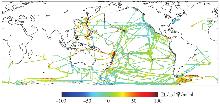
Fig. 1
Spatial distribution of NCEI shipborne gravity anomalies"
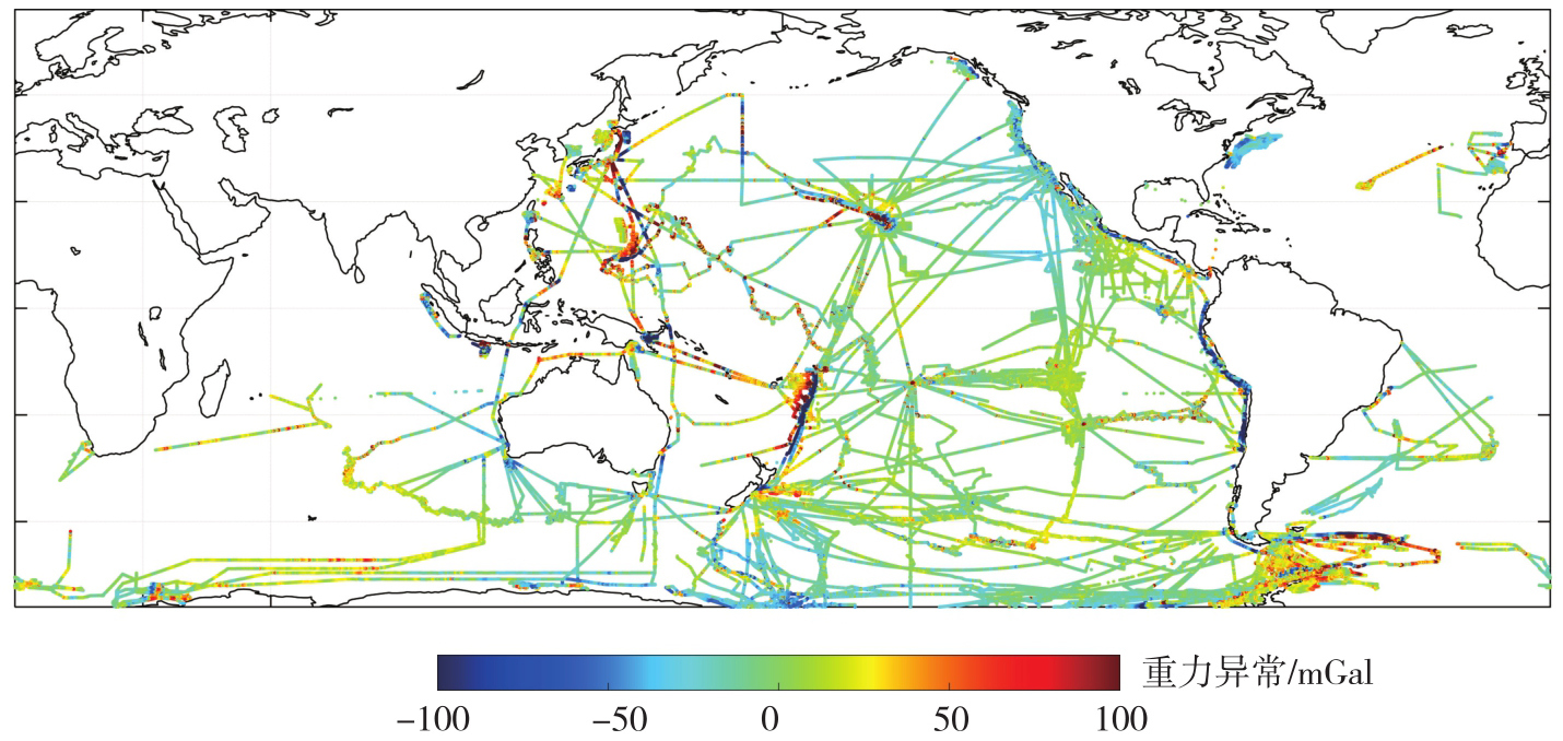
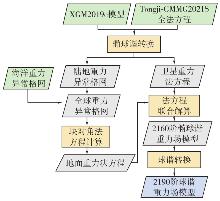
Fig. 2
Flow chart for high-resolution Earth's gravity field modelling"
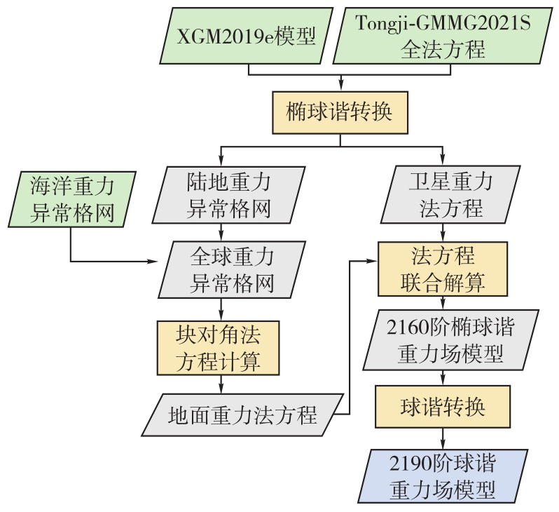
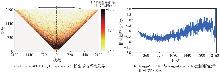
Fig. 3
Differences in spherical harmonic coefficients between Tongji-SWOT03 and Tongji-Grav32.1, and relative deviation rate in degree power between Tongji-SWOT03 and Tongji-Grav32.1"
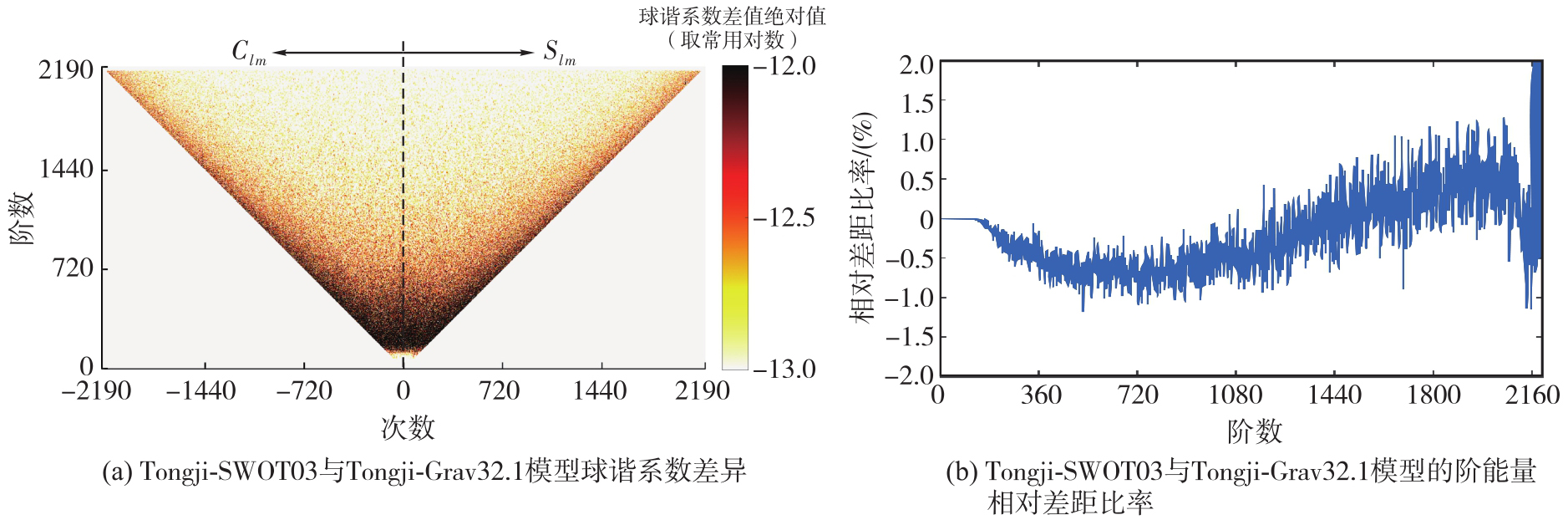
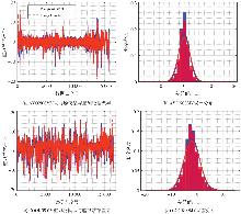
Fig. 4
Differences between model-derived and shipborne gravity anomalies and error distribution of gravity field models evaluated using shipborne data along the AVON08MV track and the COOK09MV track"
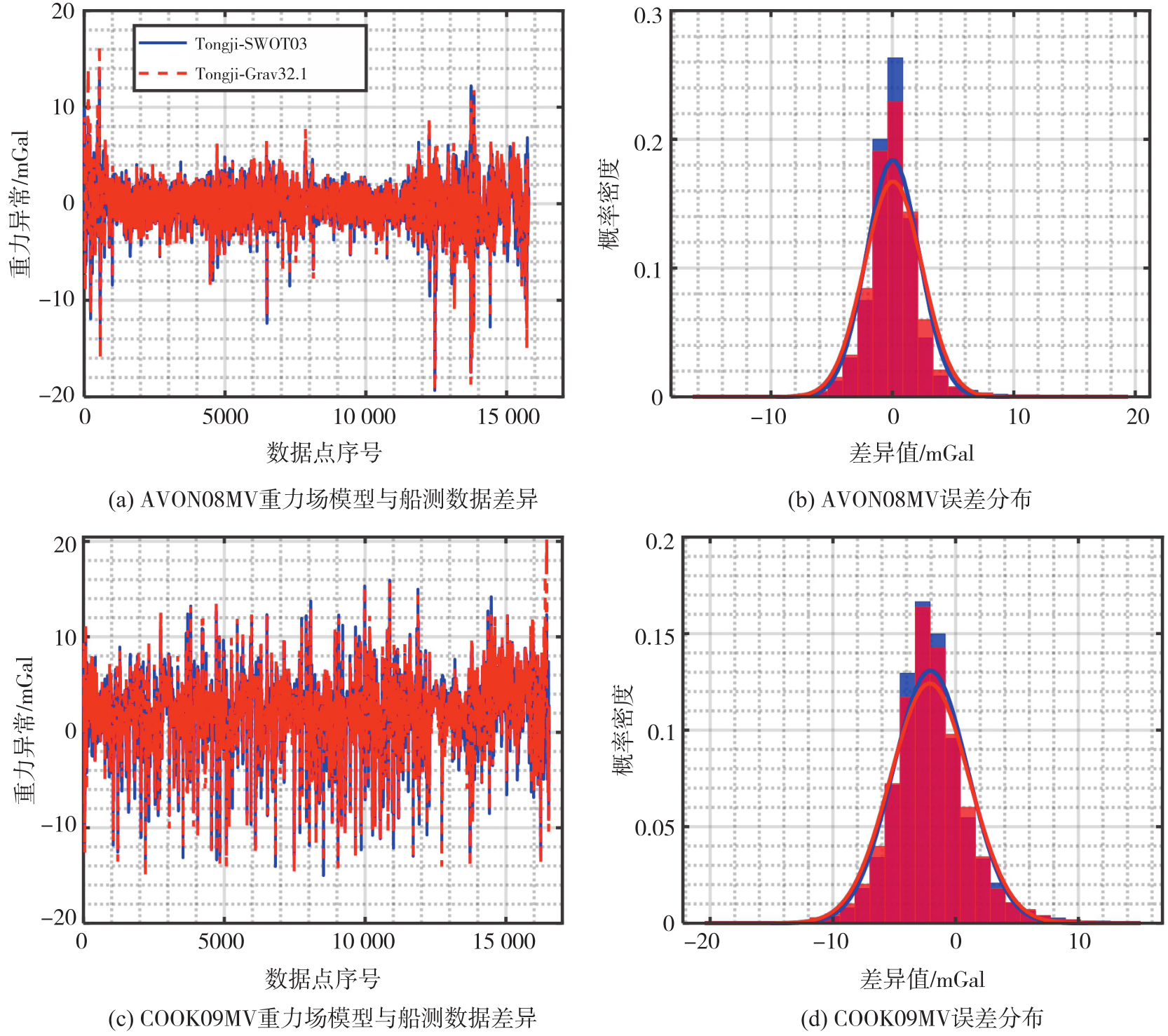
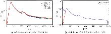
Fig. 5
Degree variances of high-resolution gravity field models"
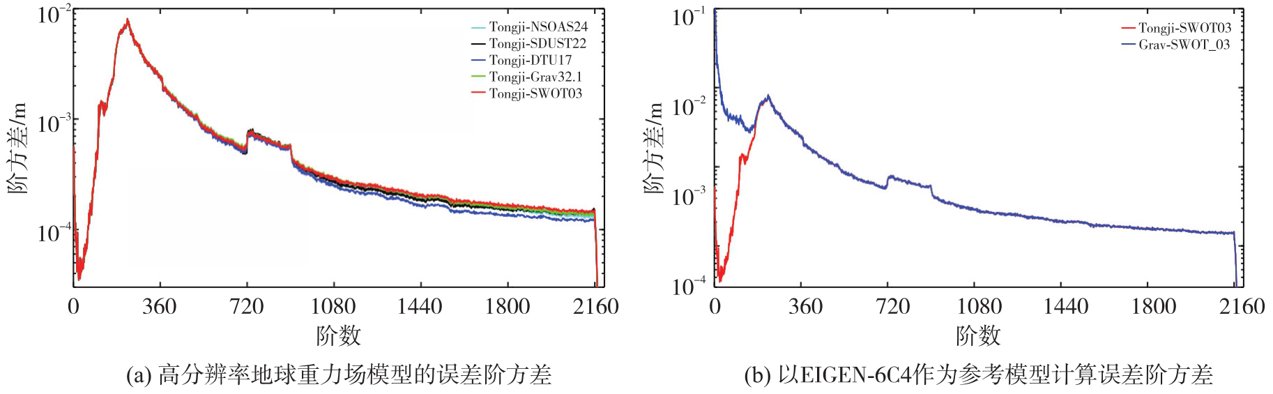
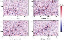
Fig. 6
Gravity anomaly differences between Tongji-SWOT03 and four gravity field models over the Southwest Indian Ridge"

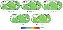
Fig. 7
Spatial differences between the combined gravity field models and marine gravity field models"


Tab. 1
Gravity anomaly differences between gravity field models and shipborne data"
| 模型 | 最小值 | 最大值 | RMS | |
|---|---|---|---|---|
| 重力场融合模型 | Tongji-SWOT03 | -50.04 | 33.74 | 3.64 |
| Tongji-Grav32.1 | -53.87 | 55.05 | 3.83 | |
| Tongji-DTU17 | -45.16 | 33.97 | 3.83 | |
| Tongji-SDUST22 | -45.56 | 37.02 | 3.84 | |
| Tongji-NSOAS24 | -43.55 | 35.70 | 3.76 | |
| 海洋重力场模型 | Grav_SWOT_03 | -51.27 | 41.21 | 3.73 |
| Grav_32.1 | -53.75 | 58.46 | 3.92 | |
| DTU17 | -46.34 | 31.59 | 3.89 | |
| SDUST2022GRA | -46.50 | 37.69 | 3.86 | |
| NSOAS24 | -44.37 | 37.17 | 3.82 |
Tab. 2
Gravity anomaly differences between gravity field models and shipborne data in nearshore and open ocean regions"
| 模型 | 卫星 | 近岸区域(0~10 km) | 近岸区域(10~20 km) | 公海区域(>20 km) | ||||||
|---|---|---|---|---|---|---|---|---|---|---|
| 最小值 | 最大值 | RMS | 最小值 | 最大值 | RMS | 最小值 | 最大值 | RMS | ||
| 重力场融合模型 | Tongji-SWOT03 | -50.04 | 32.84 | 7.32 | -33.36 | 32.79 | 5.45 | -30.57 | 34.62 | 3.41 |
| Tongji-Grav32.1 | -53.77 | 48.48 | 8.11 | -40.80 | 47.44 | 6.33 | -28.69 | 32.36 | 3.53 | |
| Tongji-DTU17 | -45.16 | 31.76 | 6.87 | -23.22 | 26.62 | 5.83 | -23.98 | 26.36 | 3.62 | |
| Tongji-SDUST22 | -45.56 | 37.48 | 8.17 | -31.68 | 31.00 | 6.09 | -25.09 | 30.46 | 3.55 | |
| Tongji-NSOAS24 | -43.55 | 34.49 | 7.53 | -29.37 | 34.65 | 5.93 | -29.02 | 28.89 | 3.50 | |
| 海洋重力场模型 | Grav_SWOT_03 | -51.27 | 33.23 | 7.43 | -34.63 | 29.71 | 5.64 | -30.64 | 42.00 | 3.49 |
| Grav_32.1 | -54.97 | 51.88 | 8.24 | -41.25 | 49.51 | 6.49 | -28.94 | 39.21 | 3.60 | |
| DTU17 | -46.34 | 31.47 | 6.94 | -23.24 | 24.29 | 5.83 | -23.71 | 25.85 | 3.68 | |
| SDUST2022GRA | -46.50 | 37.79 | 8.18 | -31.66 | 26.60 | 5.98 | -25.02 | 30.32 | 3.56 | |
| NSOAS24 | -44.37 | 35.51 | 7.59 | -29.31 | 30.01 | 5.87 | -29.06 | 28.85 | 3.55 | |
Tab. 3
Gravity anomaly differences between gravity field models and shipborne data in trench regions"
| 模型 | 卫星 | 最小值 | 最大值 | RMS |
|---|---|---|---|---|
| 重力场融合模型 | Tongji-SWOT03 | -35.99 | 28.25 | 4.24 |
| Tongji-Grav32.1 | -53.87 | 44.86 | 4.60 | |
| Tongji-DTU17 | -18.59 | 26.26 | 4.40 | |
| Tongji-SDUST22 | -41.04 | 32.25 | 4.56 | |
| Tongji-NSOAS24 | -37.54 | 29.85 | 4.44 | |
| 海洋重力场模型 | Grav_SWOT_03 | -37.65 | 30.21 | 4.35 |
| Grav_32.1 | -53.75 | 47.80 | 4.66 | |
| DTU17 | -18.64 | 25.70 | 4.44 | |
| SDUST2022GRA | -40.78 | 32.79 | 4.57 | |
| NSOAS24 | -37.43 | 31.87 | 4.52 |
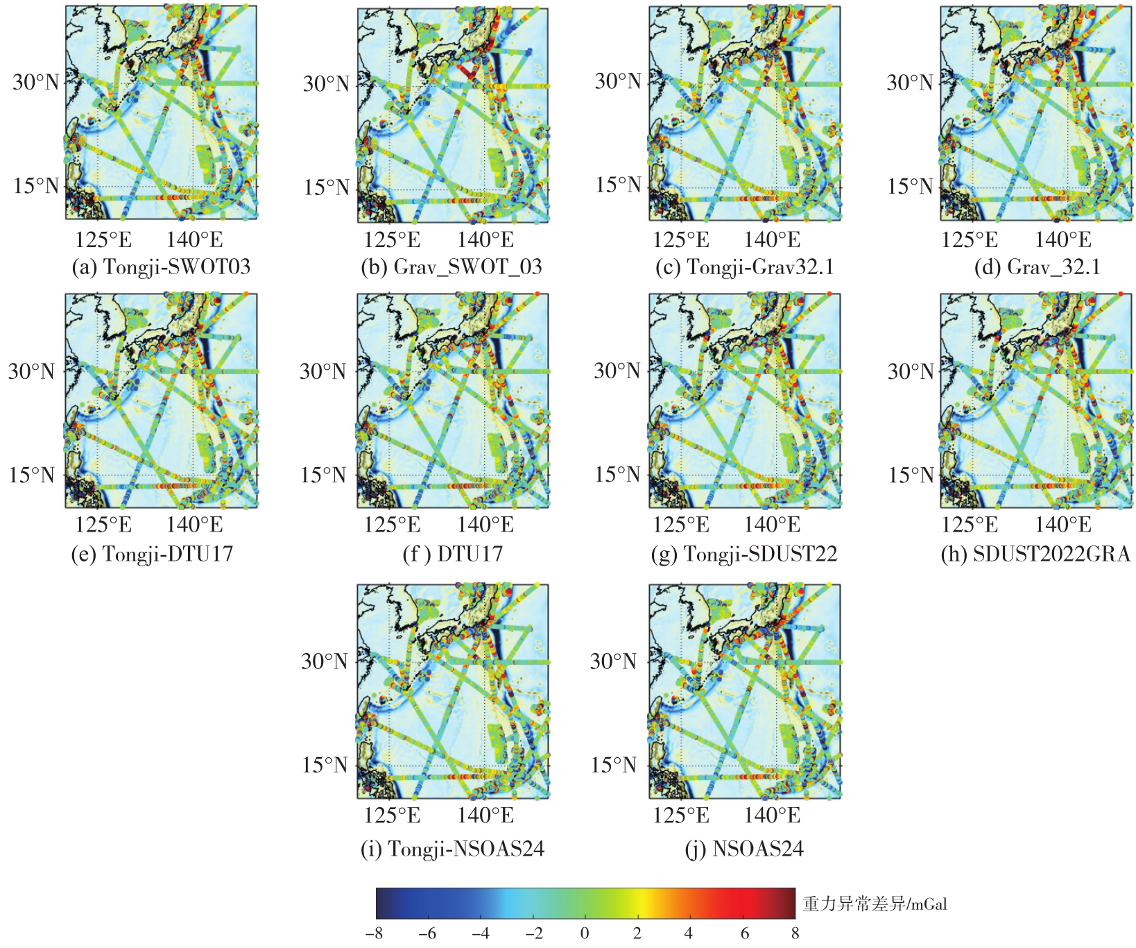
Fig. 8
Spatial distribution of gravity anomaly differences between gravity field models and shipborne data in trench regions, with gravity anomalies shown as the background"
Tab. 4
Gravity anomaly differences between shipborne data and gravity field models after replacing coefficients up to degree 1080"
| 卫星 | 最小值 | 最大值 | RMS |
|---|---|---|---|
| Tongji-SWOT03 | -61.91 | 43.04 | 4.19 |
| Tongji-Grav32.1 | -63.92 | 41.69 | 4.30 |
| Tongji-DTU17 | -52.90 | 39.08 | 4.33 |
| Tongji-SDUST22 | -53.09 | 43.68 | 4.31 |
| Tongji-NSOAS24 | -48.99 | 38.13 | 4.27 |
| [1] | 管泽霖, 管铮, 黄谟涛, 等. 局部重力场逼近理论和方法[M]. 北京: 测绘出版社, 1997. |
| Guan Zelin, Guan Zheng, Huang Motao, et al. Theory and method of local gravity field approximation[M]. Beijing: Surveying and Mapping Press, 1997. | |
| [2] | 沈云中. 应用CHAMP卫星星历精化地球重力场模型的研究[D]. 武汉: 中国科学院测量与地球物理研究所, 2000. |
| Shen Yunzhong. Refinement of Earth gravity field model using CHAMP satellite ephemeris[D]. Wuhan: Institute of Geodesy and Geophysics, Chinese Academy of Sciences, 2000. | |
| [3] | 王正涛, 党亚民, 晁定波. 超高阶地球重力位模型确定的理论与方法[M]. 北京: 测绘出版社, 2011. |
| Wang Zhengtao, Dang Yamin, Chao Dingbo. Theory and methodology of ultra-high-degree geopotential model determination[M]. Beijing: Surveying and Mapping Press, 2011. | |
| [4] | 许厚泽, 陆洋, 钟敏, 等. 卫星重力测量及其在地球物理环境变化监测中的应用[J]. 中国科学:地球科学, 2012, 42(6): 843-853. |
| Xu Houze, Lu Yang, Zhong Min, et al. Satellite gravity and its application to monitoring geophysical environmental change[J]. Scientia Sinica (Terrae), 2012, 42(6): 843-853. | |
| [5] | 宁津生, 黄谟涛, 欧阳永忠, 等. 海空重力测量技术进展[J]. 海洋测绘, 2014, 34(3): 67-72, 76. |
| Ning Jinsheng, Huang Motao, Ouyang Yongzhong, et al. Development of marine and airborne gravity measurement technologies[J]. Hydrographic Surveying and Charting, 2014, 34(3): 67-72, 76. | |
| [6] | 陈秋杰. 基于改进短弧积分法的GRACE重力反演理论、方法及应用[D]. 上海: 同济大学, 2016. |
| Chen Qiujie. Theory and methodology as well as application of GRACE gravity recovery using modified short arc approach[D]. Shanghai: Tongji University, 2016. | |
| [7] | Gruber T, Bode A, Reigber C, et al. GRIM5-C1: combination solution of the global gravity field to degree and order 120[J]. Geophysical Research Letters, 2000, 27(24): 4005-4008. |
| [8] | Sandwell D T, Müller R D, Smith W H F, et al. New global marine gravity model from CryoSat-2 and Jason-1 reveals buried tectonic structure[J]. Science, 2014, 346(6205): 65-67. |
| [9] | Andersen O B, Knudsen P. The DTU17 global marine gravity field: first validation results[M]//Fiducial reference measurements for altimetry. Cham: Springer, 2019: 83-87. |
| [10] | Ince E S, Barthelmes F, Reißland S, et al. ICGEM-15 years of successful collection and distribution of global gravitational models, associated services, and future plans[J]. Earth System Science Data, 2019, 11(2): 647-674. |
| [11] | Gruber T, Gerlach C, Haagmans R. Intercontinental height datum connection with GOCE and GPS-levelling data[J]. Journal of Geodetic Science, 2012, 2(4): 270-280. |
| [12] | Ihde J, Sánchez L, Barzaghi R, et al. Definition and proposed realization of the international height reference system (IHRS)[J]. Surveys in Geophysics, 2017, 38(3): 549-570. |
| [13] | Amin H, Sjö berg L E, Bagherbandi M. A global vertical datum defined by the conventional geoid potential and the Earth ellipsoid parameters[J]. Journal of Geodesy, 2019, 93(10): 1943-1961. |
| [14] | 李建成. 最新中国陆地数字高程基准模型:重力似大地水准面CNGG2011[J]. 测绘学报, 2012, 41(5): 651-660, 669. |
| Li Jiancheng. The recent Chinese terrestrial digital height datum model: gravimetric quasi-geoid CNGG2011[J]. Acta Geodaetica et Cartographica Sinica, 2012, 41(5): 651-660, 669. | |
| [15] | Matsuo K, Kuroishi Y. Refinement of a gravimetric geoid model for Japan using GOCE and an updated regional gravity field model[J]. Earth, Planets and Space, 2020, 72(1): 1-18. |
| [16] | Shao Kai, Gu Defeng, Ju Bing, et al. Analysis of Tiangong-2 orbit determination and prediction using onboard dual-frequency GNSS data[J]. GPS Solutions, 2019, 24(1): 11. |
| [17] | Knudsen P, Bingham R, Andersen O, et al. A global mean dynamic topography and ocean circulation estimation using a preliminary GOCE gravity model[J]. Journal of Geodesy, 2011, 85(11): 861-879. |
| [18] | Rathnayake S, Tenzer R, Eshagh M, et al. Gravity maps of the lithospheric structure beneath the Indian Ocean[J]. Surveys in Geophysics, 2019, 40(5): 1055-1093. |
| [19] | Bagherbandi M, Eshagh M. Crustal thickness recovery using an isostatic model and GOCE data[J]. Earth, Planets and Space, 2012, 64(11): 1053-1057. |
| [20] | 刘成. 铁路工程卫星定位高程拟合技术[M]. 北京: 中国铁道出版社, 2018. |
| Liu Cheng. Height fitting technology of railway engineering satellite positioning[M]. Beijing: China Railway Publishing House, 2018. | |
| [21] | 许厚泽. 卫星重力研究:21世纪大地测量研究的新热点[J]. 测绘科学, 2001, 26(3): 1-3. |
| Xu Houze. Satellite gravity missions-new hotpoint in geodesy[J]. Science of Surveying and Mapping, 2001, 26(3): 1-3. | |
| [22] | Eshagh M, Jin Shuanggen, Pail R, et al. Satellite gravimetry: methods, products, applications, and future trends[J]. Earth-Science Reviews, 2024, 253: 104783. |
| [23] | 张兴福. 应用低轨卫星跟踪数据反演地球重力场模型[D]. 上海: 同济大学, 2007. |
| Zhang Xingfu. The Earth's field model recovery on the basis of satellite-to-satellite tracking missions[D]. Shanghai: Tongji University, 2007. | |
| [24] | Sandwell D T, Harper H, Tozer B, et al. Gravity field recovery from geodetic altimeter missions[J]. Advances in Space Research, 2021, 68(2): 1059-1072. |
| [25] | Li Zhen, Guo Jinyun, Zhu Chengcheng, et al. The SDUST2022GRA global marine gravity anomalies recovered from radar and laser altimeter data: contribution of ICESat-2 laser altimetry[J]. Earth System Science Data, 2024, 16(9): 4119-4135. |
| [26] | Zhang Shengjun, Chen Xu, Zhou Runsheng, et al. NSOAS24: a new global marine gravity model derived from multi-satellite sea surface slopes[J]. Geoscientific Model Development, 2025, 18(4): 1221-1239. |
| [27] | Yu Yao, Sandwell D T, Dibarboure G. Abyssal marine tectonics from the SWOT mission[J]. Science, 2024, 386(6727): 1251-1256. |
| [28] | Fu L L, Pavelsky T, Cretaux J F, et al. The surface water and ocean topography mission: a breakthrough in radar remote sensing of the ocean and land surface water[J]. Geophysical Research Letters, 2024, 51(4): e2023GL107652. |
| [29] | Yu Daocheng, Hwang C, Andersen O B, et al. Gravity recovery from SWOT altimetry using geoid height and geoid gradient[J]. Remote Sensing of Environment, 2021, 265: 112650. |
| [30] | Sun Mingzhi, Feng Wei, An Dechao, et al. Preliminary results of marine gravity anomaly and bathymetry from SWOT wide-swath altimeter data[J]. IEEE Journal of Selected Topics in Applied Earth Observations and Remote Sensing, 2025, 18: 18107-18116. |
| [31] | Li Yang, Zhou Jiangcun, Li Jinbo, et al. Global marine gravity from 27 cycles of SWOT satellite data: accuracy and spatial resolution evaluation[J]. Journal of Geodesy, 2025, 99(6): 51. |
| [32] |
陈晓东, 杨萌, 袁园, 等. 中国近海SWOT_02重力场模型精度与空间分辨率评估[J]. 测绘学报, 2025, 54(6): 1031-1041. DOI: .
doi: 10.11947/j.AGCS.2025.20240487 |
|
Chen Xiaodong, Yang Meng, Yuan Yuan, et al. Evaluation of the accuracy and spatial resolution of SWOT_02 marine gravity model in China's offshore regions[J]. Acta Geodaetica et Cartographica Sinica, 2025, 54(6): 1031-1041. DOI: .
doi: 10.11947/j.AGCS.2025.20240487 |
|
| [33] | Xiao Yun, Yang Yuanxi, Pan Zongpeng, et al. Chinese gravimetry augment and mass change exploring mission status and future[J]. Journal of Geodesy and Geoinformation Science, 2023, 6(3): 67-75. |
| [34] | 周浩, 罗志才, 周泽兵, 等. 基于天琴一号观测数据反演地球重力场模型[J]. 华中科技大学学报(自然科学版), 2022, 50(9): 117-125. |
| Zhou Hao, Luo Zhicai, Zhou Zebing, et al. Earth's gravity field determination based on Tianqin-1 observations[J]. Journal of Huazhong University of Science and Technology (Natural Science Edition), 2022, 50(9): 117-125. | |
| [35] | 肖云, 李岩, 周泽兵, 等. 中国重力卫星进展[J]. 武汉大学学报(信息科学版), 2026, 51(3): 413-424. |
| Xiao Yun, Li Yan, Zhou Zebing, et al. Progress on the Chinese gravimetry satellite missions[J]. Geomatics and Information Science of Wuhan University, 2026, 51(3): 413-424. | |
| [36] | 蒋兴伟, 王晓慧, 彭海龙, 等. 海洋二号卫星精密定轨方案设计及实现[J]. 中国工程科学, 2013, 15(7): 19-24, 43. |
| Jiang Xingwei, Wang Xiaohui, Peng Hailong, et al. The technology of precise orbit determination for HY-2A satellite[J]. Engineering Sciences, 2013, 15(7): 19-24, 43. | |
| [37] |
翟振和, 孙中苗, 马健, 等. 中国编队海洋测绘卫星数据反演海域重力扰动矢量及性能分析[J]. 测绘学报, 2025, 54(4): 714-724. DOI: .
doi: 10.11947/J.AGCS.2025.20240340 |
|
Zhai Zhenhe, Sun Zhongmiao, Ma Jian, et al. Gravity field inversion from China ocean altimetry tandem satellites data and performance analysis[J]. Acta Geodaetica et Cartographica Sinica, 2025, 54(4): 714-724. DOI: .
doi: 10.11947/J.AGCS.2025.20240340 |
|
| [38] | Zaki A, Magdy M, Rabah M, et al. Establishing a marine gravity database around Egypt from satellite altimetry-derived and shipborne gravity data[J]. Marine Geodesy, 2022, 45(2): 101-120. |
| [39] | Chen Jianhua, Chen Qiujie, Shen Yunzhong, et al. Contribution analysis of GOCE SGG observations at different orbital altitudes to Tongji-GMMG2021S gravity field model[J]. IEEE Journal of Selected Topics in Applied Earth Observations and Remote Sensing, 2024, 17: 14284-14294. |
| [40] | Zingerle P, Pail R, Gruber T, et al. The combined global gravity field model XGM2019e[J]. Journal of Geodesy, 2020, 94(7): 66. |
| [41] | Pavlis N K, Holmes S A, Kenyon S C, et al. The development and evaluation of the Earth gravitational model 2008 (EGM2008)[J]. Journal of Geophysical Research: Solid Earth, 2012, 117(B4): B04406. |
| [42] | Colombo O L. Numerical methods for harmonic analysis on the sphere[R]. Columbus: Department of Geodetic Science, Ohio State University, 1981. |
| [43] |
梁伟, 徐新禹, 李建成, 等. 联合EGM2008模型重力异常和GOCE观测数据构建超高阶地球重力场模型SGG-UGM-1[J]. 测绘学报, 2018, 47(4): 425-434. DOI: .
doi: 10.11947/J.AGCS.2018.20170269 |
|
Liang Wei, Xu Xinyu, Li Jiancheng, et al. The determination of an ultra-high gravity field model SGG-UGM-1 by combining EGM2008 gravity anomaly and GOCE observation data[J]. Acta Geodaetica et Cartographica Sinica, 2018, 47(4): 425-434. DOI: .
doi: 10.11947/J.AGCS.2018.20170269 |
|
| [44] | Jekeli C. The exact transformation between ellipsoidal and spherical harmonic expansions[J]. Manuscripta Geodaetica, 1988, 13(2): 106-113. |
| [45] | Li Jin, Chen Jianli, Li Ziang, et al. Ellipsoidal correction in GRACE surface mass change estimation[J]. Journal of Geophysical Research: Solid Earth, 2017, 122(11): 9437-9460. |
| [46] | Lemoine F G, Kenyon S C, Factor J K, et al. The development of the joint NASA GSFC and the national imagery and mapping agency (NIMA) geopotential model EGM96[R]. Greenbelt: NASA Goddard Space Flight Center, 1998. |
| [47] | Pavlis N K. Modeling and estimation of a low degree geopotential model from terrestrial gravity data[R]. Columbus: Ohio State University, 1988. |
| [48] | Yu Y, Sandwell D T, Dibarboure G. README_SWOT_03[EB/OL]. (2025-02-12) [2025-10-07]. https://topex.ucsd.edu/pub/global_grav_1min_SWOT/README_SWOT_03.txt. |
| [49] | 郭金运, 张鸿飞, 李真, 等. 多源船载重力异常数据的联合再处理:以墨西哥湾为例[J]. 武汉大学学报(信息科学版), 2025, 50(7): 1277-1290. |
| Guo Jinyun, Zhang Hongfei, Li Zhen, et al. Joint reprocessing of multi-sources shipborne gravity anomalies: a case study of gulf of Mexico[J]. Geomatics and Information Science of Wuhan University, 2025, 50(7): 1277-1290. | |
| [50] |
Förste C, Bruinsma S L, Abrykosov O, et al. EIGEN-6C4: the latest combined global gravity field model including GOCE data up to degree and order 2190 of GFZ Potsdam and GRGS Toulouse[DS/OL]. GFZ Data Services, 2014. DOI: .
doi: 10.5880/icgem.2015.1 |
| [51] | Han S C, Sauber J, Pollitz F. Broadscale postseismic gravity change following the 2011 Tohoku-Oki earthquake and implication for deformation by viscoelastic relaxation and afterslip[J]. Geophysical Research Letters, 2014, 41(16): 5797-5805. |
| [52] | Tapley B D, Watkins M M, Flechtner F, et al. Contributions of GRACE to understanding climate change[J]. Nature Climate Change, 2019, 9(5): 358-369. |
| [53] | Zhu C, Guo J, Yuan J, et al. SDUST2021GRA: global marine gravity anomaly model recovered from Ka-band and Ku-band satellite altimeter data[J]. Earth System Science Data, 2022, 14(10): 4589-4606. |
| [1] | Chengcheng ZHU, Zhen LI, Jinyun GUO, Maosheng ZHOU, Wanqiu LI. Improved latitude difference method for calculating crossover point position from wide-swath measurement data [J]. Acta Geodaetica et Cartographica Sinica, 2026, 55(4): 673-683. |
| [2] | Yi GAO, Xin LIU, Daocheng YU, Shaoshuai YA, Shaofeng BIAN, Heping SUN, Jinyun GUO. An automated seamount detection method integrating vertical gravity gradient anomaly and seafloor topographic models [J]. Acta Geodaetica et Cartographica Sinica, 2026, 55(4): 647-657. |
| [3] | Shaoshuai YA, Xin LIU, Ruichen ZHOU, Zhen LI, Shaofeng BIAN, Jinyun GUO. High accuracy vertical gradient of gravity anomaly model determined from SWOT/KaRIn altimetry data during scientific phase [J]. Acta Geodaetica et Cartographica Sinica, 2025, 54(9): 1583-1595. |
| [4] | Jiancheng LI, Yunlong WU, Yibing YAO, Zhicai LUO. Satellite gravity technology oriented towards data-scenario-model driven approach: developments, challenges and outlook [J]. Acta Geodaetica et Cartographica Sinica, 2025, 54(9): 1537-1560. |
| [5] | Xiaodong CHEN, Meng YANG, Yuan YUAN, Wei FENG, Jinway HWANG, Min ZHONG. Evaluation of the accuracy and spatial resolution of SWOT_02 marine gravity model in China's offshore regions [J]. Acta Geodaetica et Cartographica Sinica, 2025, 54(6): 1031-1041. |
| [6] | Zhenhe ZHAI, Zhongmiao SUN, Jian MA, Bin GUAN, He HUANG, Mingda OUYANG, Lingyong HUANG, Zhiyong HUANG, Xingchen PAN, Shigeng YUAN, Shengli LIU, Sen LIU. Gravity field inversion from China ocean altimetry tandem satellites data and performance analysis [J]. Acta Geodaetica et Cartographica Sinica, 2025, 54(4): 714-724. |
| [7] | Xuli TAN, Shanshan LI, Zhiyong HUANG, Zongpeng PAN, Diao FAN, Hongfa WAN, Xianyong PEI, Zhenbang XU. Construction and analysis of the static gravity field model based on ChiGaM satellite [J]. Acta Geodaetica et Cartographica Sinica, 2025, 54(10): 1798-1811. |
| [8] | Chaolong YAO, Hongrui YOU, Xuanhui HE, Junya LU, Yiqian XIE, Qiong LI, Shuang ZHU, Zhicai LUO. A composite drought index derived from a combination of GNSS PWV/vertical deformation and GRACE/GRACE-FO data [J]. Acta Geodaetica et Cartographica Sinica, 2025, 54(10): 1757-1768. |
| [9] | Xiaoran HAN, Yinghai KE, Jinyuan YU, Mengjie ZHAO, Guoqing ZHANG. Accuracy assessment of lake level and area measurement in the Qinghai-Tibet Plateau using simulated SWOT satellite data [J]. Acta Geodaetica et Cartographica Sinica, 2024, 53(5): 823-834. |
| [10] | ZOU Xiancai. Calibration of the Satellite Gravity Gradients for GOCE and Analysis on Its Drag Free Control System [J]. Acta Geodaetica et Cartographica Sinica, 2018, 47(3): 291-297. |
| [11] | SHEN Yunzhong. Algorithm Characteristics of Dynamic Approach-based Satellite Gravimetry and Its Improvement Proposals [J]. Acta Geodaetica et Cartographica Sinica, 2017, 46(10): 1308-1315. |
| Viewed | ||||||
|
Full text |
|
|||||
|
Abstract |
|
|||||
